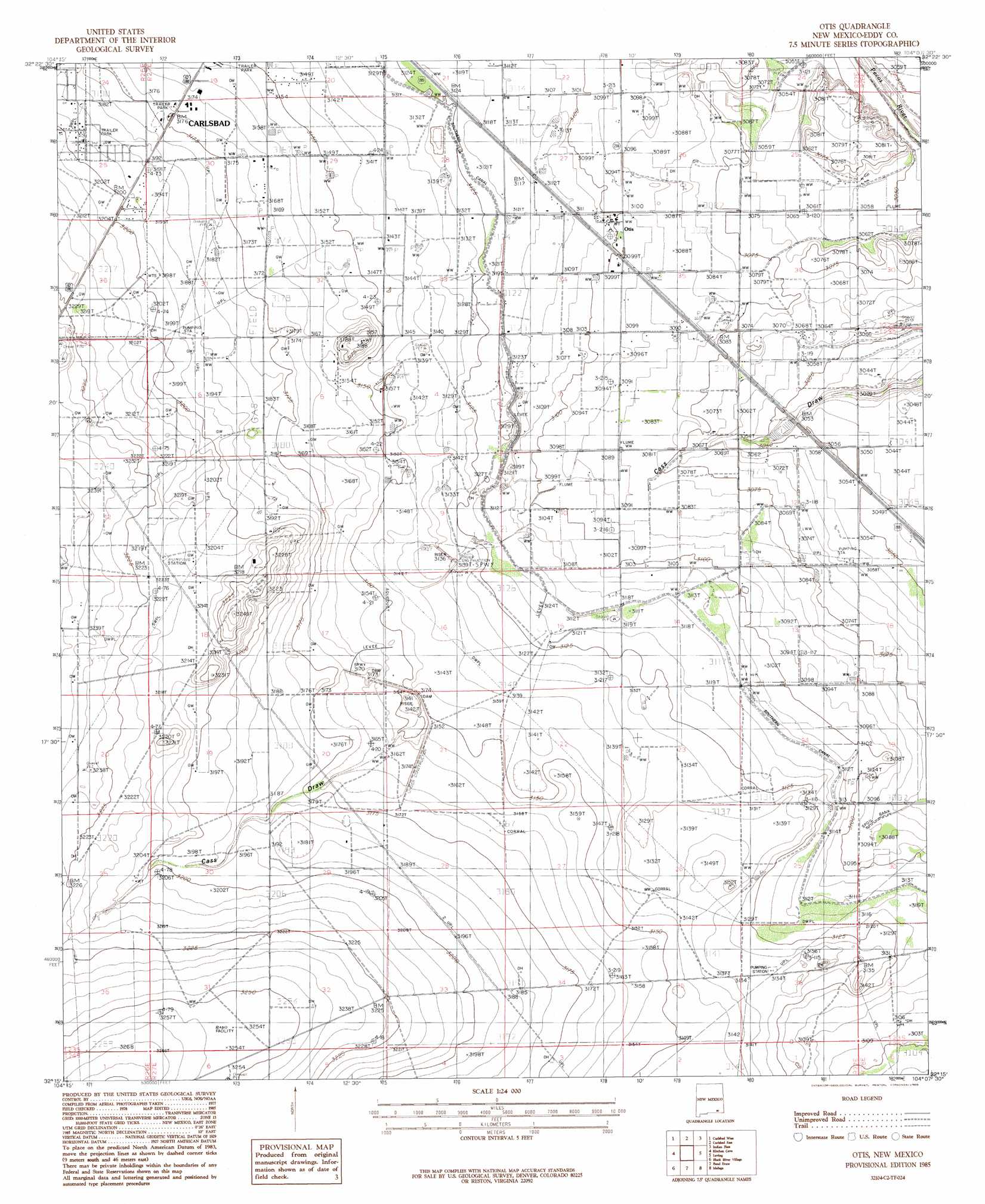
Otis Topo Map New Mexico
To zoom in, hover over the map of Otis
USGS Topo Quad 32104c2 - 1:24,000 scale
| Topo Map Name: | Otis |
| USGS Topo Quad ID: | 32104c2 |
| Print Size: | ca. 21 1/4" wide x 27" high |
| Southeast Coordinates: | 32.25° N latitude / 104.125° W longitude |
| Map Center Coordinates: | 32.3125° N latitude / 104.1875° W longitude |
| U.S. State: | NM |
| Filename: | o32104c2.jpg |
| Download Map JPG Image: | Otis topo map 1:24,000 scale |
| Map Type: | Topographic |
| Topo Series: | 7.5´ |
| Map Scale: | 1:24,000 |
| Source of Map Images: | United States Geological Survey (USGS) |
| Alternate Map Versions: |
Otis NM 1985, updated 1985 Download PDF Buy paper map Otis NM 2010 Download PDF Buy paper map Otis NM 2013 Download PDF Buy paper map Otis NM 2017 Download PDF Buy paper map |
1:24,000 Topo Quads surrounding Otis
Seven Rivers |
Lake Mcmillan South |
Angel Draw |
Illinois Camp Se |
Tower Hill North |
Azotea Peak |
Carlsbad West |
Carlsbad East |
Indian Flats |
Tower Hill South |
Carnero Peak |
Kitchen Cove |
Otis |
Loving |
Remuda Basin |
Carlsbad Caverns |
Black River Village |
Bond Draw |
Malaga |
Pierce Canyon |
Rattlesnake Spring |
Jumping Spring |
Cottonwood Hills |
Red Bluff |
Ross Ranch |
> Back to 32104a1 at 1:100,000 scale
> Back to 32104a1 at 1:250,000 scale
> Back to U.S. Topo Maps home
Otis topo map: Gazetteer
Otis: Dams
Cass Draw Site Number One Dam elevation 961m 3152′Cass Draw Site Number Two Dam elevation 950m 3116′
Municipal Tansill Lake Dam elevation 992m 3254′
Otis: Parks
Cavern City Dragway elevation 988m 3241′Otis: Populated Places
Otis elevation 945m 3100′Otis: Post Offices
Otis Post Office (historical) elevation 945m 3100′Otis: Reservoirs
Municipal Lake elevation 992m 3254′Otis digital topo map on disk
Buy this Otis topo map showing relief, roads, GPS coordinates and other geographical features, as a high-resolution digital map file on DVD: