Martha Creek Topo Map New Mexico
To zoom in, hover over the map of Martha Creek
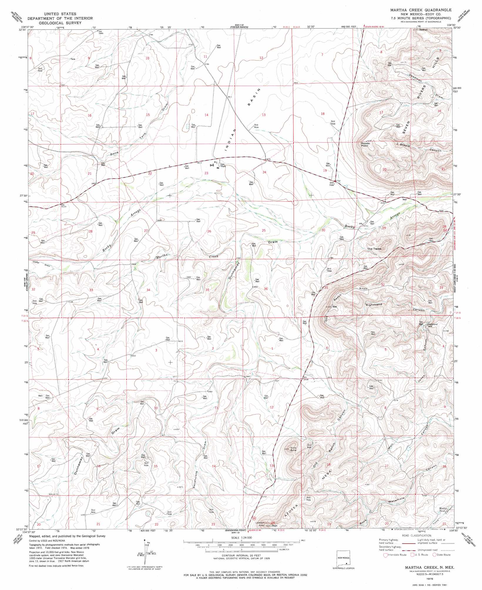
USGS Topo Quad 32104d5 - 1:24,000 scale
| Topo Map Name: | Martha Creek |
| USGS Topo Quad ID: | 32104d5 |
| Print Size: | ca. 21 1/4" wide x 27" high |
| Southeast Coordinates: | 32.375° N latitude / 104.5° W longitude |
| Map Center Coordinates: | 32.4375° N latitude / 104.5625° W longitude |
| U.S. State: | NM |
| Filename: | o32104d5.jpg |
| Download Map JPG Image: | Martha Creek topo map 1:24,000 scale |
| Map Type: | Topographic |
| Topo Series: | 7.5´ |
| Map Scale: | 1:24,000 |
| Source of Map Images: | United States Geological Survey (USGS) |
| Alternate Map Versions: |
Martha Creek NM 1978, updated 1979 Download PDF Buy paper map Martha Creek NM 2010 Download PDF Buy paper map Martha Creek NM 2013 Download PDF Buy paper map Martha Creek NM 2017 Download PDF Buy paper map |
1:24,000 Topo Quads surrounding Martha Creek
Holt Tank |
Antelope Sink |
Parish Ranch |
Dayton |
Lake Mcmillan North |
Strychnine Draw |
Box Canyon Ranch |
Foster Ranch |
Seven Rivers |
Lake Mcmillan South |
Texas Hill |
Cawley Draw |
Martha Creek |
Azotea Peak |
Carlsbad West |
Ares Peak |
Red Bluff Draw |
Bandanna Point |
Carnero Peak |
Kitchen Cove |
Pickett Hill |
Queen |
Serpentine Bends |
Carlsbad Caverns |
Black River Village |
> Back to 32104a1 at 1:100,000 scale
> Back to 32104a1 at 1:250,000 scale
> Back to U.S. Topo Maps home
Martha Creek topo map: Gazetteer
Martha Creek: Basins
Indian Basin elevation 1167m 3828′Martha Creek: Mines
Indian Basin Plant elevation 1164m 3818′Martha Creek: Reservoirs
Weld Tank elevation 1257m 4124′Martha Creek: Streams
Martha Creek elevation 1154m 3786′Martha Creek: Summits
Cone Butte elevation 1350m 4429′Lookout Point elevation 1421m 4662′
Old Ranch Knoll elevation 1332m 4370′
Rizado Point elevation 1290m 4232′
The Tepee elevation 1210m 3969′
Martha Creek: Valleys
Dunnaway Draw elevation 1132m 3713′Jones Canyon elevation 1192m 3910′
Loafer Draw elevation 1204m 3950′
Old Ranch Canyon elevation 1177m 3861′
Sacahuiste Draw elevation 1192m 3910′
Martha Creek: Wells
Righthand Well elevation 1220m 4002′Martha Creek digital topo map on disk
Buy this Martha Creek topo map showing relief, roads, GPS coordinates and other geographical features, as a high-resolution digital map file on DVD: