Illinois Camp Se Topo Map New Mexico
To zoom in, hover over the map of Illinois Camp Se
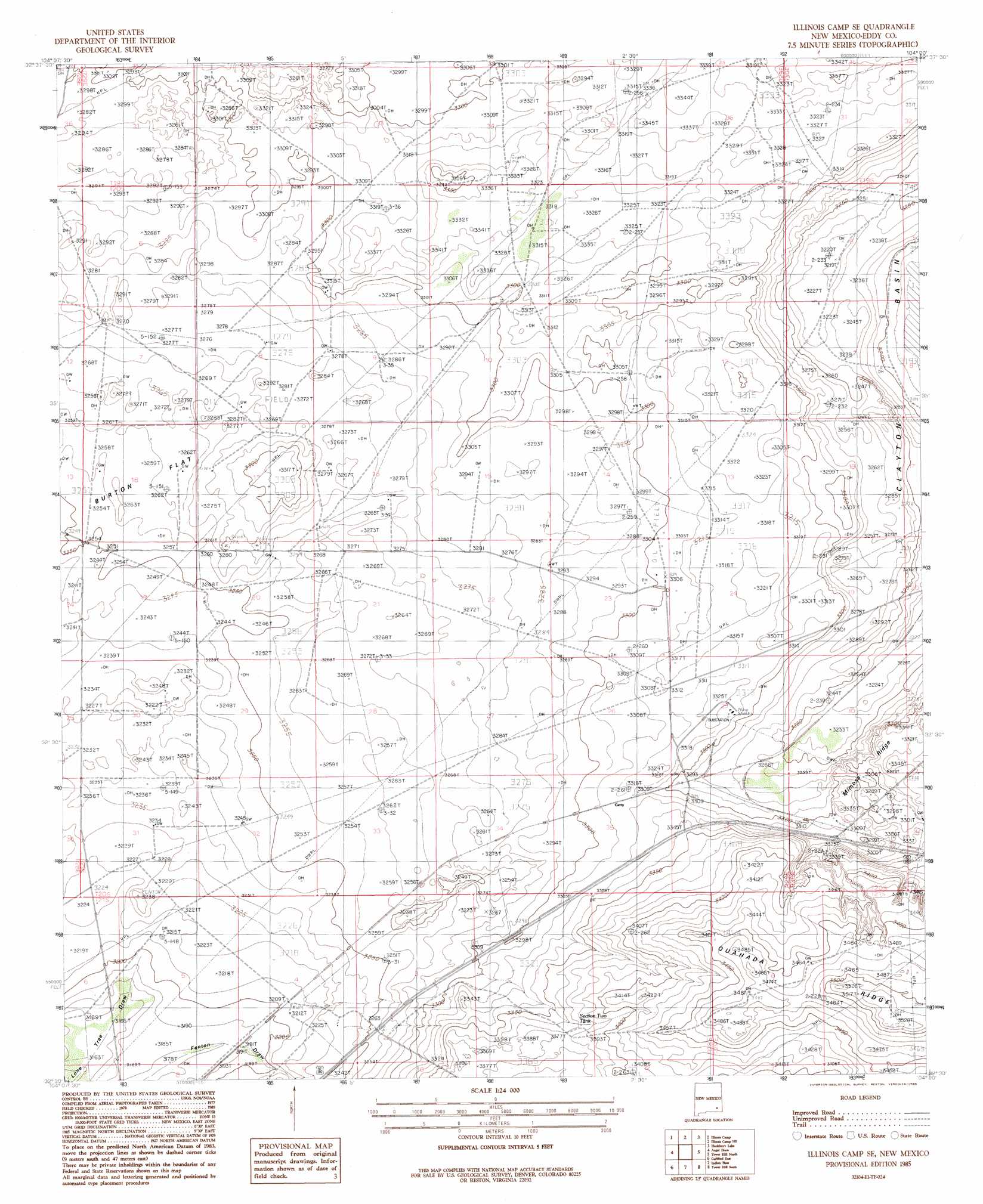
USGS Topo Quad 32104e1 - 1:24,000 scale
| Topo Map Name: | Illinois Camp Se |
| USGS Topo Quad ID: | 32104e1 |
| Print Size: | ca. 21 1/4" wide x 27" high |
| Southeast Coordinates: | 32.5° N latitude / 104° W longitude |
| Map Center Coordinates: | 32.5625° N latitude / 104.0625° W longitude |
| U.S. State: | NM |
| Filename: | o32104e1.jpg |
| Download Map JPG Image: | Illinois Camp Se topo map 1:24,000 scale |
| Map Type: | Topographic |
| Topo Series: | 7.5´ |
| Map Scale: | 1:24,000 |
| Source of Map Images: | United States Geological Survey (USGS) |
| Alternate Map Versions: |
Illinois Camp SE NM 1985, updated 1985 Download PDF Buy paper map Illinois Camp SE NM 2010 Download PDF Buy paper map Illinois Camp SE NM 2013 Download PDF Buy paper map Illinois Camp SE NM 2017 Download PDF Buy paper map |
1:24,000 Topo Quads surrounding Illinois Camp Se
Spring Lake |
Red Lake |
Red Lake Se |
Loco Hills |
Maljamar |
Lake Mcmillan North |
Illinois Camp |
Illinois Camp Ne |
Hackberry Lake |
Greenwood Lake |
Lake Mcmillan South |
Angel Draw |
Illinois Camp Se |
Tower Hill North |
Williams Sink |
Carlsbad West |
Carlsbad East |
Indian Flats |
Tower Hill South |
Livingston Ridge |
Kitchen Cove |
Otis |
Loving |
Remuda Basin |
Los Medanos |
> Back to 32104e1 at 1:100,000 scale
> Back to 32104a1 at 1:250,000 scale
> Back to U.S. Topo Maps home
Illinois Camp Se topo map: Gazetteer
Illinois Camp Se: Mines
Getty Shaft elevation 1007m 3303′National Potash Company Eddy Mine elevation 1011m 3316′
Illinois Camp Se: Wells
Chimney Well elevation 983m 3225′Millman South Well elevation 994m 3261′
Illinois Camp Se digital topo map on disk
Buy this Illinois Camp Se topo map showing relief, roads, GPS coordinates and other geographical features, as a high-resolution digital map file on DVD: