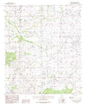
Angel Draw Topo Map New Mexico
To zoom in, hover over the map of Angel Draw
USGS Topo Quad 32104e2 - 1:24,000 scale
| Topo Map Name: | Angel Draw |
| USGS Topo Quad ID: | 32104e2 |
| Print Size: | ca. 21 1/4" wide x 27" high |
| Southeast Coordinates: | 32.5° N latitude / 104.125° W longitude |
| Map Center Coordinates: | 32.5625° N latitude / 104.1875° W longitude |
| U.S. State: | NM |
| Filename: | o32104e2.jpg |
| Download Map JPG Image: | Angel Draw topo map 1:24,000 scale |
| Map Type: | Topographic |
| Topo Series: | 7.5´ |
| Map Scale: | 1:24,000 |
| Source of Map Images: | United States Geological Survey (USGS) |
| Alternate Map Versions: |
Angel Draw NM 1985, updated 1985 Download PDF Buy paper map Angel Draw NM 2010 Download PDF Buy paper map Angel Draw NM 2013 Download PDF Buy paper map Angel Draw NM 2017 Download PDF Buy paper map |
1:24,000 Topo Quads surrounding Angel Draw
> Back to 32104e1 at 1:100,000 scale
> Back to 32104a1 at 1:250,000 scale
> Back to U.S. Topo Maps home
Angel Draw topo map: Gazetteer
Angel Draw: Flats
Burton Flat elevation 988m 3241′Saladar Flat elevation 973m 3192′
Angel Draw: Lakes
Alkali Lake elevation 966m 3169′Angel Draw: Summits
Indian Hill elevation 1041m 3415′Angel Draw: Valleys
Angel Draw elevation 985m 3231′Scanlon Draw elevation 975m 3198′
Angel Draw: Wells
00817 Water Well elevation 996m 3267′06434 Water Well elevation 999m 3277′
06435 Water Well elevation 1000m 3280′
06436 Water Well elevation 999m 3277′
06437 Water Well elevation 991m 3251′
06438 Water Well elevation 990m 3248′
06439 Water Well elevation 982m 3221′
06440 Water Well elevation 982m 3221′
06441 Water Well elevation 983m 3225′
06442 Water Well elevation 975m 3198′
06443 Water Well elevation 978m 3208′
06703 Water Well elevation 973m 3192′
06704 Water Well elevation 973m 3192′
06705 Water Well elevation 975m 3198′
06706 Water Well elevation 977m 3205′
06707 Water Well elevation 1001m 3284′
06708 Water Well elevation 975m 3198′
12178 Water Well elevation 1020m 3346′
12179 Water Well elevation 1003m 3290′
Murray West Well elevation 975m 3198′
Angel Draw digital topo map on disk
Buy this Angel Draw topo map showing relief, roads, GPS coordinates and other geographical features, as a high-resolution digital map file on DVD:


