Seven Rivers Topo Map New Mexico
To zoom in, hover over the map of Seven Rivers
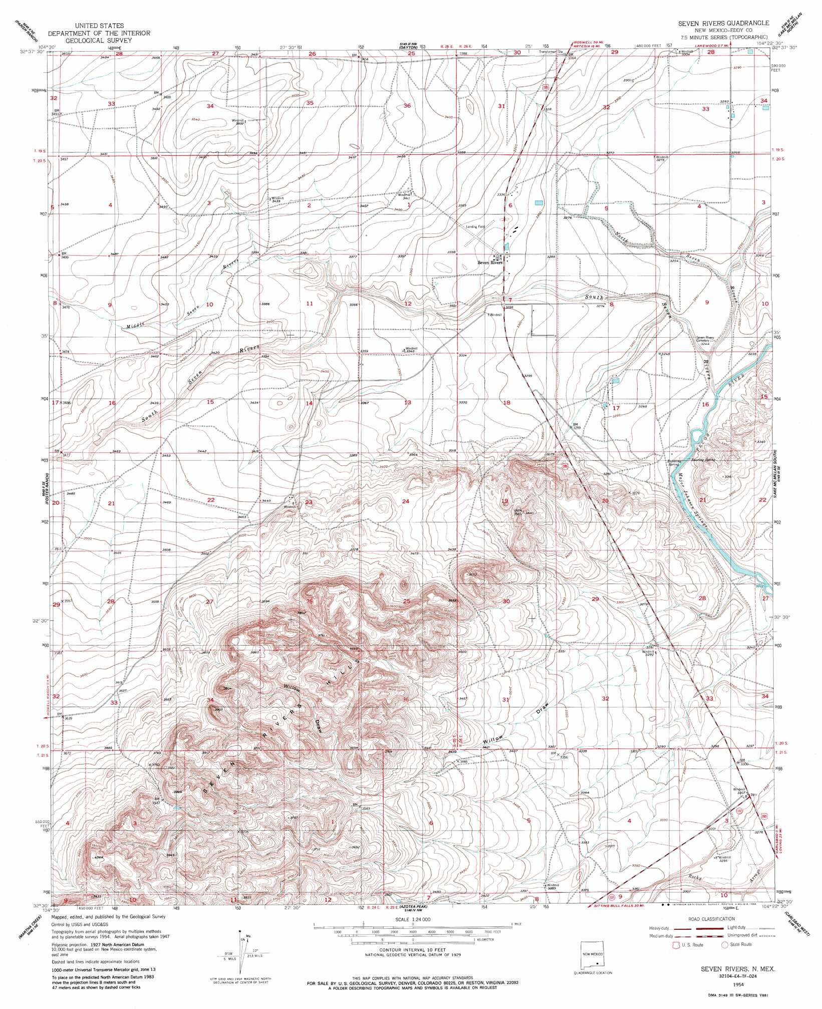
USGS Topo Quad 32104e4 - 1:24,000 scale
| Topo Map Name: | Seven Rivers |
| USGS Topo Quad ID: | 32104e4 |
| Print Size: | ca. 21 1/4" wide x 27" high |
| Southeast Coordinates: | 32.5° N latitude / 104.375° W longitude |
| Map Center Coordinates: | 32.5625° N latitude / 104.4375° W longitude |
| U.S. State: | NM |
| Filename: | o32104e4.jpg |
| Download Map JPG Image: | Seven Rivers topo map 1:24,000 scale |
| Map Type: | Topographic |
| Topo Series: | 7.5´ |
| Map Scale: | 1:24,000 |
| Source of Map Images: | United States Geological Survey (USGS) |
| Alternate Map Versions: |
Seven Rivers NM 1954, updated 1956 Download PDF Buy paper map Seven Rivers NM 1954, updated 1986 Download PDF Buy paper map Seven Rivers NM 2010 Download PDF Buy paper map Seven Rivers NM 2013 Download PDF Buy paper map Seven Rivers NM 2017 Download PDF Buy paper map |
1:24,000 Topo Quads surrounding Seven Rivers
Hope |
Hope Se |
Artesia |
Spring Lake |
Red Lake |
Antelope Sink |
Parish Ranch |
Dayton |
Lake Mcmillan North |
Illinois Camp |
Box Canyon Ranch |
Foster Ranch |
Seven Rivers |
Lake Mcmillan South |
Angel Draw |
Cawley Draw |
Martha Creek |
Azotea Peak |
Carlsbad West |
Carlsbad East |
Red Bluff Draw |
Bandanna Point |
Carnero Peak |
Kitchen Cove |
Otis |
> Back to 32104e1 at 1:100,000 scale
> Back to 32104a1 at 1:250,000 scale
> Back to U.S. Topo Maps home
Seven Rivers topo map: Gazetteer
Seven Rivers: Airports
Seven Rivers Airport elevation 1017m 3336′Seven Rivers: Populated Places
Seven Rivers elevation 1010m 3313′Seven Rivers: Post Offices
Seven Rivers Post Office (historical) elevation 1010m 3313′Seven Rivers: Springs
Bubbling Spring elevation 982m 3221′Flat Rock Spring elevation 979m 3211′
Major Johnson Springs elevation 982m 3221′
Roaring Spring elevation 988m 3241′
Twin Boils Spring elevation 981m 3218′
Seven Rivers: Streams
Middle Seven Rivers elevation 1015m 3330′North Seven Rivers elevation 982m 3221′
South Seven Rivers elevation 982m 3221′
Seven Rivers: Valleys
Willow Draw elevation 1007m 3303′Seven Rivers: Wells
10182 Water Well elevation 1001m 3284′71091 Water Well elevation 1001m 3284′
Seven Rivers digital topo map on disk
Buy this Seven Rivers topo map showing relief, roads, GPS coordinates and other geographical features, as a high-resolution digital map file on DVD: