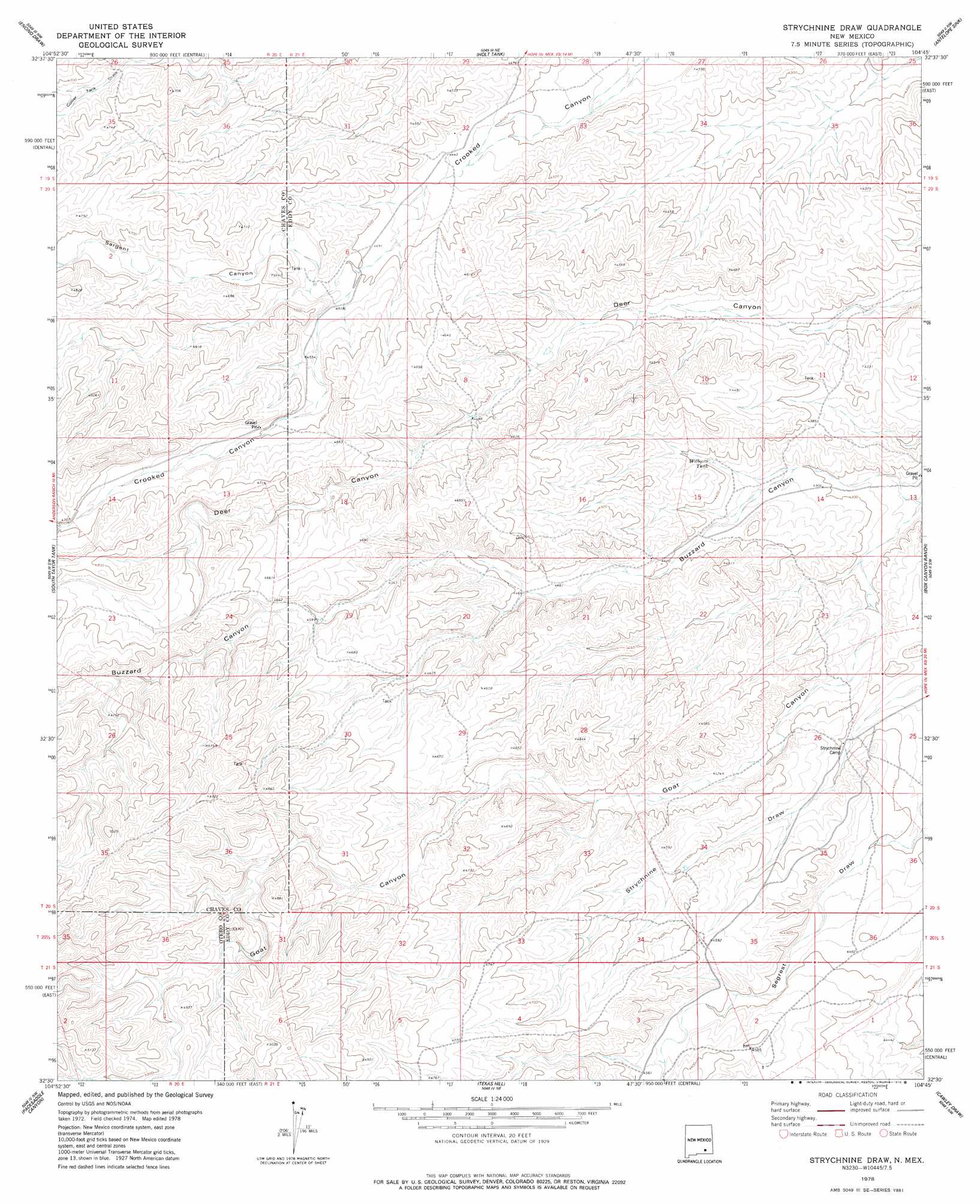
Strychnine Draw Topo Map New Mexico
To zoom in, hover over the map of Strychnine Draw
USGS Topo Quad 32104e7 - 1:24,000 scale
| Topo Map Name: | Strychnine Draw |
| USGS Topo Quad ID: | 32104e7 |
| Print Size: | ca. 21 1/4" wide x 27" high |
| Southeast Coordinates: | 32.5° N latitude / 104.75° W longitude |
| Map Center Coordinates: | 32.5625° N latitude / 104.8125° W longitude |
| U.S. State: | NM |
| Filename: | o32104e7.jpg |
| Download Map JPG Image: | Strychnine Draw topo map 1:24,000 scale |
| Map Type: | Topographic |
| Topo Series: | 7.5´ |
| Map Scale: | 1:24,000 |
| Source of Map Images: | United States Geological Survey (USGS) |
| Alternate Map Versions: |
Strychnine Draw NM 1978, updated 1978 Download PDF Buy paper map Strychnine Draw NM 2010 Download PDF Buy paper map Strychnine Draw NM 2013 Download PDF Buy paper map Strychnine Draw NM 2017 Download PDF Buy paper map |
1:24,000 Topo Quads surrounding Strychnine Draw
Meadow Hill |
Sixteenmile Draw West |
Sixteenmile Draw East |
Hope |
Hope Se |
Lewis Peak Ne |
Encino Draw |
Holt Tank |
Antelope Sink |
Parish Ranch |
Bullis Spring Ranch |
South Taylor Tank |
Strychnine Draw |
Box Canyon Ranch |
Foster Ranch |
Panama Ranch |
Packsaddle Canyon |
Texas Hill |
Cawley Draw |
Martha Creek |
Gowdy Ranch |
Algerita Canyon |
Ares Peak |
Red Bluff Draw |
Bandanna Point |
> Back to 32104e1 at 1:100,000 scale
> Back to 32104a1 at 1:250,000 scale
> Back to U.S. Topo Maps home
Strychnine Draw topo map: Gazetteer
Strychnine Draw: Reservoirs
Wilburn Tank elevation 1335m 4379′Strychnine Draw: Valleys
Goat Canyon elevation 1291m 4235′Sargent Canyon elevation 1371m 4498′
Strychnine Draw digital topo map on disk
Buy this Strychnine Draw topo map showing relief, roads, GPS coordinates and other geographical features, as a high-resolution digital map file on DVD: