Dayton Topo Map New Mexico
To zoom in, hover over the map of Dayton
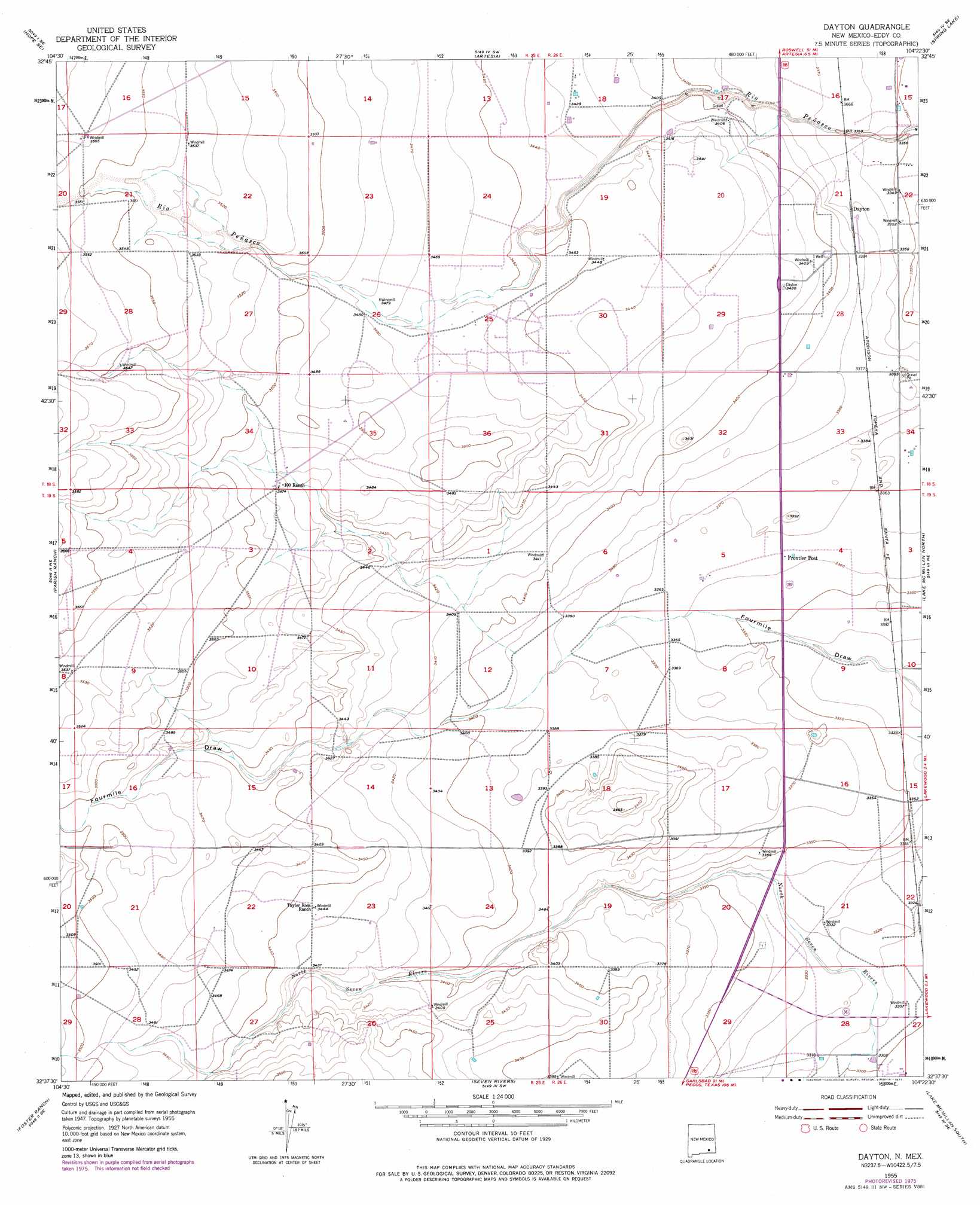
USGS Topo Quad 32104f4 - 1:24,000 scale
| Topo Map Name: | Dayton |
| USGS Topo Quad ID: | 32104f4 |
| Print Size: | ca. 21 1/4" wide x 27" high |
| Southeast Coordinates: | 32.625° N latitude / 104.375° W longitude |
| Map Center Coordinates: | 32.6875° N latitude / 104.4375° W longitude |
| U.S. State: | NM |
| Filename: | o32104f4.jpg |
| Download Map JPG Image: | Dayton topo map 1:24,000 scale |
| Map Type: | Topographic |
| Topo Series: | 7.5´ |
| Map Scale: | 1:24,000 |
| Source of Map Images: | United States Geological Survey (USGS) |
| Alternate Map Versions: |
Dayton NM 1955, updated 1956 Download PDF Buy paper map Dayton NM 1955, updated 1977 Download PDF Buy paper map Dayton NM 1955, updated 1977 Download PDF Buy paper map Dayton NM 2010 Download PDF Buy paper map Dayton NM 2013 Download PDF Buy paper map Dayton NM 2017 Download PDF Buy paper map |
1:24,000 Topo Quads surrounding Dayton
Hope Nw |
Hope Ne |
Espuela |
Artesia Ne |
Diamond Mound |
Hope |
Hope Se |
Artesia |
Spring Lake |
Red Lake |
Antelope Sink |
Parish Ranch |
Dayton |
Lake Mcmillan North |
Illinois Camp |
Box Canyon Ranch |
Foster Ranch |
Seven Rivers |
Lake Mcmillan South |
Angel Draw |
Cawley Draw |
Martha Creek |
Azotea Peak |
Carlsbad West |
Carlsbad East |
> Back to 32104e1 at 1:100,000 scale
> Back to 32104a1 at 1:250,000 scale
> Back to U.S. Topo Maps home
Dayton topo map: Gazetteer
Dayton: Populated Places
Dayton elevation 1028m 3372′Frontier Post elevation 1025m 3362′
Dayton: Post Offices
Dayton Post Office (historical) elevation 1028m 3372′Dayton digital topo map on disk
Buy this Dayton topo map showing relief, roads, GPS coordinates and other geographical features, as a high-resolution digital map file on DVD: