Sixteenmile Draw East Topo Map New Mexico
To zoom in, hover over the map of Sixteenmile Draw East
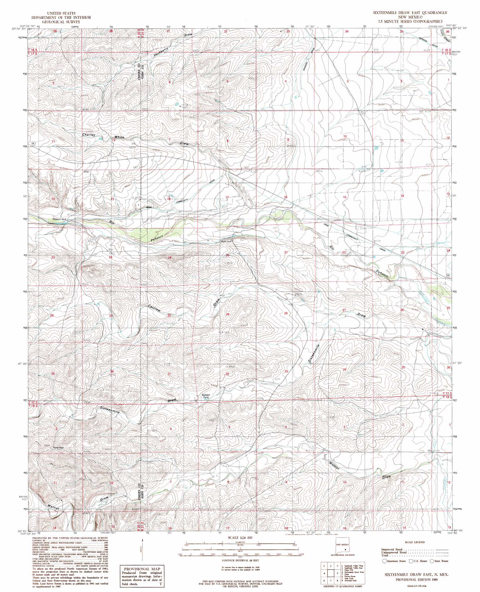
USGS Topo Quad 32104g7 - 1:24,000 scale
| Topo Map Name: | Sixteenmile Draw East |
| USGS Topo Quad ID: | 32104g7 |
| Print Size: | ca. 21 1/4" wide x 27" high |
| Southeast Coordinates: | 32.75° N latitude / 104.75° W longitude |
| Map Center Coordinates: | 32.8125° N latitude / 104.8125° W longitude |
| U.S. State: | NM |
| Filename: | o32104g7.jpg |
| Download Map JPG Image: | Sixteenmile Draw East topo map 1:24,000 scale |
| Map Type: | Topographic |
| Topo Series: | 7.5´ |
| Map Scale: | 1:24,000 |
| Source of Map Images: | United States Geological Survey (USGS) |
| Alternate Map Versions: |
Sixteenmile Draw East NM 1989, updated 1989 Download PDF Buy paper map Sixteenmile Draw East NM 2010 Download PDF Buy paper map Sixteenmile Draw East NM 2013 Download PDF Buy paper map Sixteenmile Draw East NM 2017 Download PDF Buy paper map |
1:24,000 Topo Quads surrounding Sixteenmile Draw East
Flying H |
Dark Canyon |
Indian Bluff |
Kincaid Ranch |
Hackberry Ranch |
Singer Lake |
Sagebrush Valley W. |
Sagebrush Valley E. |
Hope Nw |
Hope Ne |
Meadow Hill |
Sixteenmile Draw West |
Sixteenmile Draw East |
Hope |
Hope Se |
Lewis Peak Ne |
Encino Draw |
Holt Tank |
Antelope Sink |
Parish Ranch |
Bullis Spring Ranch |
South Taylor Tank |
Strychnine Draw |
Box Canyon Ranch |
Foster Ranch |
> Back to 32104e1 at 1:100,000 scale
> Back to 32104a1 at 1:250,000 scale
> Back to U.S. Topo Maps home
Sixteenmile Draw East topo map: Gazetteer
Sixteenmile Draw East: Canals
Hope Community Canal elevation 1285m 4215′Sixteenmile Draw East: Reservoirs
Sixteen Tank elevation 1305m 4281′Sixteenmile Draw East: Valleys
Catclaw Draw elevation 1255m 4117′Charley White Draw elevation 1310m 4297′
Sixteenmile Draw East digital topo map on disk
Buy this Sixteenmile Draw East topo map showing relief, roads, GPS coordinates and other geographical features, as a high-resolution digital map file on DVD: