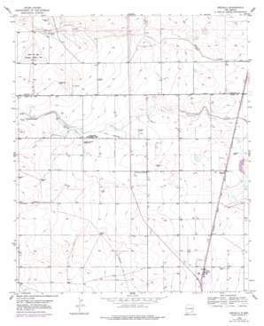
Espuela Topo Map New Mexico
To zoom in, hover over the map of Espuela
USGS Topo Quad 32104h4 - 1:24,000 scale
| Topo Map Name: | Espuela |
| USGS Topo Quad ID: | 32104h4 |
| Print Size: | ca. 21 1/4" wide x 27" high |
| Southeast Coordinates: | 32.875° N latitude / 104.375° W longitude |
| Map Center Coordinates: | 32.9375° N latitude / 104.4375° W longitude |
| U.S. State: | NM |
| Filename: | o32104h4.jpg |
| Download Map JPG Image: | Espuela topo map 1:24,000 scale |
| Map Type: | Topographic |
| Topo Series: | 7.5´ |
| Map Scale: | 1:24,000 |
| Source of Map Images: | United States Geological Survey (USGS) |
| Alternate Map Versions: |
Espuela NM 1953, updated 1954 Download PDF Buy paper map Espuela NM 1953, updated 1978 Download PDF Buy paper map Espuela NM 2010 Download PDF Buy paper map Espuela NM 2013 Download PDF Buy paper map Espuela NM 2017 Download PDF Buy paper map |
1:24,000 Topo Quads surrounding Espuela
> Back to 32104e1 at 1:100,000 scale
> Back to 32104a1 at 1:250,000 scale
> Back to U.S. Topo Maps home
Espuela topo map: Gazetteer
Espuela: Dams
O'Bannon Dam elevation 1059m 3474′Espuela: Mines
Caliche Pit elevation 1076m 3530′Sweatt Pit elevation 1040m 3412′
Espuela: Populated Places
Espuela elevation 1020m 3346′Espuela: Wells
05332 Water Well elevation 1040m 3412′05333 Water Well elevation 1041m 3415′
05334 Water Well elevation 1031m 3382′
05335 Water Well elevation 1031m 3382′
05336 Water Well elevation 1031m 3382′
07001 Water Well elevation 1071m 3513′
10329 Water Well elevation 1073m 3520′
10352 Water Well elevation 1024m 3359′
10353 Water Well elevation 1024m 3359′
10916 Water Well elevation 1024m 3359′
10924 Water Well elevation 1031m 3382′
10925 Water Well elevation 1032m 3385′
13555 Water Well elevation 1070m 3510′
13556 Water Well elevation 1066m 3497′
13558 Water Well elevation 1063m 3487′
13559 Water Well elevation 1061m 3480′
13560 Water Well elevation 1058m 3471′
13562 Water Well elevation 1059m 3474′
13563 Water Well elevation 1057m 3467′
13564 Water Well elevation 1046m 3431′
13566 Water Well elevation 1061m 3480′
13567 Water Well elevation 1042m 3418′
13568 Water Well elevation 1038m 3405′
13570 Water Well elevation 1041m 3415′
13571 Water Well elevation 1036m 3398′
13572 Water Well elevation 1024m 3359′
13592 Water Well elevation 1023m 3356′
Cottonwood Artesian Recorder Well elevation 1054m 3458′
Espuela digital topo map on disk
Buy this Espuela topo map showing relief, roads, GPS coordinates and other geographical features, as a high-resolution digital map file on DVD:


