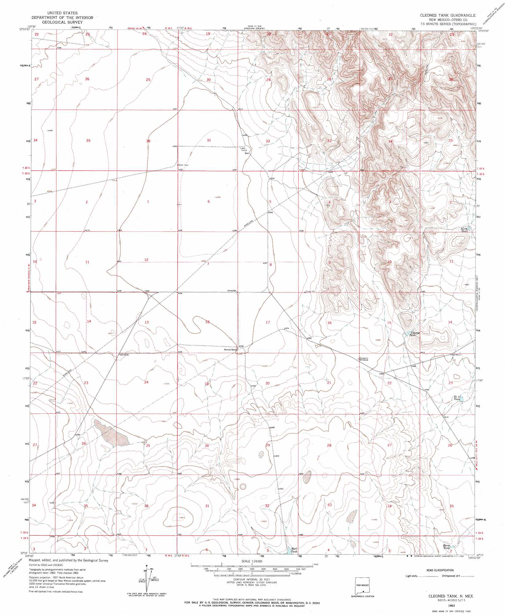
Cleones Tank Topo Map New Mexico
To zoom in, hover over the map of Cleones Tank
USGS Topo Quad 32105c4 - 1:24,000 scale
| Topo Map Name: | Cleones Tank |
| USGS Topo Quad ID: | 32105c4 |
| Print Size: | ca. 21 1/4" wide x 27" high |
| Southeast Coordinates: | 32.25° N latitude / 105.375° W longitude |
| Map Center Coordinates: | 32.3125° N latitude / 105.4375° W longitude |
| U.S. State: | NM |
| Filename: | o32105c4.jpg |
| Download Map JPG Image: | Cleones Tank topo map 1:24,000 scale |
| Map Type: | Topographic |
| Topo Series: | 7.5´ |
| Map Scale: | 1:24,000 |
| Source of Map Images: | United States Geological Survey (USGS) |
| Alternate Map Versions: |
Cleones Tank NM 1963, updated 1965 Download PDF Buy paper map Cleones Tank NM 2010 Download PDF Buy paper map Cleones Tank NM 2013 Download PDF Buy paper map Cleones Tank NM 2017 Download PDF Buy paper map |
1:24,000 Topo Quads surrounding Cleones Tank
El Paso Canyon |
Surveyors Canyon |
Pinon |
Cornucopia Canyon |
Pinon Ranch |
El Paso Draw |
Sixteen Canyon |
Indian Draw |
Cornucopia Ranch |
Tanner Ranch |
Stone Well |
Stockard Well |
Cleones Tank |
Cornucopia Ranch Se |
Hackberry Hill |
B T Ranch |
Alamo Mountain Ne |
Shiloh Hills |
Van Winkle Lake |
Lewis Canyon |
Alamo Mountain |
Cornudas Mountain |
Mcveigh Hills |
Shiloh Hills Se |
Culp Draw |
> Back to 32105a1 at 1:100,000 scale
> Back to 32104a1 at 1:250,000 scale
> Back to U.S. Topo Maps home
Cleones Tank topo map: Gazetteer
Cleones Tank: Reservoirs
Cleones Tank elevation 1348m 4422′Horse Tank elevation 1300m 4265′
North Tank elevation 1412m 4632′
Number 11 Tank elevation 1324m 4343′
Cleones Tank: Wells
Johns Water Well elevation 1311m 4301′Cleones Tank digital topo map on disk
Buy this Cleones Tank topo map showing relief, roads, GPS coordinates and other geographical features, as a high-resolution digital map file on DVD: