Pinon Topo Map New Mexico
To zoom in, hover over the map of Pinon
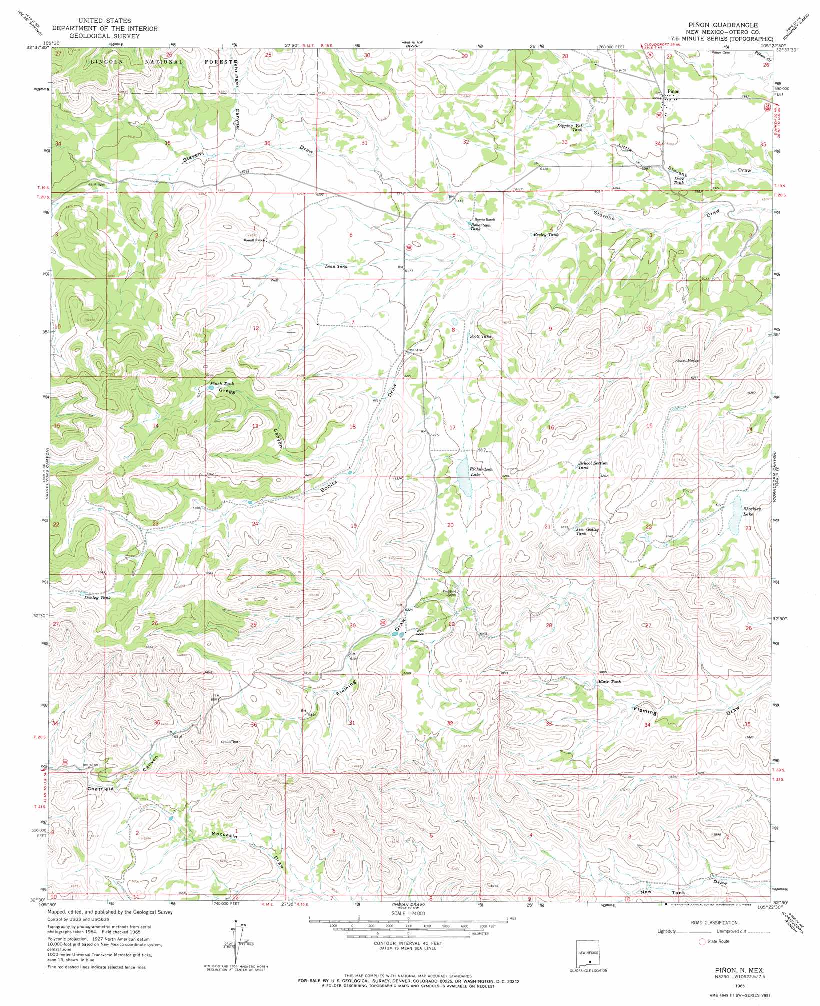
USGS Topo Quad 32105e4 - 1:24,000 scale
| Topo Map Name: | Pinon |
| USGS Topo Quad ID: | 32105e4 |
| Print Size: | ca. 21 1/4" wide x 27" high |
| Southeast Coordinates: | 32.5° N latitude / 105.375° W longitude |
| Map Center Coordinates: | 32.5625° N latitude / 105.4375° W longitude |
| U.S. State: | NM |
| Filename: | o32105e4.jpg |
| Download Map JPG Image: | Pinon topo map 1:24,000 scale |
| Map Type: | Topographic |
| Topo Series: | 7.5´ |
| Map Scale: | 1:24,000 |
| Source of Map Images: | United States Geological Survey (USGS) |
| Alternate Map Versions: |
Pinon NM 1965, updated 1968 Download PDF Buy paper map Pinon NM 2004, updated 2006 Download PDF Buy paper map Pinon NM 2011 Download PDF Buy paper map Pinon NM 2013 Download PDF Buy paper map Pinon NM 2017 Download PDF Buy paper map |
| FStopo: | US Forest Service topo Pinon is available: Download FStopo PDF Download FStopo TIF |
1:24,000 Topo Quads surrounding Pinon
Bluff Springs |
Sacramento |
Woodson Canyon |
Robertson Canyon |
Dunken |
Rogers Ruins |
Bear Spring |
Avis |
Chimney Lake |
Lewis Peak |
El Paso Canyon |
Surveyors Canyon |
Pinon |
Cornucopia Canyon |
Pinon Ranch |
El Paso Draw |
Sixteen Canyon |
Indian Draw |
Cornucopia Ranch |
Tanner Ranch |
Stone Well |
Stockard Well |
Cleones Tank |
Cornucopia Ranch Se |
Hackberry Hill |
> Back to 32105e1 at 1:100,000 scale
> Back to 32104a1 at 1:250,000 scale
> Back to U.S. Topo Maps home
Pinon topo map: Gazetteer
Pinon: Lakes
Richardson Lake elevation 1889m 6197′Shockley Lake elevation 1859m 6099′
Pinon: Populated Places
Piñon elevation 1847m 6059′Pinon: Reservoirs
Blair Tank elevation 1792m 5879′Danley Tank elevation 2040m 6692′
Dare Tank elevation 1815m 5954′
Dean Tank elevation 1908m 6259′
Dipping Vat Tank elevation 1840m 6036′
Finch Tank elevation 2004m 6574′
Jim Godley Tank elevation 1928m 6325′
Resley Tank elevation 1851m 6072′
Robertson Tank elevation 1862m 6108′
School Section Tank elevation 1904m 6246′
Scott Tank elevation 1869m 6131′
Pinon: Streams
South Prong Stevens Creek elevation 1828m 5997′Pinon: Valleys
Behringer Canyon elevation 2144m 7034′Bonita Draw elevation 1828m 5997′
Gregg Canyon elevation 1916m 6286′
Pinon digital topo map on disk
Buy this Pinon topo map showing relief, roads, GPS coordinates and other geographical features, as a high-resolution digital map file on DVD: