Pipeline Canyon Topo Map New Mexico
To zoom in, hover over the map of Pipeline Canyon
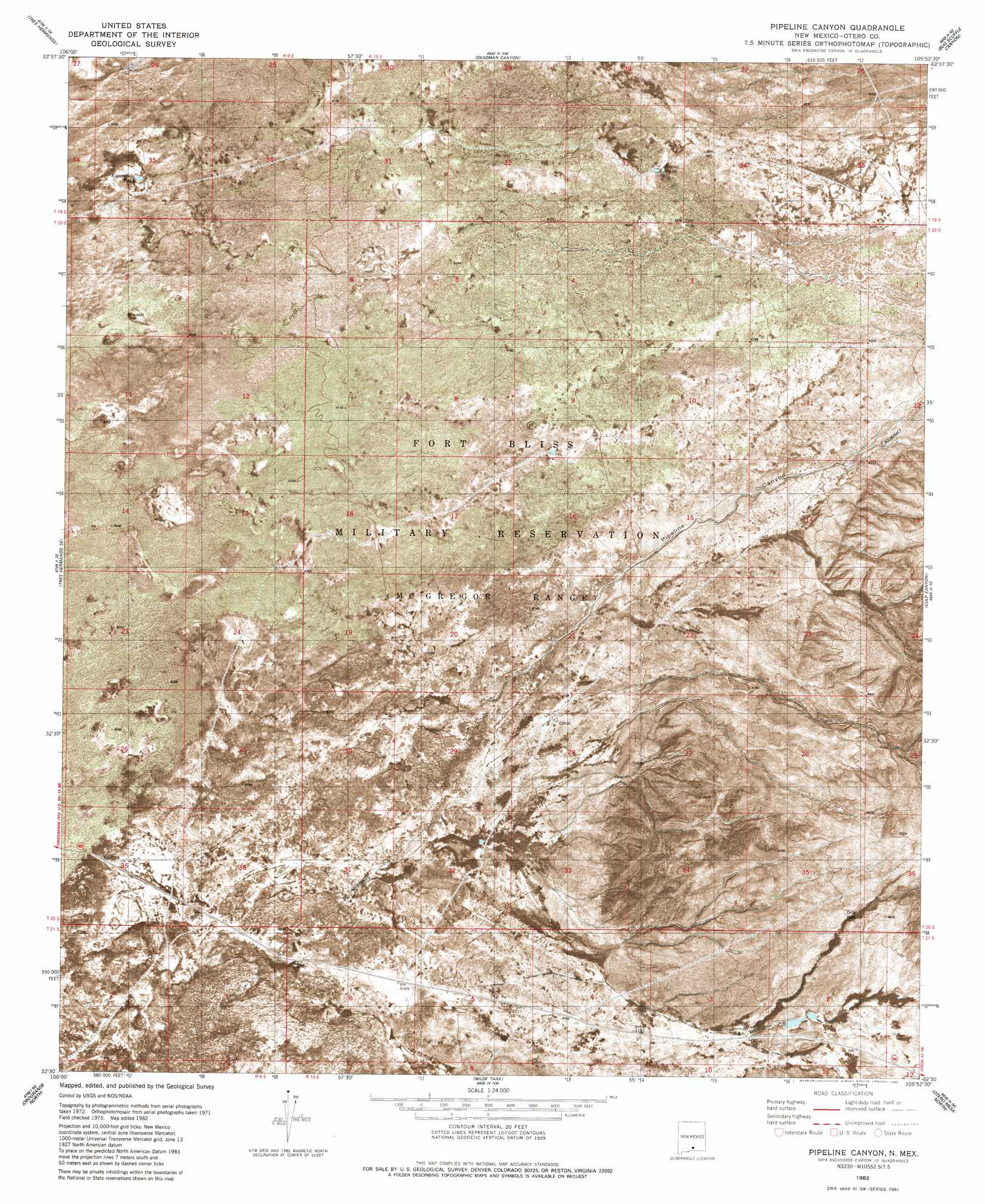
USGS Topo Quad 32105e8 - 1:24,000 scale
| Topo Map Name: | Pipeline Canyon |
| USGS Topo Quad ID: | 32105e8 |
| Print Size: | ca. 21 1/4" wide x 27" high |
| Southeast Coordinates: | 32.5° N latitude / 105.875° W longitude |
| Map Center Coordinates: | 32.5625° N latitude / 105.9375° W longitude |
| U.S. State: | NM |
| Filename: | p32105e8.jpg |
| Download Map JPG Image: | Pipeline Canyon topo map 1:24,000 scale |
| Map Type: | Orthophoto |
| Topo Series: | 7.5´ |
| Map Scale: | 1:24,000 |
| Source of Map Images: | United States Geological Survey (USGS) |
| Alternate Map Versions: |
Pipeline Canyon NM 1982, updated 1982 Download PDF Buy paper map Pipeline Canyon NM 2010 Download PDF Buy paper map Pipeline Canyon NM 2013 Download PDF Buy paper map Pipeline Canyon NM 2017 Download PDF Buy paper map |
1:24,000 Topo Quads surrounding Pipeline Canyon
Garton Lake |
Holloman |
Alamogordo South |
Sacramento Peak |
Bluff Springs |
Foster Lake |
Tres Hermanos |
Deadman Canyon |
Bug Scuffle Canyon |
Rogers Ruins |
Tres Hermanos Sw |
Tres Hermanos Se |
Pipeline Canyon |
Culp Canyon |
El Paso Canyon |
Elephant Mountain |
Orogrande North |
Wilde Tank |
Otero Mesa North |
El Paso Draw |
Elwood |
Orogrande South |
Mack Tanks |
Otero Mesa South |
Stone Well |
> Back to 32105e1 at 1:100,000 scale
> Back to 32104a1 at 1:250,000 scale
> Back to U.S. Topo Maps home
Pipeline Canyon topo map: Gazetteer
Pipeline Canyon: Canals
Orogrande Aqueduct elevation 1298m 4258′Pipeline Canyon: Valleys
Pipeline Canyon elevation 1263m 4143′Pipeline Canyon digital topo map on disk
Buy this Pipeline Canyon topo map showing relief, roads, GPS coordinates and other geographical features, as a high-resolution digital map file on DVD: