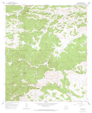
Avis Topo Map New Mexico
To zoom in, hover over the map of Avis
USGS Topo Quad 32105f4 - 1:24,000 scale
| Topo Map Name: | Avis |
| USGS Topo Quad ID: | 32105f4 |
| Print Size: | ca. 21 1/4" wide x 27" high |
| Southeast Coordinates: | 32.625° N latitude / 105.375° W longitude |
| Map Center Coordinates: | 32.6875° N latitude / 105.4375° W longitude |
| U.S. State: | NM |
| Filename: | o32105f4.jpg |
| Download Map JPG Image: | Avis topo map 1:24,000 scale |
| Map Type: | Topographic |
| Topo Series: | 7.5´ |
| Map Scale: | 1:24,000 |
| Source of Map Images: | United States Geological Survey (USGS) |
| Alternate Map Versions: |
Avis NM 1965, updated 1968 Download PDF Buy paper map Avis NM 2004, updated 2006 Download PDF Buy paper map Avis NM 2011 Download PDF Buy paper map Avis NM 2013 Download PDF Buy paper map Avis NM 2017 Download PDF Buy paper map |
| FStopo: | US Forest Service topo Avis is available: Download FStopo PDF Download FStopo TIF |
1:24,000 Topo Quads surrounding Avis
> Back to 32105e1 at 1:100,000 scale
> Back to 32104a1 at 1:250,000 scale
> Back to U.S. Topo Maps home
Avis topo map: Gazetteer
Avis: Populated Places
Avis elevation 2075m 6807′Avis: Post Offices
Avis Post Office (historical) elevation 2075m 6807′Avis: Reservoirs
Behringer Tank elevation 2013m 6604′Creek Tank elevation 1931m 6335′
Daugharty Tank elevation 1965m 6446′
Godley Tank elevation 2024m 6640′
Ivans Tank elevation 2021m 6630′
Lardhole Tank elevation 2023m 6637′
Little Tank elevation 1937m 6354′
Lower Lick Tank elevation 2003m 6571′
New Tank elevation 1987m 6519′
Piñon Tank elevation 1897m 6223′
Railsplitter Number One Tank elevation 2080m 6824′
Avis: Valleys
Elk Canyon elevation 1994m 6541′Hilton Canyon elevation 1974m 6476′
Lick Canyon elevation 1890m 6200′
Prairie Dog Canyon elevation 1984m 6509′
Salt Box Canyon elevation 1956m 6417′
Avis: Wells
Brooks Well elevation 1987m 6519′Avis digital topo map on disk
Buy this Avis topo map showing relief, roads, GPS coordinates and other geographical features, as a high-resolution digital map file on DVD:


