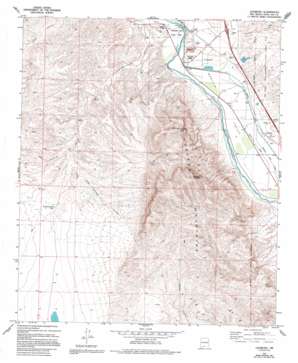
Leasburg Topo Map New Mexico
To zoom in, hover over the map of Leasburg
USGS Topo Quad 32106d8 - 1:24,000 scale
| Topo Map Name: | Leasburg |
| USGS Topo Quad ID: | 32106d8 |
| Print Size: | ca. 21 1/4" wide x 27" high |
| Southeast Coordinates: | 32.375° N latitude / 106.875° W longitude |
| Map Center Coordinates: | 32.4375° N latitude / 106.9375° W longitude |
| U.S. State: | NM |
| Filename: | o32106d8.jpg |
| Download Map JPG Image: | Leasburg topo map 1:24,000 scale |
| Map Type: | Topographic |
| Topo Series: | 7.5´ |
| Map Scale: | 1:24,000 |
| Source of Map Images: | United States Geological Survey (USGS) |
| Alternate Map Versions: |
Leasburg NM 1978, updated 1978 Download PDF Buy paper map Leasburg NM 1978, updated 1994 Download PDF Buy paper map Leasburg NM 1996, updated 2002 Download PDF Buy paper map Leasburg NM 2010 Download PDF Buy paper map Leasburg NM 2013 Download PDF Buy paper map Leasburg NM 2017 Download PDF Buy paper map |
1:24,000 Topo Quads surrounding Leasburg
> Back to 32106a1 at 1:100,000 scale
> Back to 32106a1 at 1:250,000 scale
> Back to U.S. Topo Maps home
Leasburg topo map: Gazetteer
Leasburg: Canals
American Bend Lateral elevation 1207m 3959′Selden Drain elevation 1205m 3953′
Leasburg: Dams
Leasburg Dam elevation 1209m 3966′Leasburg Diversion Dam elevation 1209m 3966′
Lucero Detention Dike elevation 1208m 3963′
Leasburg: Mines
Gilliland elevation 1441m 4727′Gilliland Claim elevation 1521m 4990′
Iron Hill District elevation 1468m 4816′
Willis Groups elevation 1339m 4393′
Leasburg: Parks
Bartlett-Garcia Conde Initial Survey Point Historical Marker elevation 1217m 3992′Fort Selden State Monument elevation 1215m 3986′
Fort Selden State Monument Historical Marker elevation 1217m 3992′
Leasburg Dam State Park elevation 1208m 3963′
Roblado Mountains Wilderness Study Area elevation 1788m 5866′
Leasburg: Populated Places
Fort Selden elevation 1217m 3992′Leasburg elevation 1207m 3959′
Leasburg: Post Offices
Fort Selden Post Office (historical) elevation 1215m 3986′Leasburg Post Office elevation 1207m 3959′
Leasburg: Ranges
Robledo Mountains elevation 1469m 4819′Leasburg: Reservoirs
Hawkins North Tank elevation 1349m 4425′Leasburg: Streams
Lucero Arroyo elevation 1204m 3950′Leasburg: Summits
Lookout Peak elevation 1705m 5593′Robledo Mountain elevation 1788m 5866′
Leasburg: Valleys
Faulkner Canyon elevation 1213m 3979′Indian Springs Canyon elevation 1320m 4330′
Rincon Valley elevation 1211m 3973′
Wagner Canyon elevation 1218m 3996′
Leasburg: Wells
United States Bureau of Reclamation 41 Water Well elevation 1205m 3953′United States Bureau of Reclamation 42 Water Well elevation 1205m 3953′
United States Bureau of Reclamation 43 Water Well elevation 1200m 3937′
Leasburg digital topo map on disk
Buy this Leasburg topo map showing relief, roads, GPS coordinates and other geographical features, as a high-resolution digital map file on DVD:


