Lake Lucero Se Topo Map New Mexico
To zoom in, hover over the map of Lake Lucero Se
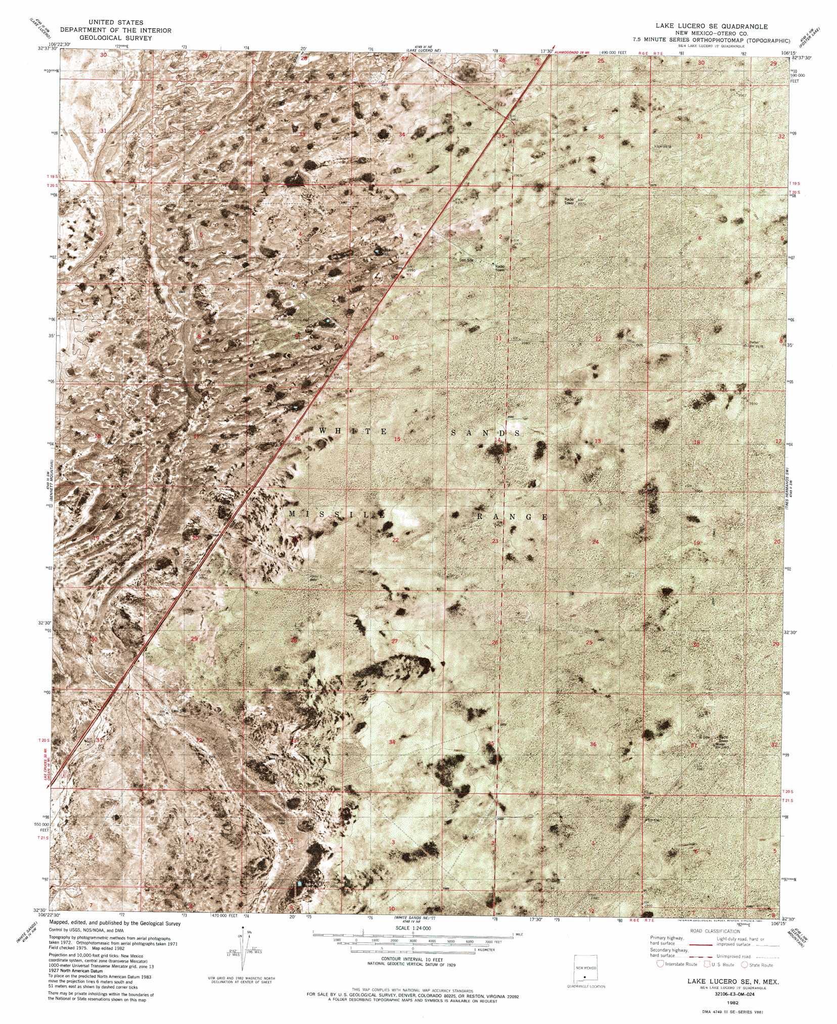
USGS Topo Quad 32106e3 - 1:24,000 scale
| Topo Map Name: | Lake Lucero Se |
| USGS Topo Quad ID: | 32106e3 |
| Print Size: | ca. 21 1/4" wide x 27" high |
| Southeast Coordinates: | 32.5° N latitude / 106.25° W longitude |
| Map Center Coordinates: | 32.5625° N latitude / 106.3125° W longitude |
| U.S. State: | NM |
| Filename: | p32106e3.jpg |
| Download Map JPG Image: | Lake Lucero Se topo map 1:24,000 scale |
| Map Type: | Orthophoto |
| Topo Series: | 7.5´ |
| Map Scale: | 1:24,000 |
| Source of Map Images: | United States Geological Survey (USGS) |
| Alternate Map Versions: |
Lake Lucero SE NM 1948, updated 1974 Download PDF Buy paper map Lake Lucero SE NM 1950 Download PDF Buy paper map Lake Lucero SE NM 1982, updated 1982 Download PDF Buy paper map Lake Lucero SE NM 2010 Download PDF Buy paper map Lake Lucero SE NM 2013 Download PDF Buy paper map Lake Lucero SE NM 2017 Download PDF Buy paper map |
1:24,000 Topo Quads surrounding Lake Lucero Se
Gardner Peak |
Heart Of The Sands Sw |
Heart Of The Sands |
Garton Lake |
Holloman |
San Andres Peak |
Lake Lucero |
Lake Lucero Ne |
Foster Lake |
Tres Hermanos |
Bear Peak |
Bennett Mountain |
Lake Lucero Se |
Tres Hermanos Sw |
Tres Hermanos Se |
Organ |
White Sands |
White Sands Ne |
Elephant Mountain |
Orogrande North |
Organ Peak |
Davies Tank |
White Sands Se |
Elwood |
Orogrande South |
> Back to 32106e1 at 1:100,000 scale
> Back to 32106a1 at 1:250,000 scale
> Back to U.S. Topo Maps home
Lake Lucero Se topo map: Gazetteer
Lake Lucero Se: Reservoirs
Burch Tank elevation 1211m 3973′Dousette Tank elevation 1214m 3982′
Tompson Reservoir elevation 1211m 3973′
Lake Lucero Se digital topo map on disk
Buy this Lake Lucero Se topo map showing relief, roads, GPS coordinates and other geographical features, as a high-resolution digital map file on DVD: