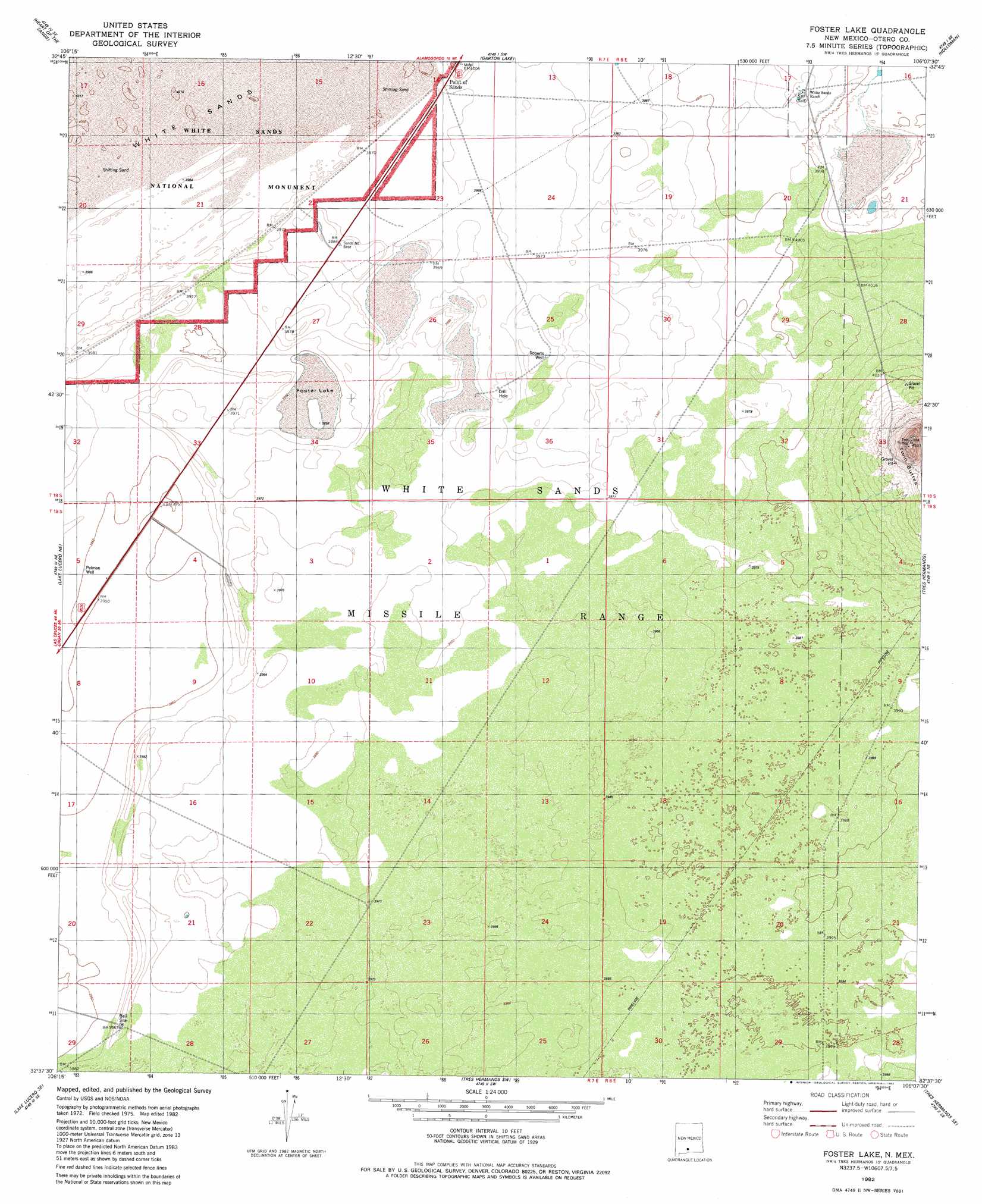
Foster Lake Topo Map New Mexico
To zoom in, hover over the map of Foster Lake
USGS Topo Quad 32106f2 - 1:24,000 scale
| Topo Map Name: | Foster Lake |
| USGS Topo Quad ID: | 32106f2 |
| Print Size: | ca. 21 1/4" wide x 27" high |
| Southeast Coordinates: | 32.625° N latitude / 106.125° W longitude |
| Map Center Coordinates: | 32.6875° N latitude / 106.1875° W longitude |
| U.S. State: | NM |
| Filename: | o32106f2.jpg |
| Download Map JPG Image: | Foster Lake topo map 1:24,000 scale |
| Map Type: | Topographic |
| Topo Series: | 7.5´ |
| Map Scale: | 1:24,000 |
| Source of Map Images: | United States Geological Survey (USGS) |
| Alternate Map Versions: |
Tres Hermanos NW NM 1976, updated 1980 Download PDF Buy paper map Foster Lake NM 1982, updated 1982 Download PDF Buy paper map Foster Lake NM 2010 Download PDF Buy paper map Foster Lake NM 2013 Download PDF Buy paper map Foster Lake NM 2017 Download PDF Buy paper map |
1:24,000 Topo Quads surrounding Foster Lake
Heart Of The Sands Nw |
Heart Of The Sands Ne |
Lost River |
Malone Draw |
Alamogordo North |
Heart Of The Sands Sw |
Heart Of The Sands |
Garton Lake |
Holloman |
Alamogordo South |
Lake Lucero |
Lake Lucero Ne |
Foster Lake |
Tres Hermanos |
Deadman Canyon |
Bennett Mountain |
Lake Lucero Se |
Tres Hermanos Sw |
Tres Hermanos Se |
Pipeline Canyon |
White Sands |
White Sands Ne |
Elephant Mountain |
Orogrande North |
Wilde Tank |
> Back to 32106e1 at 1:100,000 scale
> Back to 32106a1 at 1:250,000 scale
> Back to U.S. Topo Maps home
Foster Lake topo map: Gazetteer
Foster Lake: Lakes
Foster Lake elevation 1205m 3953′Foster Lake: Populated Places
Point of Sands elevation 1213m 3979′Foster Lake: Springs
Harrington Spring elevation 1229m 4032′Salt Spring elevation 1229m 4032′
Foster Lake: Summits
Twin Buttes elevation 1342m 4402′Foster Lake: Valleys
Little San Nicolas Canyon elevation 1216m 3989′Foster Lake: Wells
Pelman Well elevation 1205m 3953′Roberts Well elevation 1214m 3982′
Foster Lake digital topo map on disk
Buy this Foster Lake topo map showing relief, roads, GPS coordinates and other geographical features, as a high-resolution digital map file on DVD: