Thorn Well Topo Map New Mexico
To zoom in, hover over the map of Thorn Well
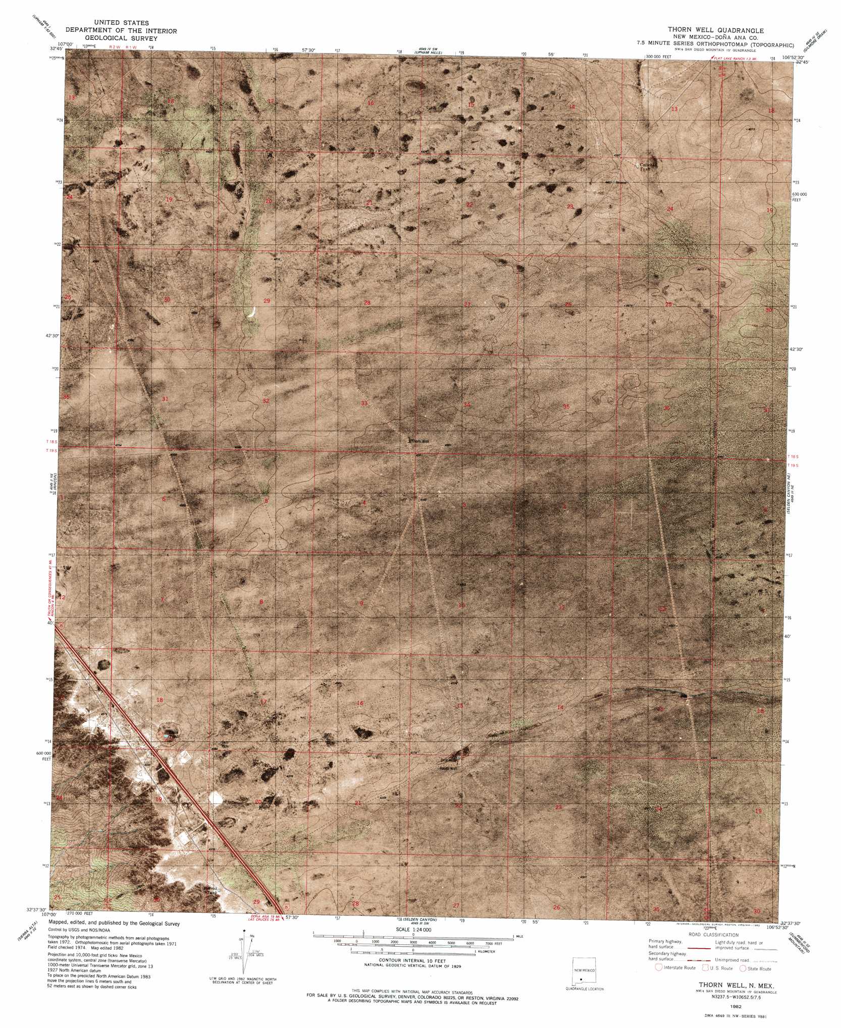
USGS Topo Quad 32106f8 - 1:24,000 scale
| Topo Map Name: | Thorn Well |
| USGS Topo Quad ID: | 32106f8 |
| Print Size: | ca. 21 1/4" wide x 27" high |
| Southeast Coordinates: | 32.625° N latitude / 106.875° W longitude |
| Map Center Coordinates: | 32.6875° N latitude / 106.9375° W longitude |
| U.S. State: | NM |
| Filename: | p32106f8.jpg |
| Download Map JPG Image: | Thorn Well topo map 1:24,000 scale |
| Map Type: | Orthophoto |
| Topo Series: | 7.5´ |
| Map Scale: | 1:24,000 |
| Source of Map Images: | United States Geological Survey (USGS) |
| Alternate Map Versions: |
Thorn Well NM 1982, updated 1982 Download PDF Buy paper map Thorn Well NM 1996, updated 2002 Download PDF Buy paper map Thorn Well NM 2010 Download PDF Buy paper map Thorn Well NM 2013 Download PDF Buy paper map Thorn Well NM 2017 Download PDF Buy paper map |
1:24,000 Topo Quads surrounding Thorn Well
Apache Gap |
Upham |
Prisor Hill |
Prisor Well |
Hembrillo Basin |
Mcleod Tank |
Alivio |
Upham Hills |
Gilmore Draw |
Fleck Draw |
Hatch |
Rincon |
Thorn Well |
Seldon Canyon Ne |
Goldenburg Draw |
Souse Springs |
Sierra Alta |
Seldon Canyon |
Summerford Mountain |
Taylor Well |
Magdalena Peak |
Rough And Ready Hills |
Leasburg |
Dona Ana |
Organ Peak Nw |
> Back to 32106e1 at 1:100,000 scale
> Back to 32106a1 at 1:250,000 scale
> Back to U.S. Topo Maps home
Thorn Well topo map: Gazetteer
Thorn Well: Post Offices
Detroit Post Office (historical) elevation 1331m 4366′Thorn Well: Reservoirs
Caliche Tank elevation 1335m 4379′Lake Tank elevation 1325m 4347′
Sump Tank elevation 1335m 4379′
Thorn Well: Wells
Detroit Well elevation 1331m 4366′South Water Well elevation 1326m 4350′
South Well elevation 1329m 4360′
Thorn Well elevation 1340m 4396′
Thorn Well digital topo map on disk
Buy this Thorn Well topo map showing relief, roads, GPS coordinates and other geographical features, as a high-resolution digital map file on DVD: