Hembrillo Basin Topo Map New Mexico
To zoom in, hover over the map of Hembrillo Basin
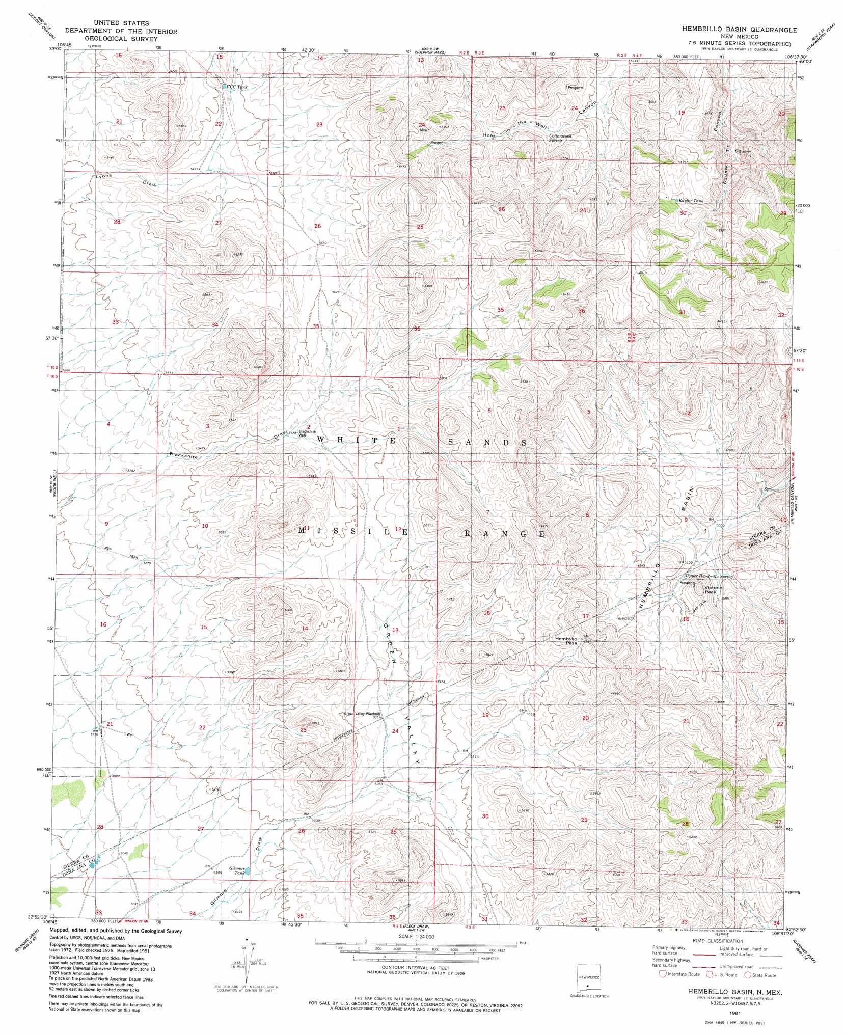
USGS Topo Quad 32106h6 - 1:24,000 scale
| Topo Map Name: | Hembrillo Basin |
| USGS Topo Quad ID: | 32106h6 |
| Print Size: | ca. 21 1/4" wide x 27" high |
| Southeast Coordinates: | 32.875° N latitude / 106.625° W longitude |
| Map Center Coordinates: | 32.9375° N latitude / 106.6875° W longitude |
| U.S. State: | NM |
| Filename: | o32106h6.jpg |
| Download Map JPG Image: | Hembrillo Basin topo map 1:24,000 scale |
| Map Type: | Topographic |
| Topo Series: | 7.5´ |
| Map Scale: | 1:24,000 |
| Source of Map Images: | United States Geological Survey (USGS) |
| Alternate Map Versions: |
Hembrillo Basin NM 1981, updated 1981 Download PDF Buy paper map Hembrillo Basin NM 1996, updated 2002 Download PDF Buy paper map Hembrillo Basin NM 2010 Download PDF Buy paper map Hembrillo Basin NM 2013 Download PDF Buy paper map Hembrillo Basin NM 2017 Download PDF Buy paper map |
1:24,000 Topo Quads surrounding Hembrillo Basin
Shannon Canyon Nw |
Shannon Canyon |
Hardscrabble Mountains |
Tip Top Canyon |
Lumley Lake Nw |
Polecat Tank |
Dugout Canyon |
Sulphur Pass |
Strawberry Peak |
Lumley Lake |
Prisor Hill |
Prisor Well |
Hembrillo Basin |
Hembrillo Canyon |
Heart Of The Sands Nw |
Upham Hills |
Gilmore Draw |
Fleck Draw |
Gardner Peak |
Heart Of The Sands Sw |
Thorn Well |
Seldon Canyon Ne |
Goldenburg Draw |
San Andres Peak |
Lake Lucero |
> Back to 32106e1 at 1:100,000 scale
> Back to 32106a1 at 1:250,000 scale
> Back to U.S. Topo Maps home
Hembrillo Basin topo map: Gazetteer
Hembrillo Basin: Basins
Green Valley elevation 1635m 5364′Hembrillo Basin elevation 1552m 5091′
Hembrillo Basin: Gaps
Hembrillo Pass elevation 1728m 5669′Hembrillo Basin: Reservoirs
CCC Tank elevation 1705m 5593′Gilmore Tank elevation 1568m 5144′
Kaylor Tank elevation 1768m 5800′
Little Tank elevation 1634m 5360′
Hembrillo Basin: Springs
Cottonwood Spring elevation 1602m 5255′Upper Hembrillo Spring elevation 1585m 5200′
Hembrillo Basin: Summits
Squaw Tit elevation 1810m 5938′Victorio Peak elevation 1676m 5498′
Hembrillo Basin: Wells
Blackshire Well elevation 1665m 5462′Hembrillo Basin digital topo map on disk
Buy this Hembrillo Basin topo map showing relief, roads, GPS coordinates and other geographical features, as a high-resolution digital map file on DVD: