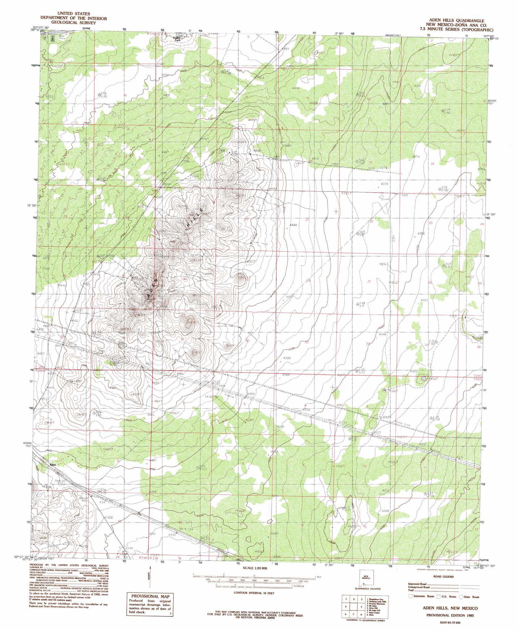
Aden Hills Topo Map New Mexico
To zoom in, hover over the map of Aden Hills
USGS Topo Quad 32107b1 - 1:24,000 scale
| Topo Map Name: | Aden Hills |
| USGS Topo Quad ID: | 32107b1 |
| Print Size: | ca. 21 1/4" wide x 27" high |
| Southeast Coordinates: | 32.125° N latitude / 107° W longitude |
| Map Center Coordinates: | 32.1875° N latitude / 107.0625° W longitude |
| U.S. State: | NM |
| Filename: | o32107b1.jpg |
| Download Map JPG Image: | Aden Hills topo map 1:24,000 scale |
| Map Type: | Topographic |
| Topo Series: | 7.5´ |
| Map Scale: | 1:24,000 |
| Source of Map Images: | United States Geological Survey (USGS) |
| Alternate Map Versions: |
Aden Hills NM 1985, updated 1985 Download PDF Buy paper map Aden Hills NM 1996, updated 2001 Download PDF Buy paper map Aden Hills NM 2010 Download PDF Buy paper map Aden Hills NM 2013 Download PDF Buy paper map Aden Hills NM 2017 Download PDF Buy paper map |
1:24,000 Topo Quads surrounding Aden Hills
Good Sight Peak Ne |
Magdalena Peak |
Rough And Ready Hills |
Leasburg |
Dona Ana |
Lazy E Ranch |
Magdalena Gap |
Sleeping Lady Hills |
Picacho Mountain |
Las Cruces |
Cambray |
Mount Aden |
Aden Hills |
Afton Nw |
Black Mesa |
X-7 Ranch |
Mount Aden Sw |
Aden Crater |
Afton |
Little Black Mountain |
P O L Ranch |
Potrillo Peak |
Mount Riley |
Kilbourne Hole |
Lanark |
> Back to 32107a1 at 1:100,000 scale
> Back to 32106a1 at 1:250,000 scale
> Back to U.S. Topo Maps home
Aden Hills topo map: Gazetteer
Aden Hills: Ranges
Aden Hills elevation 1421m 4662′Aden Hills: Wells
00020 Water Well elevation 1370m 4494′Aden Well elevation 1388m 4553′
Aden Hills digital topo map on disk
Buy this Aden Hills topo map showing relief, roads, GPS coordinates and other geographical features, as a high-resolution digital map file on DVD: