Magdalena Peak Topo Map New Mexico
To zoom in, hover over the map of Magdalena Peak
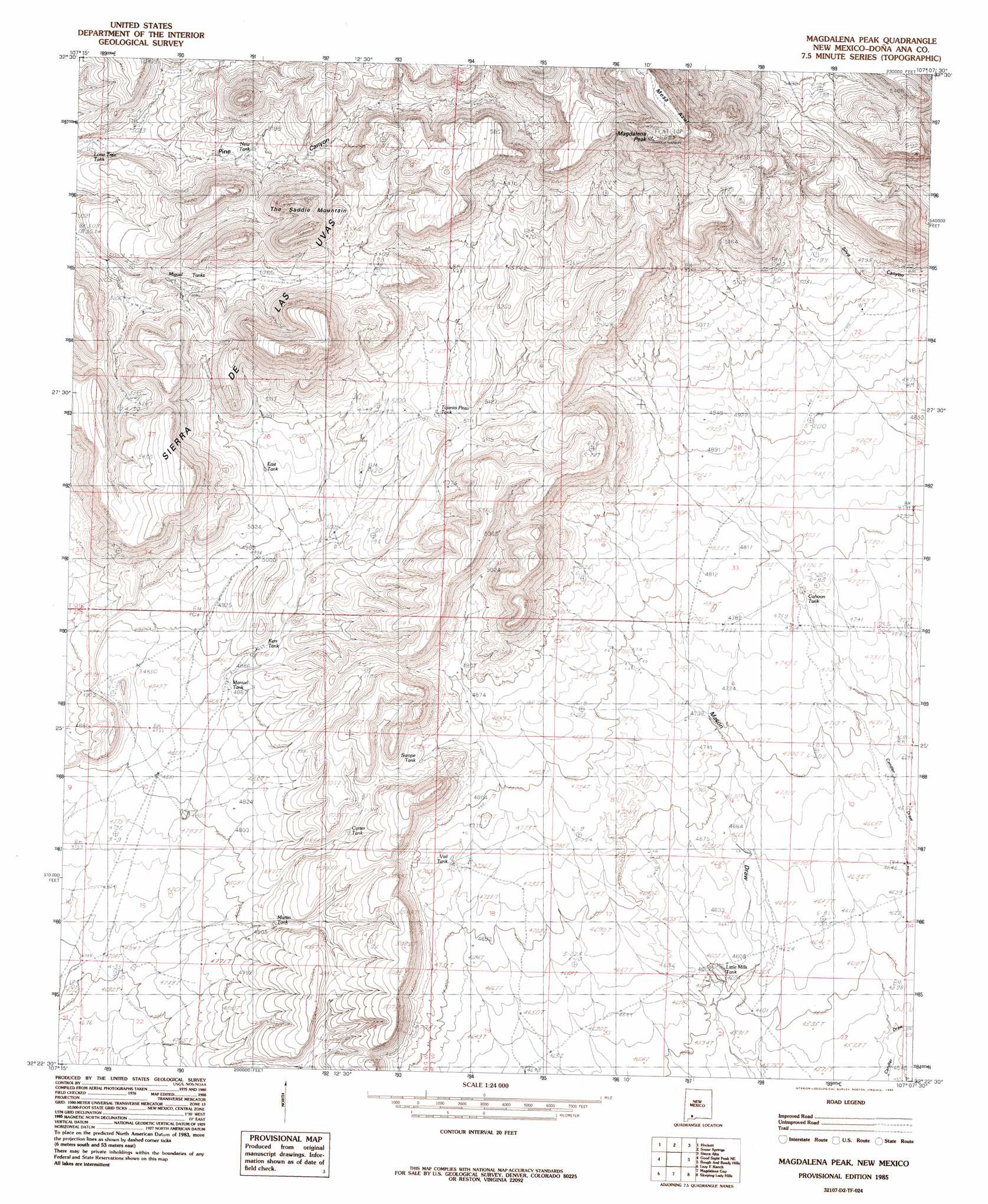
USGS Topo Quad 32107d2 - 1:24,000 scale
| Topo Map Name: | Magdalena Peak |
| USGS Topo Quad ID: | 32107d2 |
| Print Size: | ca. 21 1/4" wide x 27" high |
| Southeast Coordinates: | 32.375° N latitude / 107.125° W longitude |
| Map Center Coordinates: | 32.4375° N latitude / 107.1875° W longitude |
| U.S. State: | NM |
| Filename: | o32107d2.jpg |
| Download Map JPG Image: | Magdalena Peak topo map 1:24,000 scale |
| Map Type: | Topographic |
| Topo Series: | 7.5´ |
| Map Scale: | 1:24,000 |
| Source of Map Images: | United States Geological Survey (USGS) |
| Alternate Map Versions: |
Magdalena Peak NM 1985, updated 1985 Download PDF Buy paper map Magdalena Peak NM 1996, updated 2001 Download PDF Buy paper map Magdalena Peak NM 2010 Download PDF Buy paper map Magdalena Peak NM 2013 Download PDF Buy paper map |
1:24,000 Topo Quads surrounding Magdalena Peak
Jug Canyon |
Arroyo Cuervo |
Hatch |
Rincon |
Thorn Well |
Nutt |
Hockett |
Souse Springs |
Sierra Alta |
Seldon Canyon |
Good Sight Peak |
Good Sight Peak Ne |
Magdalena Peak |
Rough And Ready Hills |
Leasburg |
Myndus |
Lazy E Ranch |
Magdalena Gap |
Sleeping Lady Hills |
Picacho Mountain |
Akela |
Cambray |
Mount Aden |
Aden Hills |
Afton Nw |
> Back to 32107a1 at 1:100,000 scale
> Back to 32106a1 at 1:250,000 scale
> Back to U.S. Topo Maps home
Magdalena Peak topo map: Gazetteer
Magdalena Peak: Ranges
Sierra de las Uvas elevation 1720m 5643′Magdalena Peak: Reservoirs
Cahoon Tank elevation 1456m 4776′Carter Tank elevation 1512m 4960′
East Tank elevation 1538m 5045′
Kerr Tank elevation 1494m 4901′
Lone Tree Tank elevation 1535m 5036′
Manuel Tank elevation 1488m 4881′
Martin Tank elevation 1469m 4819′
Miguel Tanks elevation 1582m 5190′
New Tank elevation 1579m 5180′
Shorty Swope Tank elevation 1495m 4904′
Swope Tank elevation 1506m 4940′
Tajanio Pinto Tank elevation 1563m 5127′
Twin Hills Tank elevation 1592m 5223′
Upper Swope Tank elevation 1588m 5209′
Vail Tank elevation 1449m 4753′
Magdalena Peak: Summits
Magdalena Peak elevation 1984m 6509′Mesa Azur elevation 2002m 6568′
The Saddle Mountain elevation 1762m 5780′
Magdalena Peak: Wells
Little Mills Wells elevation 1405m 4609′Monterey Well elevation 1467m 4812′
Magdalena Peak digital topo map on disk
Buy this Magdalena Peak topo map showing relief, roads, GPS coordinates and other geographical features, as a high-resolution digital map file on DVD: