Hockett Topo Map New Mexico
To zoom in, hover over the map of Hockett
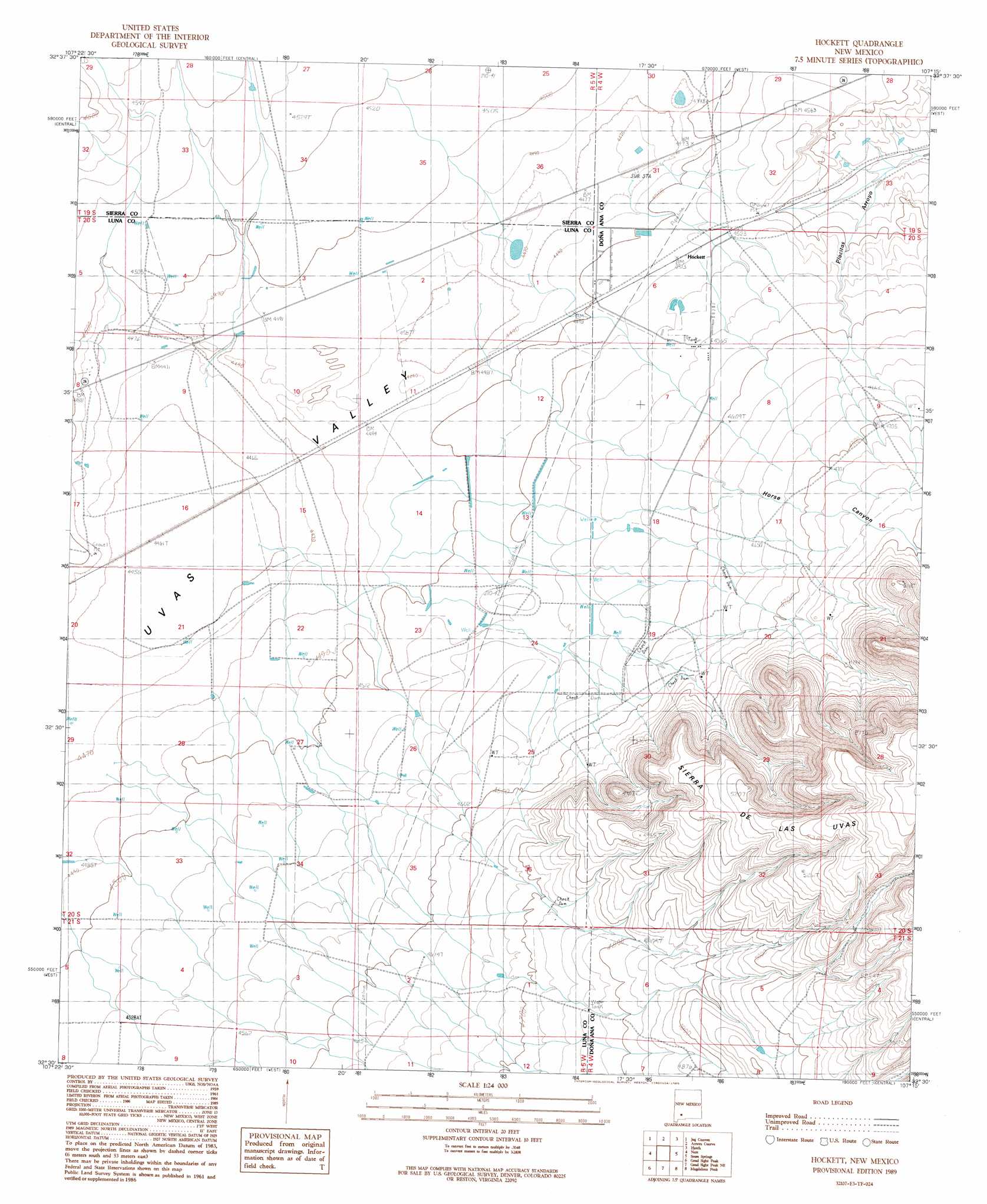
USGS Topo Quad 32107e3 - 1:24,000 scale
| Topo Map Name: | Hockett |
| USGS Topo Quad ID: | 32107e3 |
| Print Size: | ca. 21 1/4" wide x 27" high |
| Southeast Coordinates: | 32.5° N latitude / 107.25° W longitude |
| Map Center Coordinates: | 32.5625° N latitude / 107.3125° W longitude |
| U.S. State: | NM |
| Filename: | o32107e3.jpg |
| Download Map JPG Image: | Hockett topo map 1:24,000 scale |
| Map Type: | Topographic |
| Topo Series: | 7.5´ |
| Map Scale: | 1:24,000 |
| Source of Map Images: | United States Geological Survey (USGS) |
| Alternate Map Versions: |
Hockett NM 1989, updated 1989 Download PDF Buy paper map Hockett NM 1996, updated 2002 Download PDF Buy paper map Hockett NM 2010 Download PDF Buy paper map Hockett NM 2013 Download PDF Buy paper map Hockett NM 2017 Download PDF Buy paper map |
1:24,000 Topo Quads surrounding Hockett
Mcclede Mountain |
Clark Spring Canyon |
Garfield |
Mcleod Tank |
Alivio |
Lake Valley |
Jug Canyon |
Arroyo Cuervo |
Hatch |
Rincon |
Greg Hills |
Nutt |
Hockett |
Souse Springs |
Sierra Alta |
Florida |
Good Sight Peak |
Good Sight Peak Ne |
Magdalena Peak |
Rough And Ready Hills |
Carne |
Myndus |
Lazy E Ranch |
Magdalena Gap |
Sleeping Lady Hills |
> Back to 32107e1 at 1:100,000 scale
> Back to 32106a1 at 1:250,000 scale
> Back to U.S. Topo Maps home
Hockett topo map: Gazetteer
Hockett: Populated Places
Hockett elevation 1378m 4520′Hockett: Valleys
Horse Canyon elevation 1364m 4475′Thirtysix Canyon elevation 1365m 4478′
Hockett: Wells
05008 Water Well elevation 1383m 4537′06154 Water Well elevation 1373m 4504′
10007 Water Well elevation 1375m 4511′
10013 Water Well elevation 1380m 4527′
10448 Water Well elevation 1381m 4530′
10450 Water Well elevation 1364m 4475′
10451 Water Well elevation 1367m 4484′
10457 Water Well elevation 1386m 4547′
Hockett digital topo map on disk
Buy this Hockett topo map showing relief, roads, GPS coordinates and other geographical features, as a high-resolution digital map file on DVD: