Faywood Se Topo Map New Mexico
To zoom in, hover over the map of Faywood Se
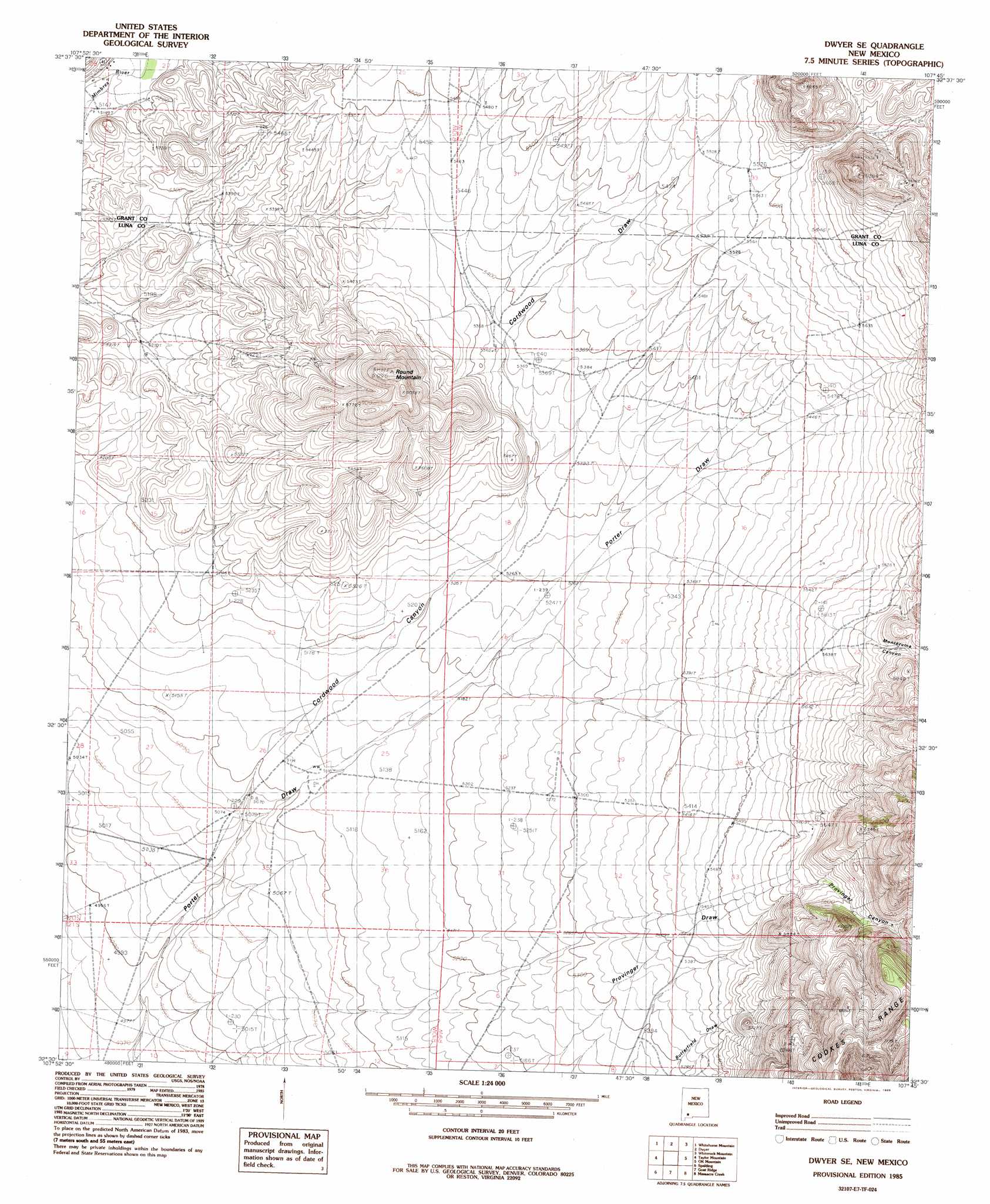
USGS Topo Quad 32107e7 - 1:24,000 scale
| Topo Map Name: | Faywood Se |
| USGS Topo Quad ID: | 32107e7 |
| Print Size: | ca. 21 1/4" wide x 27" high |
| Southeast Coordinates: | 32.5° N latitude / 107.75° W longitude |
| Map Center Coordinates: | 32.5625° N latitude / 107.8125° W longitude |
| U.S. State: | NM |
| Filename: | o32107e7.jpg |
| Download Map JPG Image: | Faywood Se topo map 1:24,000 scale |
| Map Type: | Topographic |
| Topo Series: | 7.5´ |
| Map Scale: | 1:24,000 |
| Source of Map Images: | United States Geological Survey (USGS) |
| Alternate Map Versions: |
Dwyer SE NM 1985, updated 1985 Download PDF Buy paper map Dwyer SE NM 2010 Download PDF Buy paper map Dwyer SE NM 2013 Download PDF Buy paper map Dwyer SE NM 2017 Download PDF Buy paper map |
1:24,000 Topo Quads surrounding Faywood Se
Santa Rita |
San Lorenzo |
Maverick Mountain |
Pa Mountain |
Mcclede Mountain |
Hurley East |
Whitehorse Mountain |
Dwyer |
Whiterock Mountain |
Lake Valley |
Faywood Station |
Taylor Mountain |
Faywood Se |
Ok Canyon |
Greg Hills |
Antelope Hill |
Spalding |
Goat Ridge |
Massacre Peak |
Florida |
Grandmother Mountain East |
Williams Ranch |
Deming West |
Deming East |
Carne |
> Back to 32107e1 at 1:100,000 scale
> Back to 32106a1 at 1:250,000 scale
> Back to U.S. Topo Maps home
Faywood Se topo map: Gazetteer
Faywood Se: Mines
White Eagle Mine elevation 1827m 5994′Faywood Se: Summits
Round Mountain elevation 1843m 6046′Round Mountain elevation 1847m 6059′
Faywood Se: Valleys
Montezuma Canyon elevation 1750m 5741′Faywood Se: Wells
01516 Water Well elevation 1714m 5623′01517 Water Well elevation 1636m 5367′
01518 Water Well elevation 1636m 5367′
01520 Water Well elevation 1641m 5383′
01524 Water Well elevation 1612m 5288′
01525 Water Well elevation 1721m 5646′
01526 Water Well elevation 1661m 5449′
01544 Water Well elevation 1537m 5042′
01577 Water Well elevation 1561m 5121′
01578 Water Well elevation 1562m 5124′
Faywood Se digital topo map on disk
Buy this Faywood Se topo map showing relief, roads, GPS coordinates and other geographical features, as a high-resolution digital map file on DVD: