Whitehorse Mountain Topo Map New Mexico
To zoom in, hover over the map of Whitehorse Mountain
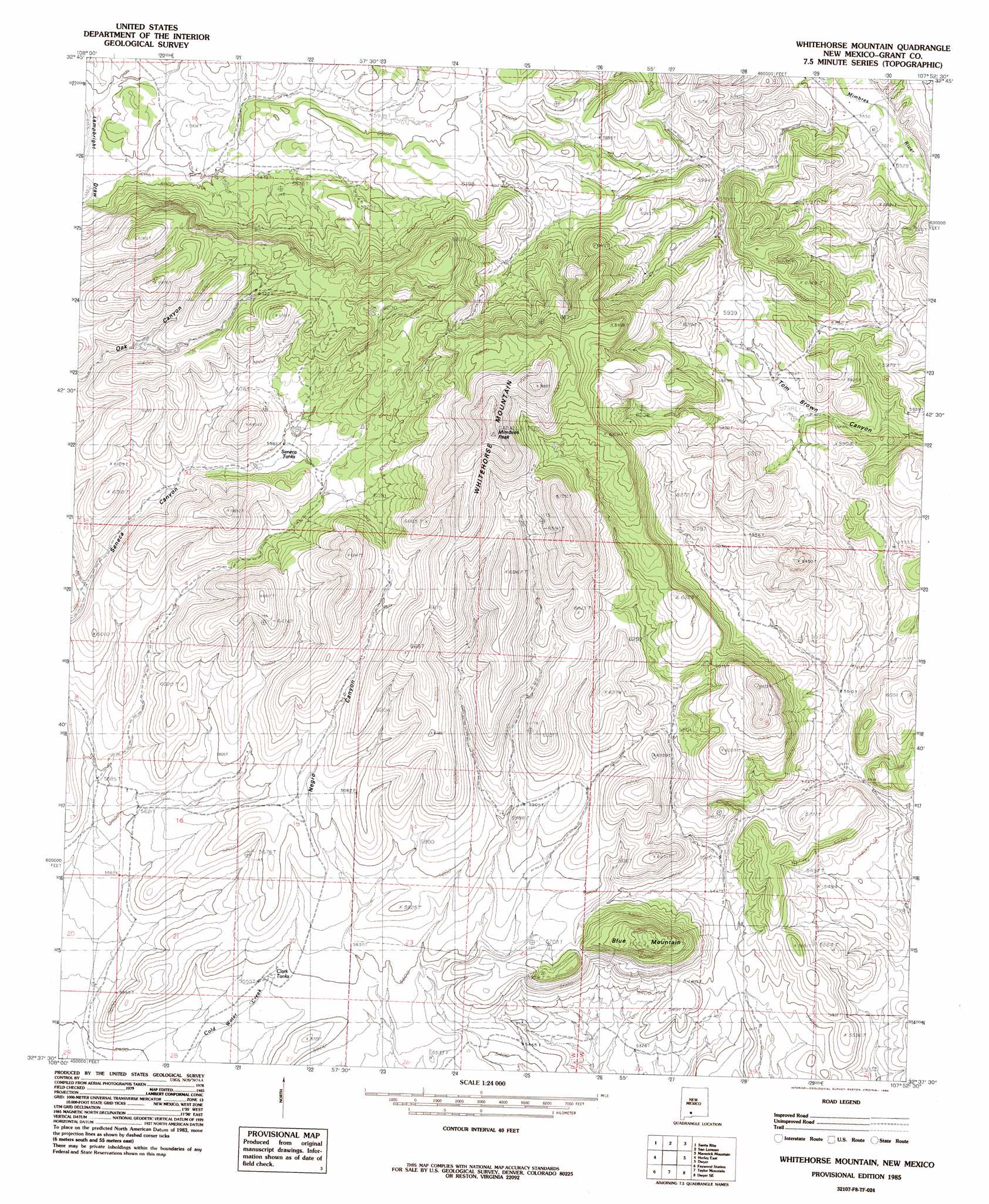
USGS Topo Quad 32107f8 - 1:24,000 scale
| Topo Map Name: | Whitehorse Mountain |
| USGS Topo Quad ID: | 32107f8 |
| Print Size: | ca. 21 1/4" wide x 27" high |
| Southeast Coordinates: | 32.625° N latitude / 107.875° W longitude |
| Map Center Coordinates: | 32.6875° N latitude / 107.9375° W longitude |
| U.S. State: | NM |
| Filename: | o32107f8.jpg |
| Download Map JPG Image: | Whitehorse Mountain topo map 1:24,000 scale |
| Map Type: | Topographic |
| Topo Series: | 7.5´ |
| Map Scale: | 1:24,000 |
| Source of Map Images: | United States Geological Survey (USGS) |
| Alternate Map Versions: |
Whitehorse Mountain NM 1985, updated 1985 Download PDF Buy paper map Whitehorse Mountain NM 2010 Download PDF Buy paper map Whitehorse Mountain NM 2013 Download PDF Buy paper map Whitehorse Mountain NM 2017 Download PDF Buy paper map |
1:24,000 Topo Quads surrounding Whitehorse Mountain
Twin Sisters |
Allie Canyon |
Hendricks Peak |
Hillsboro Peak |
Kingston |
Fort Bayard |
Santa Rita |
San Lorenzo |
Maverick Mountain |
Pa Mountain |
Hurley West |
Hurley East |
Whitehorse Mountain |
Dwyer |
Whiterock Mountain |
Whitewater |
Faywood Station |
Taylor Mountain |
Faywood Se |
Ok Canyon |
Cow Springs Mountain |
Antelope Hill |
Spalding |
Goat Ridge |
Massacre Peak |
> Back to 32107e1 at 1:100,000 scale
> Back to 32106a1 at 1:250,000 scale
> Back to U.S. Topo Maps home
Whitehorse Mountain topo map: Gazetteer
Whitehorse Mountain: Populated Places
Big Mill elevation 1725m 5659′Sherman elevation 1690m 5544′
Whitehorse Mountain: Post Offices
Sherman Post Office (historical) elevation 1690m 5544′Whitehorse Mountain: Reservoirs
Clark Tanks elevation 1697m 5567′Seneca Tanks elevation 1819m 5967′
Whitehorse Mountain: Summits
Blue Mountain elevation 1919m 6295′Mimbres Peak elevation 2259m 7411′
Whitehorse Mountain elevation 2259m 7411′
Whitehorse Mountain: Valleys
Oak Canyon elevation 1765m 5790′Seneca Canyon elevation 1689m 5541′
Whitehorse Mountain digital topo map on disk
Buy this Whitehorse Mountain topo map showing relief, roads, GPS coordinates and other geographical features, as a high-resolution digital map file on DVD: