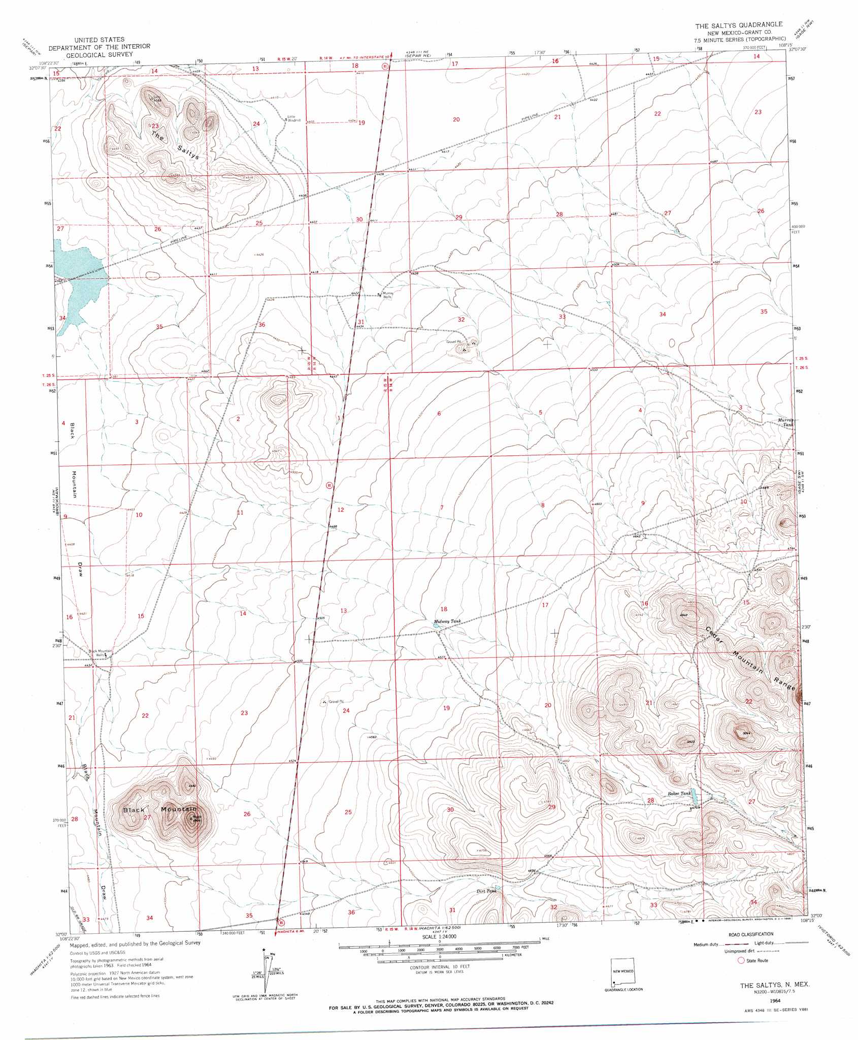
The Saltys Topo Map New Mexico
To zoom in, hover over the map of The Saltys
USGS Topo Quad 32108a3 - 1:24,000 scale
| Topo Map Name: | The Saltys |
| USGS Topo Quad ID: | 32108a3 |
| Print Size: | ca. 21 1/4" wide x 27" high |
| Southeast Coordinates: | 32° N latitude / 108.25° W longitude |
| Map Center Coordinates: | 32.0625° N latitude / 108.3125° W longitude |
| U.S. State: | NM |
| Filename: | o32108a3.jpg |
| Download Map JPG Image: | The Saltys topo map 1:24,000 scale |
| Map Type: | Topographic |
| Topo Series: | 7.5´ |
| Map Scale: | 1:24,000 |
| Source of Map Images: | United States Geological Survey (USGS) |
| Alternate Map Versions: |
The Saltys NM 1964, updated 1966 Download PDF Buy paper map The Saltys NM 2010 Download PDF Buy paper map The Saltys NM 2013 Download PDF Buy paper map The Saltys NM 2017 Download PDF Buy paper map |
1:24,000 Topo Quads surrounding The Saltys
Lisbon |
Ninetysix Ranch |
Soldiers Farewell Hill |
Grandmother Mountain West |
Grandmother Mountain East |
Muir Ranch |
Separ |
Separ Ne |
Gage Nw |
Gage |
Coyote Peak |
Brockman |
The Saltys |
Gage Sw |
Gage Se |
Playas Lake North |
Playas Peak |
Hachita |
Hat Top Mountain |
Flying W Mountain |
Playas Lake South |
Hachita Peak |
Doyle Peak |
Victorio Ranch |
Victorio Ranch Se |
> Back to 32108a1 at 1:100,000 scale
> Back to 32108a1 at 1:250,000 scale
> Back to U.S. Topo Maps home
The Saltys topo map: Gazetteer
The Saltys: Reservoirs
Baker Tank elevation 1445m 4740′Dirt Tank elevation 1414m 4639′
Midway Tank elevation 1390m 4560′
Murray Tank elevation 1409m 4622′
The Saltys: Summits
Black Mountain elevation 1491m 4891′The Saltys elevation 1388m 4553′
Turkey Knob elevation 1595m 5232′
The Saltys: Wells
Baker Tank Water Well elevation 1448m 4750′Black Mountain Water Well elevation 1350m 4429′
Black Mountain Well elevation 1350m 4429′
Murray Water Wells elevation 1350m 4429′
Murray Wells elevation 1350m 4429′
The Saltys digital topo map on disk
Buy this The Saltys topo map showing relief, roads, GPS coordinates and other geographical features, as a high-resolution digital map file on DVD: