Gage Nw Topo Map New Mexico
To zoom in, hover over the map of Gage Nw
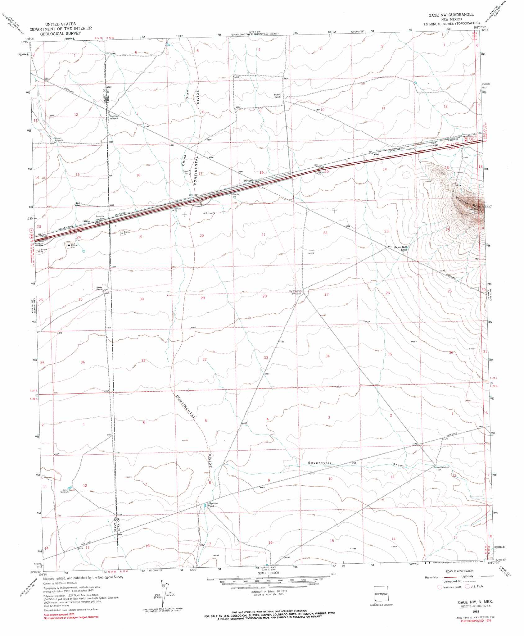
USGS Topo Quad 32108b2 - 1:24,000 scale
| Topo Map Name: | Gage Nw |
| USGS Topo Quad ID: | 32108b2 |
| Print Size: | ca. 21 1/4" wide x 27" high |
| Southeast Coordinates: | 32.125° N latitude / 108.125° W longitude |
| Map Center Coordinates: | 32.1875° N latitude / 108.1875° W longitude |
| U.S. State: | NM |
| Filename: | o32108b2.jpg |
| Download Map JPG Image: | Gage Nw topo map 1:24,000 scale |
| Map Type: | Topographic |
| Topo Series: | 7.5´ |
| Map Scale: | 1:24,000 |
| Source of Map Images: | United States Geological Survey (USGS) |
| Alternate Map Versions: |
Gage NW NM 1963, updated 1966 Download PDF Buy paper map Gage NW NM 1963, updated 1990 Download PDF Buy paper map Gage NW NM 2010 Download PDF Buy paper map Gage NW NM 2013 Download PDF Buy paper map Gage NW NM 2017 Download PDF Buy paper map |
1:24,000 Topo Quads surrounding Gage Nw
C Bar Ranch |
Werney Hill |
Cow Springs Mountain |
Antelope Hill |
Spalding |
Ninetysix Ranch |
Soldiers Farewell Hill |
Grandmother Mountain West |
Grandmother Mountain East |
Williams Ranch |
Separ |
Separ Ne |
Gage Nw |
Gage |
Red Mountain |
Brockman |
The Saltys |
Gage Sw |
Gage Se |
Bisbee Hills |
Playas Peak |
Hachita |
Hat Top Mountain |
Flying W Mountain |
Hermanas Nw |
> Back to 32108a1 at 1:100,000 scale
> Back to 32108a1 at 1:250,000 scale
> Back to U.S. Topo Maps home
Gage Nw topo map: Gazetteer
Gage Nw: Populated Places
Wilna elevation 1391m 4563′Gage Nw: Post Offices
Ruia Post Office (historical) elevation 1391m 4563′Gage Nw: Reservoirs
Briar Hill Tank elevation 1388m 4553′Pipeline Tank elevation 1363m 4471′
Gage Nw: Valleys
China Draw elevation 1393m 4570′Gage Nw: Wells
01429 Water Well elevation 1345m 4412′01430 Water Well elevation 1343m 4406′
06040 Water Well elevation 1398m 4586′
06080 Water Well elevation 1361m 4465′
Gage Nw digital topo map on disk
Buy this Gage Nw topo map showing relief, roads, GPS coordinates and other geographical features, as a high-resolution digital map file on DVD: