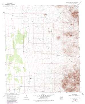
Swallow Fork Peak Topo Map New Mexico
To zoom in, hover over the map of Swallow Fork Peak
USGS Topo Quad 32108b7 - 1:24,000 scale
| Topo Map Name: | Swallow Fork Peak |
| USGS Topo Quad ID: | 32108b7 |
| Print Size: | ca. 21 1/4" wide x 27" high |
| Southeast Coordinates: | 32.125° N latitude / 108.75° W longitude |
| Map Center Coordinates: | 32.1875° N latitude / 108.8125° W longitude |
| U.S. State: | NM |
| Filename: | o32108b7.jpg |
| Download Map JPG Image: | Swallow Fork Peak topo map 1:24,000 scale |
| Map Type: | Topographic |
| Topo Series: | 7.5´ |
| Map Scale: | 1:24,000 |
| Source of Map Images: | United States Geological Survey (USGS) |
| Alternate Map Versions: |
Swallow Fork Peak NM 1965, updated 1966 Download PDF Buy paper map Swallow Fork Peak NM 1965, updated 1980 Download PDF Buy paper map Swallow Fork Peak NM 2010 Download PDF Buy paper map Swallow Fork Peak NM 2013 Download PDF Buy paper map Swallow Fork Peak NM 2017 Download PDF Buy paper map |
1:24,000 Topo Quads surrounding Swallow Fork Peak
> Back to 32108a1 at 1:100,000 scale
> Back to 32108a1 at 1:250,000 scale
> Back to U.S. Topo Maps home
Swallow Fork Peak topo map: Gazetteer
Swallow Fork Peak: Areas
Lighting Dock Area KGRA elevation 1371m 4498′Swallow Fork Peak: Mines
Bug House Mine elevation 1404m 4606′Cedar Lode elevation 1566m 5137′
Light Load Mine elevation 1404m 4606′
Lucky Strike Lode elevation 1462m 4796′
Silver Bell Mine elevation 1433m 4701′
Swallow Fork Peak: Populated Places
Leitendorf (historical) elevation 1388m 4553′Swallow Fork Peak: Reservoirs
C C C Tank elevation 1362m 4468′Goat Camp Tank elevation 1435m 4708′
Wheelbarrow Tank elevation 1396m 4580′
Swallow Fork Peak: Springs
Able Seep elevation 1494m 4901′Swallow Fork Peak: Streams
Mansfield Wash elevation 1270m 4166′Swallow Fork Peak: Summits
Fourmile Hill elevation 1347m 4419′Goat Mountain elevation 1697m 5567′
Lightning Dock Mountain elevation 1682m 5518′
Mexican Hat elevation 1645m 5396′
Swallow Fork Peak elevation 1483m 4865′
Twelvemile Hill elevation 1346m 4416′
Swallow Fork Peak: Valleys
Goat Canyon elevation 1305m 4281′Hampton Draw elevation 1272m 4173′
Jose Placencia Canyon elevation 1283m 4209′
New Well Canyon elevation 1360m 4461′
Wildcat Canyon elevation 1317m 4320′
Woodhaul Canyon elevation 1284m 4212′
Swallow Fork Peak: Wells
10031 Water Well elevation 1271m 4169′10032 Water Well elevation 1270m 4166′
10056 Water Well elevation 1280m 4199′
New Well elevation 1430m 4691′
Well A Water Well elevation 1283m 4209′
Swallow Fork Peak digital topo map on disk
Buy this Swallow Fork Peak topo map showing relief, roads, GPS coordinates and other geographical features, as a high-resolution digital map file on DVD:


