Mondel Topo Map New Mexico
To zoom in, hover over the map of Mondel
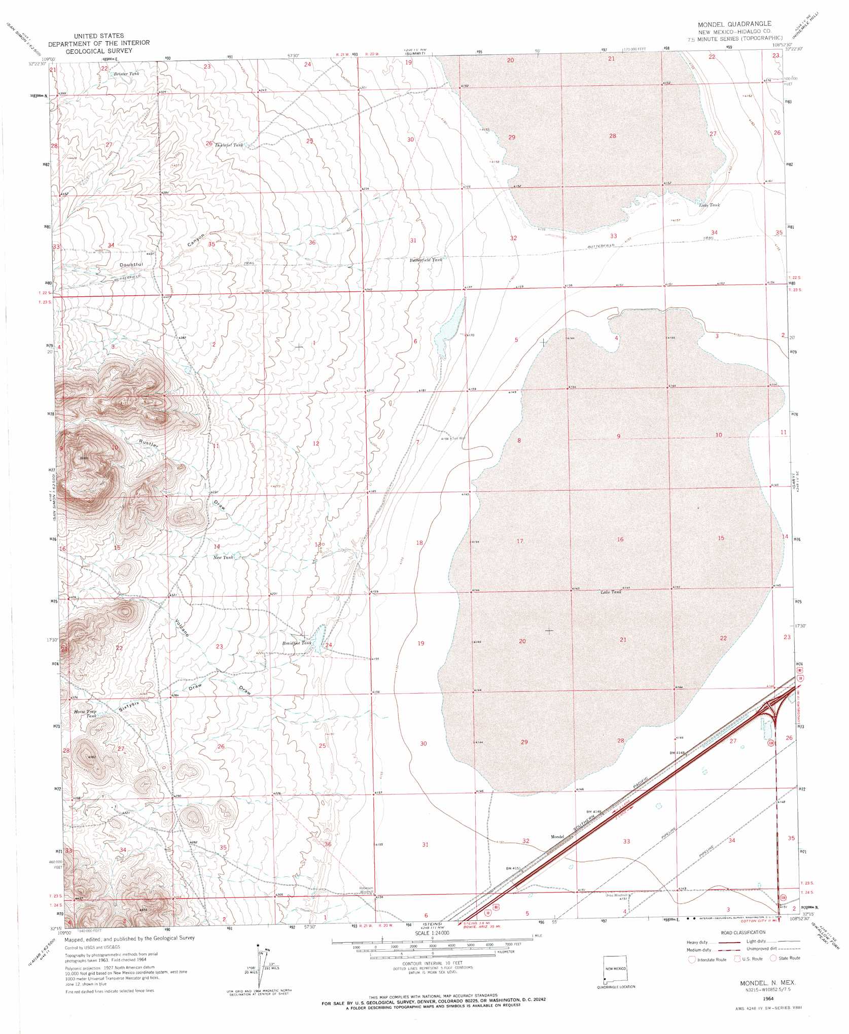
USGS Topo Quad 32108c8 - 1:24,000 scale
| Topo Map Name: | Mondel |
| USGS Topo Quad ID: | 32108c8 |
| Print Size: | ca. 21 1/4" wide x 27" high |
| Southeast Coordinates: | 32.25° N latitude / 108.875° W longitude |
| Map Center Coordinates: | 32.3125° N latitude / 108.9375° W longitude |
| U.S. State: | NM |
| Filename: | o32108c8.jpg |
| Download Map JPG Image: | Mondel topo map 1:24,000 scale |
| Map Type: | Topographic |
| Topo Series: | 7.5´ |
| Map Scale: | 1:24,000 |
| Source of Map Images: | United States Geological Survey (USGS) |
| Alternate Map Versions: |
Mondel NM 1964, updated 1966 Download PDF Buy paper map Mondel NM 2010 Download PDF Buy paper map Mondel NM 2013 Download PDF Buy paper map Mondel NM 2017 Download PDF Buy paper map |
1:24,000 Topo Quads surrounding Mondel
Whitlock Peak |
Round Mountain |
Rock Tank Draw |
Caprock Mountain |
Willow Draw |
Orange Butte |
Engine Mountain |
Summit |
Ninemile Hill |
Culberson Ranch |
San Simon |
Doubtful Mountain |
Mondel |
Gary |
Lordsburg |
Vanar Nw |
Vanar |
Steins |
Swallow Fork Peak |
Pyramid Peak |
Blue Mountain |
San Simon Cienega |
Cotton City |
Table Top Mountain |
South Pyramid Peak |
> Back to 32108a1 at 1:100,000 scale
> Back to 32108a1 at 1:250,000 scale
> Back to U.S. Topo Maps home
Mondel topo map: Gazetteer
Mondel: Flats
South Alkali Flat elevation 1263m 4143′Mondel: Populated Places
Mondel elevation 1266m 4153′Mondel: Reservoirs
Braidfoot Tank elevation 1276m 4186′Brister Tank elevation 1323m 4340′
Butterfield Tank elevation 1275m 4183′
Doubtful Tank elevation 1305m 4281′
Horse Trap Tank elevation 1322m 4337′
Lake Tank elevation 1267m 4156′
Lake Tank elevation 1263m 4143′
New Tank elevation 1299m 4261′
Mondel: Valleys
Doubtful Canyon elevation 1282m 4206′Rustler Draw elevation 1267m 4156′
Sixtysix Draw elevation 1292m 4238′
Volcano Draw elevation 1267m 4156′
Mondel: Wells
UNKS Windmill Water Well elevation 1266m 4153′Mondel digital topo map on disk
Buy this Mondel topo map showing relief, roads, GPS coordinates and other geographical features, as a high-resolution digital map file on DVD: