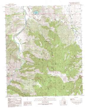
Mangas Springs Topo Map New Mexico
To zoom in, hover over the map of Mangas Springs
USGS Topo Quad 32108g5 - 1:24,000 scale
| Topo Map Name: | Mangas Springs |
| USGS Topo Quad ID: | 32108g5 |
| Print Size: | ca. 21 1/4" wide x 27" high |
| Southeast Coordinates: | 32.75° N latitude / 108.5° W longitude |
| Map Center Coordinates: | 32.8125° N latitude / 108.5625° W longitude |
| U.S. State: | NM |
| Filename: | o32108g5.jpg |
| Download Map JPG Image: | Mangas Springs topo map 1:24,000 scale |
| Map Type: | Topographic |
| Topo Series: | 7.5´ |
| Map Scale: | 1:24,000 |
| Source of Map Images: | United States Geological Survey (USGS) |
| Alternate Map Versions: |
Mangas Springs NM 1990, updated 1991 Download PDF Buy paper map Mangas Springs NM 1999, updated 2002 Download PDF Buy paper map Mangas Springs NM 2011 Download PDF Buy paper map Mangas Springs NM 2013 Download PDF Buy paper map Mangas Springs NM 2017 Download PDF Buy paper map |
| FStopo: | US Forest Service topo Mangas Springs is available: Download FStopo PDF Download FStopo TIF |
1:24,000 Topo Quads surrounding Mangas Springs
> Back to 32108e1 at 1:100,000 scale
> Back to 32108a1 at 1:250,000 scale
> Back to U.S. Topo Maps home
Mangas Springs topo map: Gazetteer
Mangas Springs: Basins
Buzzard Bay elevation 1622m 5321′Mangas Springs: Dams
Bill Evans Lake Dam elevation 1416m 4645′Lebus Recreation Reservoir Dam elevation 1416m 4645′
Mangas Springs: Gaps
Ramsey Saddle elevation 1592m 5223′Mangas Springs: Lakes
Mangas Lake elevation 1446m 4744′Mangas Springs: Mines
Blackhawk elevation 1618m 5308′Blackmoor Mine elevation 1572m 5157′
Cora Miller Mine elevation 1446m 4744′
Fleming Canyon Prospects elevation 1653m 5423′
Old Smokey Group elevation 1514m 4967′
Purple Heart Mine elevation 1616m 5301′
Telegraph Mine elevation 1515m 4970′
Mangas Springs: Populated Places
Mangas Springs elevation 1443m 4734′Telegraph (historical) elevation 1515m 4970′
Mangas Springs: Ranges
Big Burro Mountains elevation 1675m 5495′Mangas Springs: Reservoirs
Barney Kerr Tank elevation 1673m 5488′Bill Evans Lake elevation 1416m 4645′
Blue Stone Tank elevation 1498m 4914′
Bone Tank elevation 1342m 4402′
Boundary Tank elevation 1677m 5501′
Cake Canyon Tank elevation 1467m 4812′
Fence Line Tank elevation 1684m 5524′
Grassy Flat Tank elevation 1738m 5702′
Ira Canyon Tank elevation 1511m 4957′
Juniper Tank elevation 1655m 5429′
Pig Tank elevation 1650m 5413′
Purple Heart Tank elevation 1621m 5318′
Mangas Springs: Ridges
Ira Ridge elevation 1684m 5524′Mangas Springs: Springs
Adobe Spring elevation 1446m 4744′Adobe Spring elevation 1368m 4488′
Butterfly Seep elevation 1615m 5298′
East Prong Spring elevation 1504m 4934′
Grapevine Spring elevation 1517m 4977′
Miller Spring elevation 1657m 5436′
Tub Spring elevation 1480m 4855′
Wild Horse Spring elevation 1594m 5229′
Mangas Springs: Streams
Mangas Creek elevation 1334m 4376′Mangas Springs: Summits
Saddle Rock elevation 1714m 5623′Saint Peters Rock elevation 1482m 4862′
Schoolhouse Mountain elevation 1941m 6368′
Wild Horse Mesa elevation 1734m 5688′
Mangas Springs: Valleys
Bear Canyon elevation 1300m 4265′Black Hawk Canyon elevation 1547m 5075′
Blacksmith Canyon elevation 1438m 4717′
Buzzard Canyon elevation 1318m 4324′
Cake Canyon elevation 1383m 4537′
Cherokee Canyon elevation 1335m 4379′
Cordell Canyon elevation 1442m 4730′
Cottonwood Canyon elevation 1461m 4793′
Davis Canyon elevation 1334m 4376′
Dud Canyon elevation 1455m 4773′
East Fork Schoolhouse Canyon elevation 1380m 4527′
Faucet Canyon elevation 1300m 4265′
Ira Canyon elevation 1326m 4350′
Little Bear Canyon elevation 1447m 4747′
Mangas Valley elevation 1334m 4376′
Miller Canyon elevation 1580m 5183′
Moonhull Canyon elevation 1329m 4360′
North Fork Ira Canyon elevation 1377m 4517′
North Fork Wild Horse Canyon elevation 1580m 5183′
Pancho Canyon elevation 1334m 4376′
Patterson Canyon elevation 1331m 4366′
Pyrite Canyon elevation 1297m 4255′
Road Canyon elevation 1317m 4320′
Schoolhouse Canyon elevation 1351m 4432′
Sheep Corral Draw elevation 1443m 4734′
South Fork Buzzard Canyon elevation 1404m 4606′
West Fork Schoolhouse Canyon elevation 1378m 4520′
Wild Horse Canyon elevation 1305m 4281′
Mangas Springs: Wells
Blue Stone Well elevation 1614m 5295′Mangas Springs digital topo map on disk
Buy this Mangas Springs topo map showing relief, roads, GPS coordinates and other geographical features, as a high-resolution digital map file on DVD:


