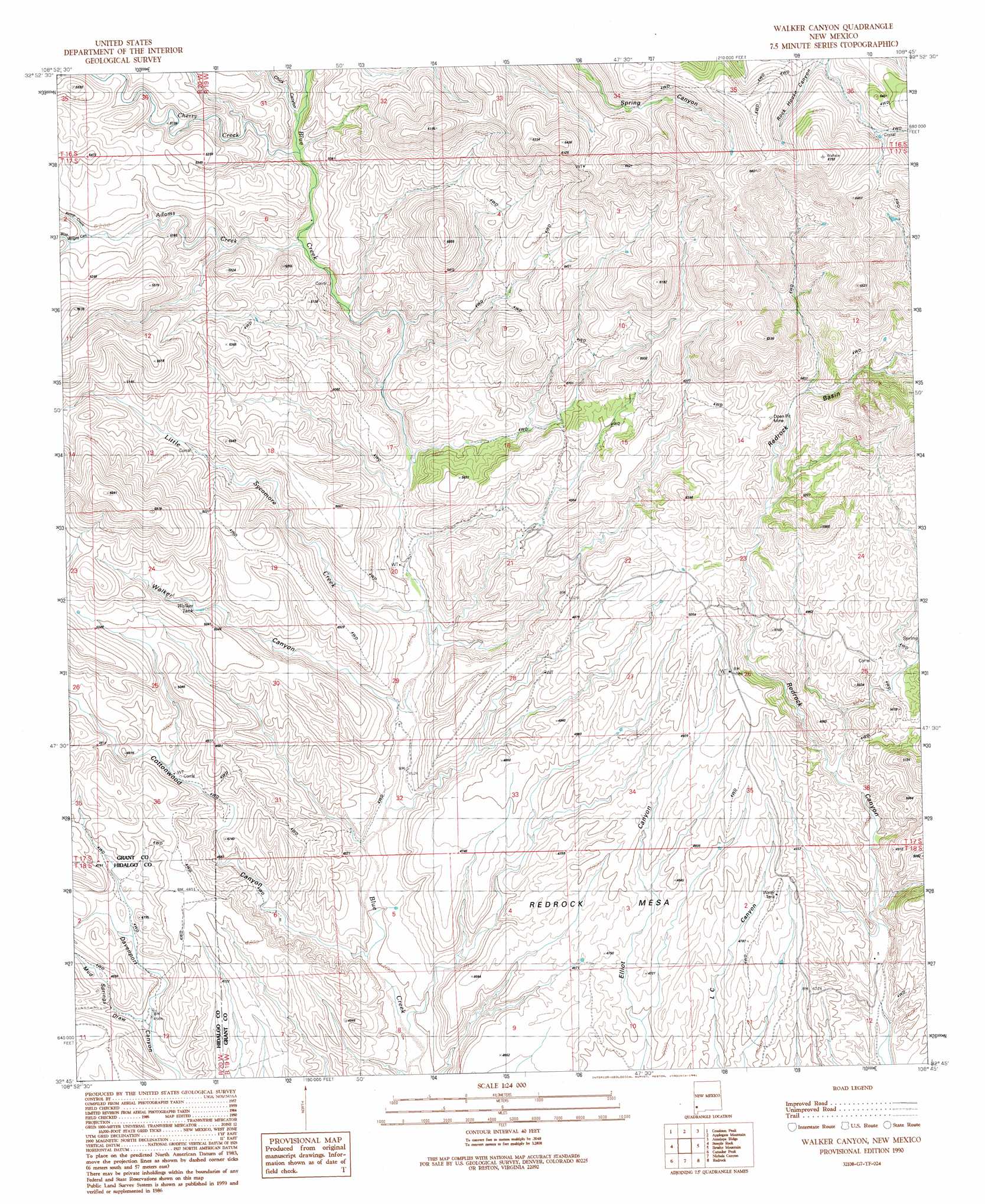
Walker Canyon Topo Map New Mexico
To zoom in, hover over the map of Walker Canyon
USGS Topo Quad 32108g7 - 1:24,000 scale
| Topo Map Name: | Walker Canyon |
| USGS Topo Quad ID: | 32108g7 |
| Print Size: | ca. 21 1/4" wide x 27" high |
| Southeast Coordinates: | 32.75° N latitude / 108.75° W longitude |
| Map Center Coordinates: | 32.8125° N latitude / 108.8125° W longitude |
| U.S. State: | NM |
| Filename: | o32108g7.jpg |
| Download Map JPG Image: | Walker Canyon topo map 1:24,000 scale |
| Map Type: | Topographic |
| Topo Series: | 7.5´ |
| Map Scale: | 1:24,000 |
| Source of Map Images: | United States Geological Survey (USGS) |
| Alternate Map Versions: |
Walker Canyon NM 1990, updated 1991 Download PDF Buy paper map Walker Canyon NM 2010 Download PDF Buy paper map Walker Canyon NM 2013 Download PDF Buy paper map Walker Canyon NM 2017 Download PDF Buy paper map |
1:24,000 Topo Quads surrounding Walker Canyon
Big Lue Mountains |
Mule Creek |
Bear Mountain |
Buckhorn |
Canteen Canyon |
Tillie Hall Peak |
Crookson Peak |
Applegate Mountain |
Antelope Ridge |
Cliff |
Goat Camp Spring |
Steeple Rock |
Walker Canyon |
Brushy Mountain |
Mangas Springs |
Duncan |
Canador Peak |
Nichols Canyon |
Redrock |
Bullard Peak |
Round Mountain |
Rock Tank Draw |
Caprock Mountain |
Willow Draw |
Eagle Eye Peak |
> Back to 32108e1 at 1:100,000 scale
> Back to 32108a1 at 1:250,000 scale
> Back to U.S. Topo Maps home
Walker Canyon topo map: Gazetteer
Walker Canyon: Basins
Redrock Basin elevation 1597m 5239′Redrock Basin elevation 1644m 5393′
Walker Canyon: Populated Places
Gunn Place (historical) elevation 1486m 4875′Matthew Place elevation 1461m 4793′
Walker Canyon: Reservoirs
Walker Tank elevation 1501m 4924′Walker Canyon: Streams
Adams Creek elevation 1470m 4822′Cherry Creek elevation 1490m 4888′
Kemp Creek elevation 1566m 5137′
Little Sycamore Creek elevation 1388m 4553′
Walker Canyon: Summits
Redrock Mesa elevation 1430m 4691′Redrock Mesa elevation 1431m 4694′
Walker Canyon: Valleys
Bud Wright Canyon elevation 1568m 5144′Chick Canyon elevation 1497m 4911′
Cottonwood Canyon elevation 1335m 4379′
Mud Springs Draw elevation 1412m 4632′
Walker Canyon elevation 1380m 4527′
Walker Canyon digital topo map on disk
Buy this Walker Canyon topo map showing relief, roads, GPS coordinates and other geographical features, as a high-resolution digital map file on DVD: