Dorsey Ranch Topo Map New Mexico
To zoom in, hover over the map of Dorsey Ranch
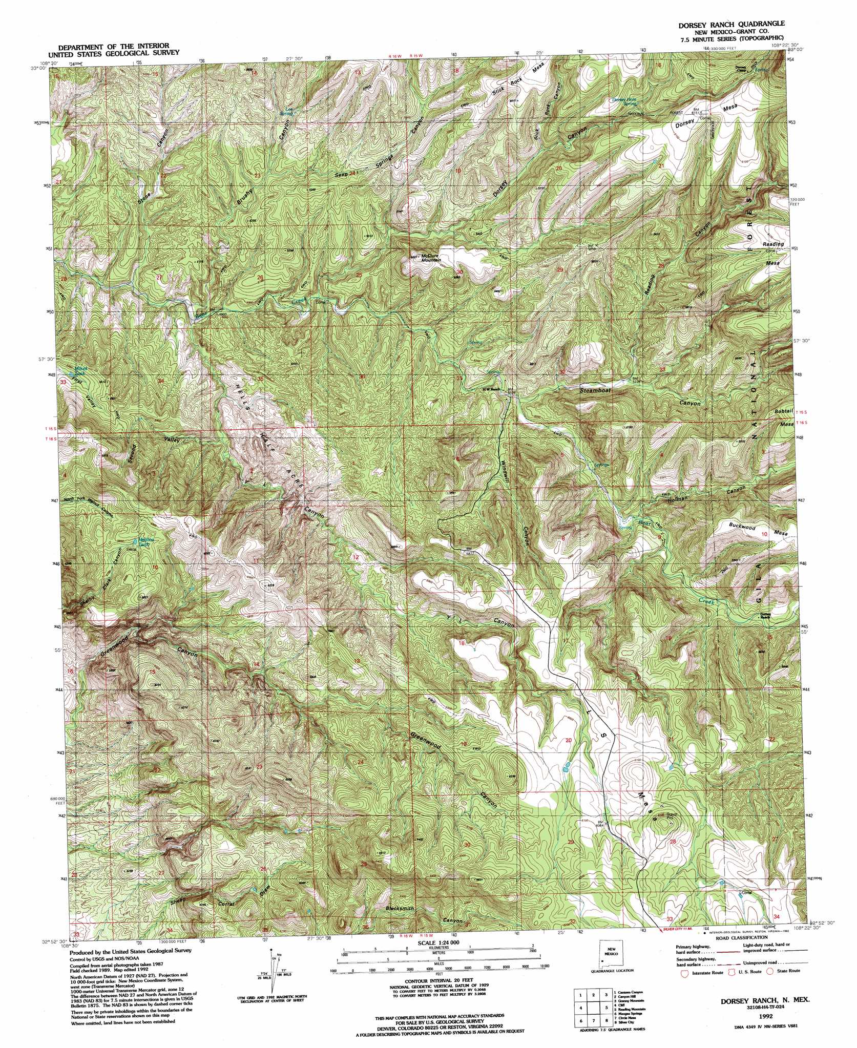
USGS Topo Quad 32108h4 - 1:24,000 scale
| Topo Map Name: | Dorsey Ranch |
| USGS Topo Quad ID: | 32108h4 |
| Print Size: | ca. 21 1/4" wide x 27" high |
| Southeast Coordinates: | 32.875° N latitude / 108.375° W longitude |
| Map Center Coordinates: | 32.9375° N latitude / 108.4375° W longitude |
| U.S. State: | NM |
| Filename: | o32108h4.jpg |
| Download Map JPG Image: | Dorsey Ranch topo map 1:24,000 scale |
| Map Type: | Topographic |
| Topo Series: | 7.5´ |
| Map Scale: | 1:24,000 |
| Source of Map Images: | United States Geological Survey (USGS) |
| Alternate Map Versions: |
Dorsey Ranch NM 1950, updated 1963 Download PDF Buy paper map Dorsey Ranch NM 1950, updated 1975 Download PDF Buy paper map Dorsey Ranch NM 1951 Download PDF Buy paper map Dorsey Ranch NM 1992, updated 1992 Download PDF Buy paper map Dorsey Ranch NM 1999, updated 2002 Download PDF Buy paper map Dorsey Ranch NM 2011 Download PDF Buy paper map Dorsey Ranch NM 2013 Download PDF Buy paper map Dorsey Ranch NM 2017 Download PDF Buy paper map |
| FStopo: | US Forest Service topo Dorsey Ranch is available: Download FStopo PDF Download FStopo TIF |
1:24,000 Topo Quads surrounding Dorsey Ranch
Rice Ranch |
Shelley Peak |
Diablo Range |
Little Turkey Park |
Gila Hot Springs |
Buckhorn |
Canteen Canyon |
Canyon Hill |
Granny Mountain |
Copperas Peak |
Antelope Ridge |
Cliff |
Dorsey Ranch |
Reading Mountain |
Twin Sisters |
Brushy Mountain |
Mangas Springs |
Circle Mesa |
Silver City |
Fort Bayard |
Redrock |
Bullard Peak |
Wind Mountain |
Tyrone |
Hurley West |
> Back to 32108e1 at 1:100,000 scale
> Back to 32108a1 at 1:250,000 scale
> Back to U.S. Topo Maps home
Dorsey Ranch topo map: Gazetteer
Dorsey Ranch: Areas
Hells Half Acre elevation 1594m 5229′Dorsey Ranch: Dams
Redding Mesa Dam elevation 1839m 6033′Dorsey Ranch: Reservoirs
Medina Tank elevation 1761m 5777′Mikes Tank elevation 1632m 5354′
Taylor Tank elevation 1881m 6171′
Dorsey Ranch: Springs
Dorsey Hole Spring elevation 1767m 5797′Dorsey Spring elevation 1636m 5367′
Lee Spring elevation 1602m 5255′
Dorsey Ranch: Summits
Dorsey Mesa elevation 1875m 6151′McClure Mountain elevation 1715m 5626′
Dorsey Ranch: Valleys
Brushy Canyon elevation 1489m 4885′Dorsey Canyon elevation 1526m 5006′
Holman Canyon elevation 1596m 5236′
Reading Canyon elevation 1595m 5232′
Second Valley elevation 1537m 5042′
Seep Springs Canyon elevation 1567m 5141′
Slick Rock Canyon elevation 1665m 5462′
Steamboat Canyon elevation 1562m 5124′
Stone Canyon elevation 1478m 4849′
Windmill Canyon elevation 1567m 5141′
Y L Canyon elevation 1492m 4895′
Dorsey Ranch digital topo map on disk
Buy this Dorsey Ranch topo map showing relief, roads, GPS coordinates and other geographical features, as a high-resolution digital map file on DVD: