Bowie Mountain South Topo Map Arizona
To zoom in, hover over the map of Bowie Mountain South
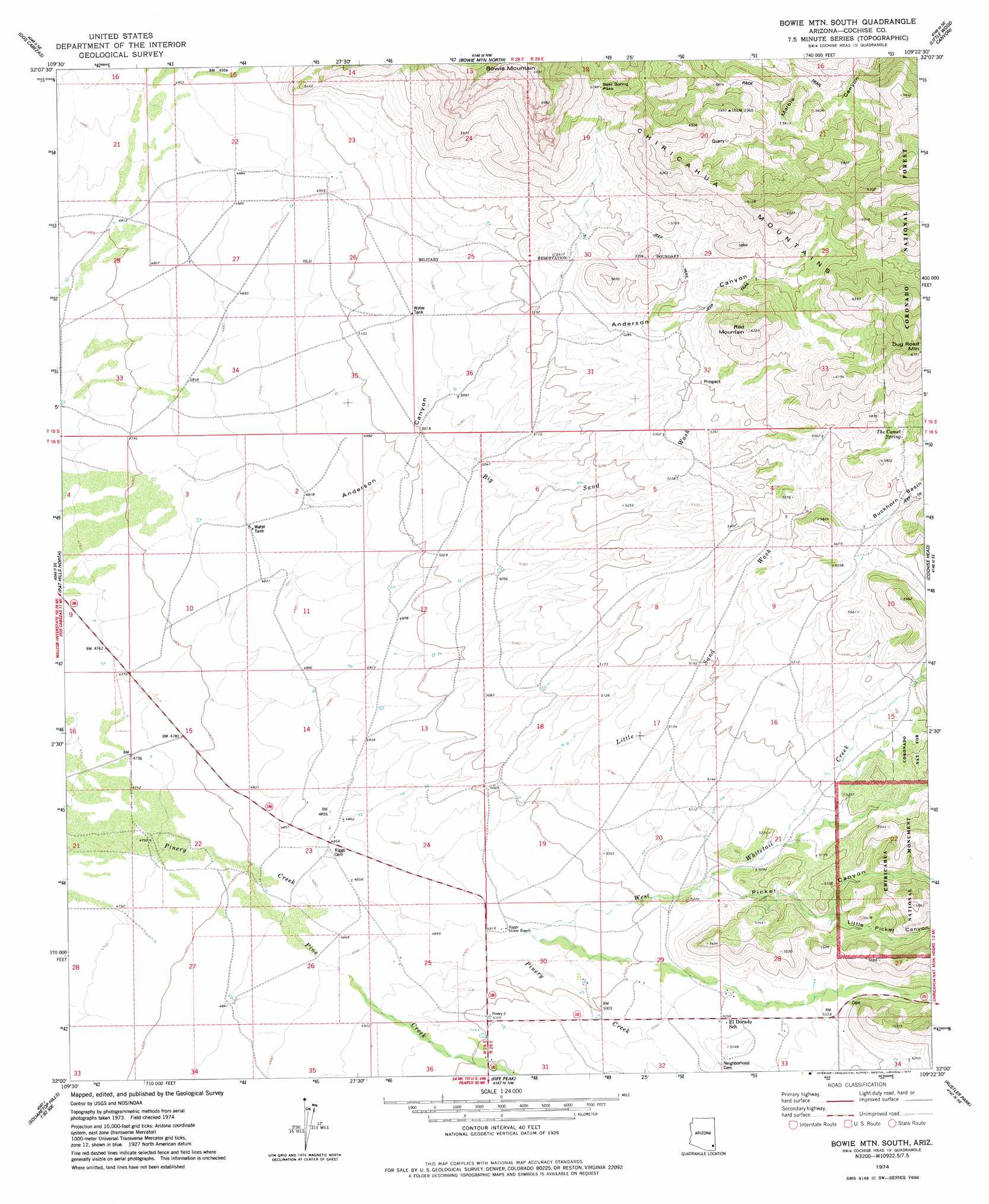
USGS Topo Quad 32109a4 - 1:24,000 scale
| Topo Map Name: | Bowie Mountain South |
| USGS Topo Quad ID: | 32109a4 |
| Print Size: | ca. 21 1/4" wide x 27" high |
| Southeast Coordinates: | 32° N latitude / 109.375° W longitude |
| Map Center Coordinates: | 32.0625° N latitude / 109.4375° W longitude |
| U.S. State: | AZ |
| Filename: | o32109a4.jpg |
| Download Map JPG Image: | Bowie Mountain South topo map 1:24,000 scale |
| Map Type: | Topographic |
| Topo Series: | 7.5´ |
| Map Scale: | 1:24,000 |
| Source of Map Images: | United States Geological Survey (USGS) |
| Alternate Map Versions: |
Bowie Mtn South AZ 1974, updated 1977 Download PDF Buy paper map Bowie Mountain South AZ 2012 Download PDF Buy paper map Bowie Mountain South AZ 2014 Download PDF Buy paper map |
| FStopo: | US Forest Service topo Bowie Mountain South is available: Download FStopo PDF Download FStopo TIF |
1:24,000 Topo Quads surrounding Bowie Mountain South
Railroad Pass |
Luzena |
Bowie |
Olga |
San Simon |
Simmons Peak |
Dos Cabezas |
Bowie Mountain North |
Little Wood Canyon |
Vanar Nw |
Dos Cabezas Sw |
Pat Hills North |
Bowie Mountain South |
Cochise Head |
Blue Mountain |
Sulphur Hills |
Pat Hills South |
Fife Peak |
Rustler Park |
Portal |
Squaretop Hills West |
Squaretop Hills East |
Stanford Canyon |
Chiricahua Peak |
Portal Peak |
> Back to 32109a1 at 1:100,000 scale
> Back to 32108a1 at 1:250,000 scale
> Back to U.S. Topo Maps home
Bowie Mountain South topo map: Gazetteer
Bowie Mountain South: Gaps
Bear Spring Pass elevation 1766m 5793′Bowie Mountain South: Mines
Marble Quarry elevation 1720m 5643′Bowie Mountain South: Springs
The Comet Spring elevation 1741m 5711′Bowie Mountain South: Streams
Big Sand Wash elevation 1513m 4963′Little Sand Wash elevation 1493m 4898′
Pine Creek elevation 1463m 4799′
West Whitetail Creek elevation 1466m 4809′
Bowie Mountain South: Summits
Bowie Mountain elevation 2096m 6876′Dug Road Mountain elevation 2050m 6725′
Red Mountain elevation 1893m 6210′
Bowie Mountain South: Valleys
Anderson Canyon elevation 1500m 4921′Little Picket Canyon elevation 1573m 5160′
Picket Canyon elevation 1536m 5039′
Bowie Mountain South: Wells
Red Wing Well elevation 1517m 4977′Bowie Mountain South digital topo map on disk
Buy this Bowie Mountain South topo map showing relief, roads, GPS coordinates and other geographical features, as a high-resolution digital map file on DVD: