Dos Cabezas Sw Topo Map Arizona
To zoom in, hover over the map of Dos Cabezas Sw
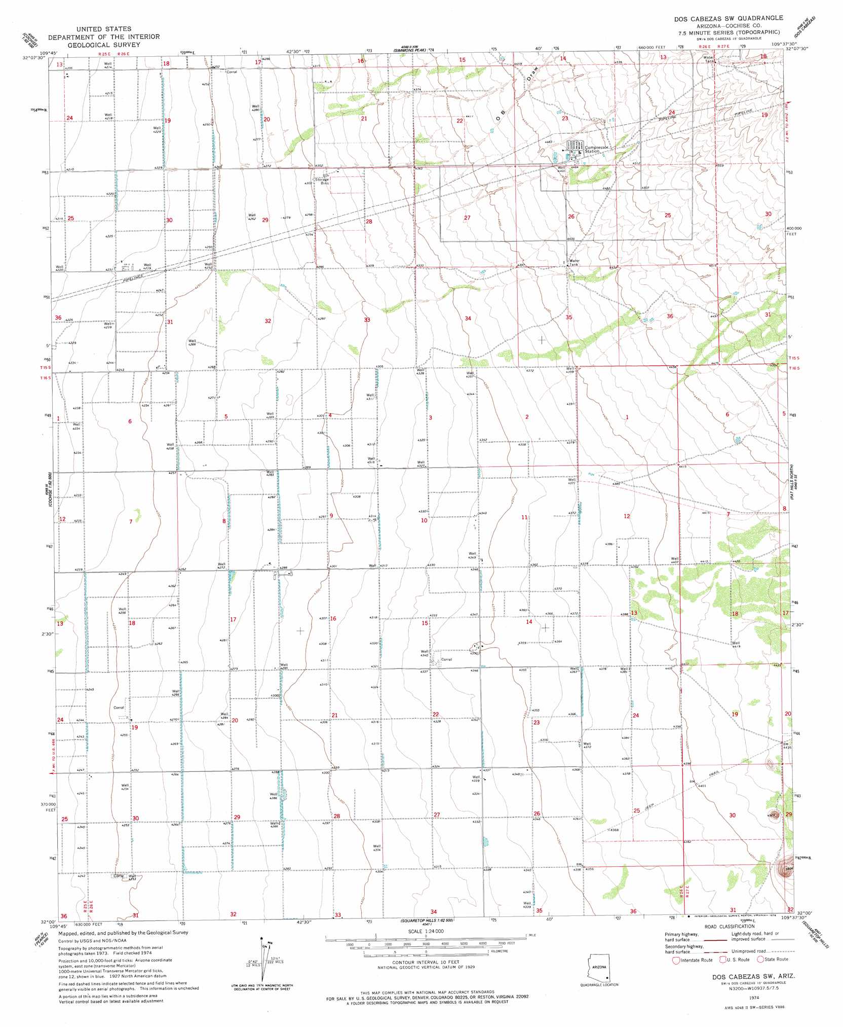
USGS Topo Quad 32109a6 - 1:24,000 scale
| Topo Map Name: | Dos Cabezas Sw |
| USGS Topo Quad ID: | 32109a6 |
| Print Size: | ca. 21 1/4" wide x 27" high |
| Southeast Coordinates: | 32° N latitude / 109.625° W longitude |
| Map Center Coordinates: | 32.0625° N latitude / 109.6875° W longitude |
| U.S. State: | AZ |
| Filename: | o32109a6.jpg |
| Download Map JPG Image: | Dos Cabezas Sw topo map 1:24,000 scale |
| Map Type: | Topographic |
| Topo Series: | 7.5´ |
| Map Scale: | 1:24,000 |
| Source of Map Images: | United States Geological Survey (USGS) |
| Alternate Map Versions: |
Dos Cabezas SW AZ 1974, updated 1976 Download PDF Buy paper map Dos Cabezas SW AZ 2011 Download PDF Buy paper map Dos Cabezas SW AZ 2014 Download PDF Buy paper map |
1:24,000 Topo Quads surrounding Dos Cabezas Sw
Square Mountain |
Willcox North |
Railroad Pass |
Luzena |
Bowie |
Red Bird Hills |
Willcox South |
Simmons Peak |
Dos Cabezas |
Bowie Mountain North |
Cochise |
Sulphur Spring |
Dos Cabezas Sw |
Pat Hills North |
Bowie Mountain South |
Cochise Stronghold |
Pearce |
Sulphur Hills |
Pat Hills South |
Fife Peak |
Black Diamond Peak |
Turquoise Mountain |
Squaretop Hills West |
Squaretop Hills East |
Stanford Canyon |
> Back to 32109a1 at 1:100,000 scale
> Back to 32108a1 at 1:250,000 scale
> Back to U.S. Topo Maps home
Dos Cabezas Sw digital topo map on disk
Buy this Dos Cabezas Sw topo map showing relief, roads, GPS coordinates and other geographical features, as a high-resolution digital map file on DVD: