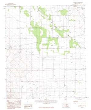
Vanar Nw Topo Map Arizona
To zoom in, hover over the map of Vanar Nw
USGS Topo Quad 32109b2 - 1:24,000 scale
| Topo Map Name: | Vanar Nw |
| USGS Topo Quad ID: | 32109b2 |
| Print Size: | ca. 21 1/4" wide x 27" high |
| Southeast Coordinates: | 32.125° N latitude / 109.125° W longitude |
| Map Center Coordinates: | 32.1875° N latitude / 109.1875° W longitude |
| U.S. State: | AZ |
| Filename: | o32109b2.jpg |
| Download Map JPG Image: | Vanar Nw topo map 1:24,000 scale |
| Map Type: | Topographic |
| Topo Series: | 7.5´ |
| Map Scale: | 1:24,000 |
| Source of Map Images: | United States Geological Survey (USGS) |
| Alternate Map Versions: |
Vanar NW AZ 1987, updated 1987 Download PDF Buy paper map Vanar NW AZ 1996, updated 2003 Download PDF Buy paper map Vanar NW AZ 2011 Download PDF Buy paper map Vanar NW AZ 2014 Download PDF Buy paper map |
1:24,000 Topo Quads surrounding Vanar Nw
> Back to 32109a1 at 1:100,000 scale
> Back to 32108a1 at 1:250,000 scale
> Back to U.S. Topo Maps home
Vanar Nw topo map: Gazetteer
Vanar Nw: Streams
East Whitetail Creek elevation 1177m 3861′Vanar Wash elevation 1128m 3700′
Whitetail Creek elevation 1177m 3861′
Vanar Nw digital topo map on disk
Buy this Vanar Nw topo map showing relief, roads, GPS coordinates and other geographical features, as a high-resolution digital map file on DVD:


