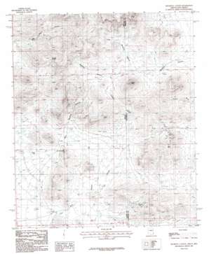
Doubtful Mountain Topo Map Arizona
To zoom in, hover over the map of Doubtful Mountain
USGS Topo Quad 32109c1 - 1:24,000 scale
| Topo Map Name: | Doubtful Mountain |
| USGS Topo Quad ID: | 32109c1 |
| Print Size: | ca. 21 1/4" wide x 27" high |
| Southeast Coordinates: | 32.25° N latitude / 109° W longitude |
| Map Center Coordinates: | 32.3125° N latitude / 109.0625° W longitude |
| U.S. States: | AZ, NM |
| Filename: | o32109c1.jpg |
| Download Map JPG Image: | Doubtful Mountain topo map 1:24,000 scale |
| Map Type: | Topographic |
| Topo Series: | 7.5´ |
| Map Scale: | 1:24,000 |
| Source of Map Images: | United States Geological Survey (USGS) |
| Alternate Map Versions: |
Doubtful Canyon AZ 1987, updated 1987 Download PDF Buy paper map Doubtful Canyon AZ 1998, updated 2003 Download PDF Buy paper map Doubtful Canyon AZ 2010 Download PDF Buy paper map Doubtful Canyon AZ 2011 Download PDF Buy paper map Doubtful Canyon AZ 2014 Download PDF Buy paper map |
1:24,000 Topo Quads surrounding Doubtful Mountain
> Back to 32109a1 at 1:100,000 scale
> Back to 32108a1 at 1:250,000 scale
> Back to U.S. Topo Maps home
Doubtful Mountain topo map: Gazetteer
Doubtful Mountain: Mines
Black Face elevation 1415m 4642′Buckhorn Prospect elevation 1422m 4665′
Elore Mine elevation 1424m 4671′
Eloro Mine elevation 1435m 4708′
Mayflower Prospect elevation 1422m 4665′
Merrimac Prospect elevation 1422m 4665′
National Mine elevation 1357m 4452′
Volcano Mine elevation 1424m 4671′
Doubtful Mountain: Populated Places
Wheeler Place elevation 1248m 4094′Doubtful Mountain: Ranges
Steins Peak Range elevation 1742m 5715′Doubtful Mountain: Reservoirs
Dean Tank elevation 1240m 4068′McKenzie Tank elevation 1229m 4032′
Doubtful Mountain: Springs
Canteen Spring elevation 1459m 4786′Ward Spring elevation 1361m 4465′
Doubtful Mountain: Summits
Roostercomb elevation 1441m 4727′Steins Peak elevation 1742m 5715′
Doubtful Mountain: Valleys
Little Doubtful Canyon elevation 1452m 4763′Little Doubtful Canyon elevation 1444m 4737′
Powers Canyon elevation 1222m 4009′
Powers Canyon elevation 1222m 4009′
Ward Canyon elevation 1311m 4301′
West Doubtful Canyon elevation 1244m 4081′
Doubtful Mountain digital topo map on disk
Buy this Doubtful Mountain topo map showing relief, roads, GPS coordinates and other geographical features, as a high-resolution digital map file on DVD:


