San Simon Topo Map Arizona
To zoom in, hover over the map of San Simon
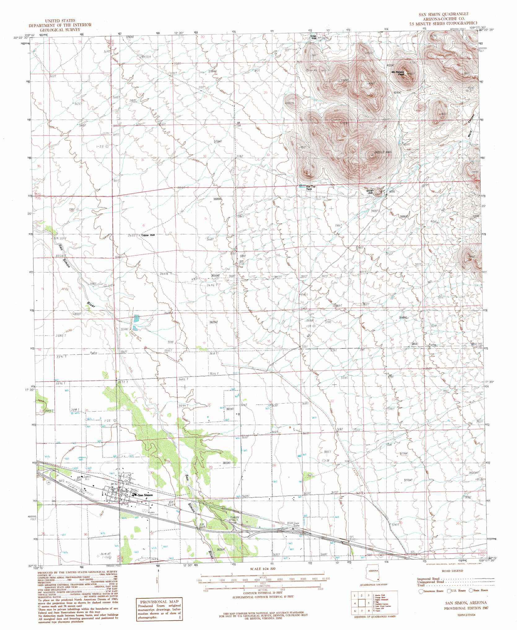
USGS Topo Quad 32109c2 - 1:24,000 scale
| Topo Map Name: | San Simon |
| USGS Topo Quad ID: | 32109c2 |
| Print Size: | ca. 21 1/4" wide x 27" high |
| Southeast Coordinates: | 32.25° N latitude / 109.125° W longitude |
| Map Center Coordinates: | 32.3125° N latitude / 109.1875° W longitude |
| U.S. State: | AZ |
| Filename: | o32109c2.jpg |
| Download Map JPG Image: | San Simon topo map 1:24,000 scale |
| Map Type: | Topographic |
| Topo Series: | 7.5´ |
| Map Scale: | 1:24,000 |
| Source of Map Images: | United States Geological Survey (USGS) |
| Alternate Map Versions: |
San Simon AZ 1987, updated 1987 Download PDF Buy paper map San Simon AZ 1998, updated 2003 Download PDF Buy paper map San Simon AZ 2011 Download PDF Buy paper map San Simon AZ 2014 Download PDF Buy paper map |
1:24,000 Topo Quads surrounding San Simon
Javelina Peak |
Whitlock Cienega |
Whitlock Peak |
Round Mountain |
Rock Tank Draw |
Ryan Draw |
Martin Well |
Orange Butte |
Engine Mountain |
Summit |
Bowie |
Olga |
San Simon |
Doubtful Mountain |
Mondel |
Bowie Mountain North |
Little Wood Canyon |
Vanar Nw |
Vanar |
Steins |
Bowie Mountain South |
Cochise Head |
Blue Mountain |
San Simon Cienega |
Cotton City |
> Back to 32109a1 at 1:100,000 scale
> Back to 32108a1 at 1:250,000 scale
> Back to U.S. Topo Maps home
San Simon topo map: Gazetteer
San Simon: Crossings
East San Simon Interchange elevation 1108m 3635′West San Simon Interchange elevation 1099m 3605′
San Simon: Dams
West Doubtful Detention Dam elevation 1099m 3605′San Simon: Populated Places
San Simon elevation 0m 0′San Simon: Post Offices
San Simon Post Office elevation 1105m 3625′San Simon: Reservoirs
Hat Top Tank elevation 1172m 3845′San Simon: Summits
Gold Hill elevation 1258m 4127′McKenzie Peak elevation 1491m 4891′
San Simon: Wells
Copper Well elevation 1104m 3622′Kings Well elevation 1214m 3982′
San Simon digital topo map on disk
Buy this San Simon topo map showing relief, roads, GPS coordinates and other geographical features, as a high-resolution digital map file on DVD: