Engine Mountain Topo Map Arizona
To zoom in, hover over the map of Engine Mountain
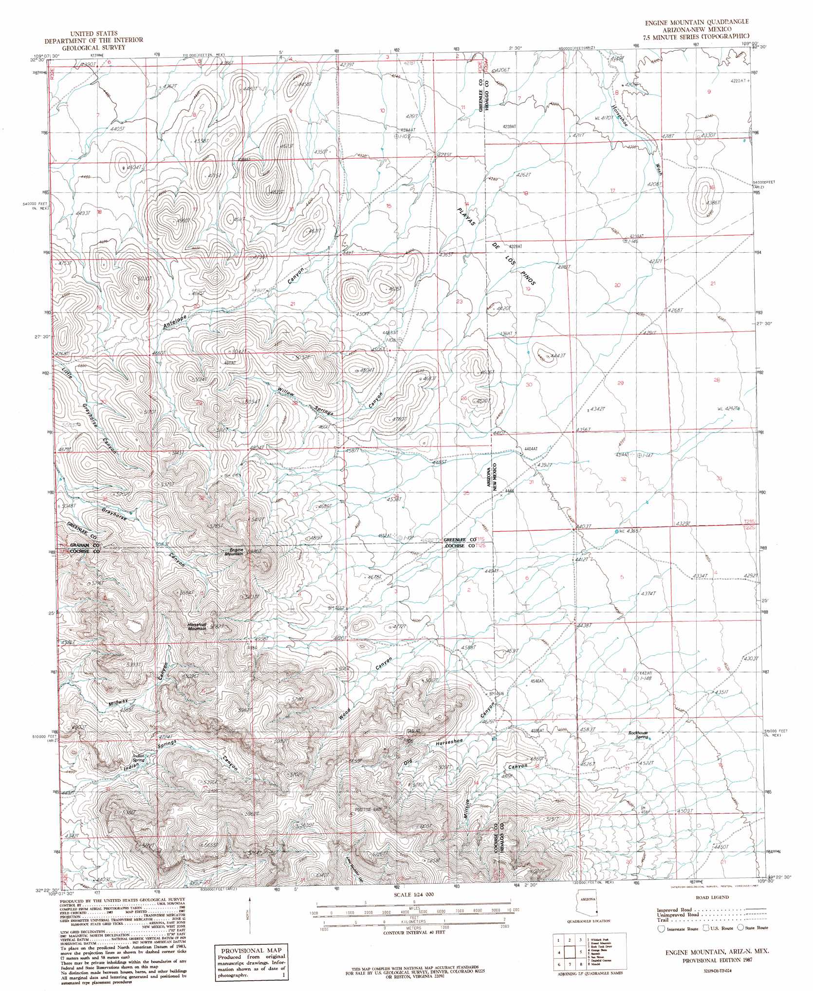
USGS Topo Quad 32109d1 - 1:24,000 scale
| Topo Map Name: | Engine Mountain |
| USGS Topo Quad ID: | 32109d1 |
| Print Size: | ca. 21 1/4" wide x 27" high |
| Southeast Coordinates: | 32.375° N latitude / 109° W longitude |
| Map Center Coordinates: | 32.4375° N latitude / 109.0625° W longitude |
| U.S. States: | AZ, NM |
| Filename: | o32109d1.jpg |
| Download Map JPG Image: | Engine Mountain topo map 1:24,000 scale |
| Map Type: | Topographic |
| Topo Series: | 7.5´ |
| Map Scale: | 1:24,000 |
| Source of Map Images: | United States Geological Survey (USGS) |
| Alternate Map Versions: |
Engine Mountain AZ 2010 Download PDF Buy paper map Engine Mountain AZ 2011 Download PDF Buy paper map Engine Mountain AZ 2014 Download PDF Buy paper map |
1:24,000 Topo Quads surrounding Engine Mountain
Whitlock Mountains Ne |
Hot Well |
Duncan |
Canador Peak |
Nichols Canyon |
Whitlock Cienega |
Whitlock Peak |
Round Mountain |
Rock Tank Draw |
Caprock Mountain |
Martin Well |
Orange Butte |
Engine Mountain |
Summit |
Ninemile Hill |
Olga |
San Simon |
Doubtful Mountain |
Mondel |
Gary |
Little Wood Canyon |
Vanar Nw |
Vanar |
Steins |
Swallow Fork Peak |
> Back to 32109a1 at 1:100,000 scale
> Back to 32108a1 at 1:250,000 scale
> Back to U.S. Topo Maps home
Engine Mountain topo map: Gazetteer
Engine Mountain: Flats
Playas de Los Pinos elevation 1319m 4327′Playas de los Pinos elevation 1331m 4366′
Engine Mountain: Parks
Peloncillo Mountains Wilderness Study Area elevation 1515m 4970′Engine Mountain: Springs
Indian Spring elevation 1407m 4616′Rockhouse Spring elevation 1364m 4475′
Engine Mountain: Summits
Engine Mountain elevation 1808m 5931′Horsefoot Mountain elevation 1722m 5649′
Engine Mountain: Valleys
Indian Springs Canyon elevation 1349m 4425′Millsite Canyon elevation 1323m 4340′
Millsite Canyon elevation 1400m 4593′
Old Horseshoe Canyon elevation 1320m 4330′
Old Horseshoe Canyon elevation 1404m 4606′
Willow Springs Canyon elevation 1362m 4468′
Wood Canyon elevation 1304m 4278′
Wood Canyon elevation 1429m 4688′
Engine Mountain digital topo map on disk
Buy this Engine Mountain topo map showing relief, roads, GPS coordinates and other geographical features, as a high-resolution digital map file on DVD: