Whitlock Mountains Ne Topo Map Arizona
To zoom in, hover over the map of Whitlock Mountains Ne
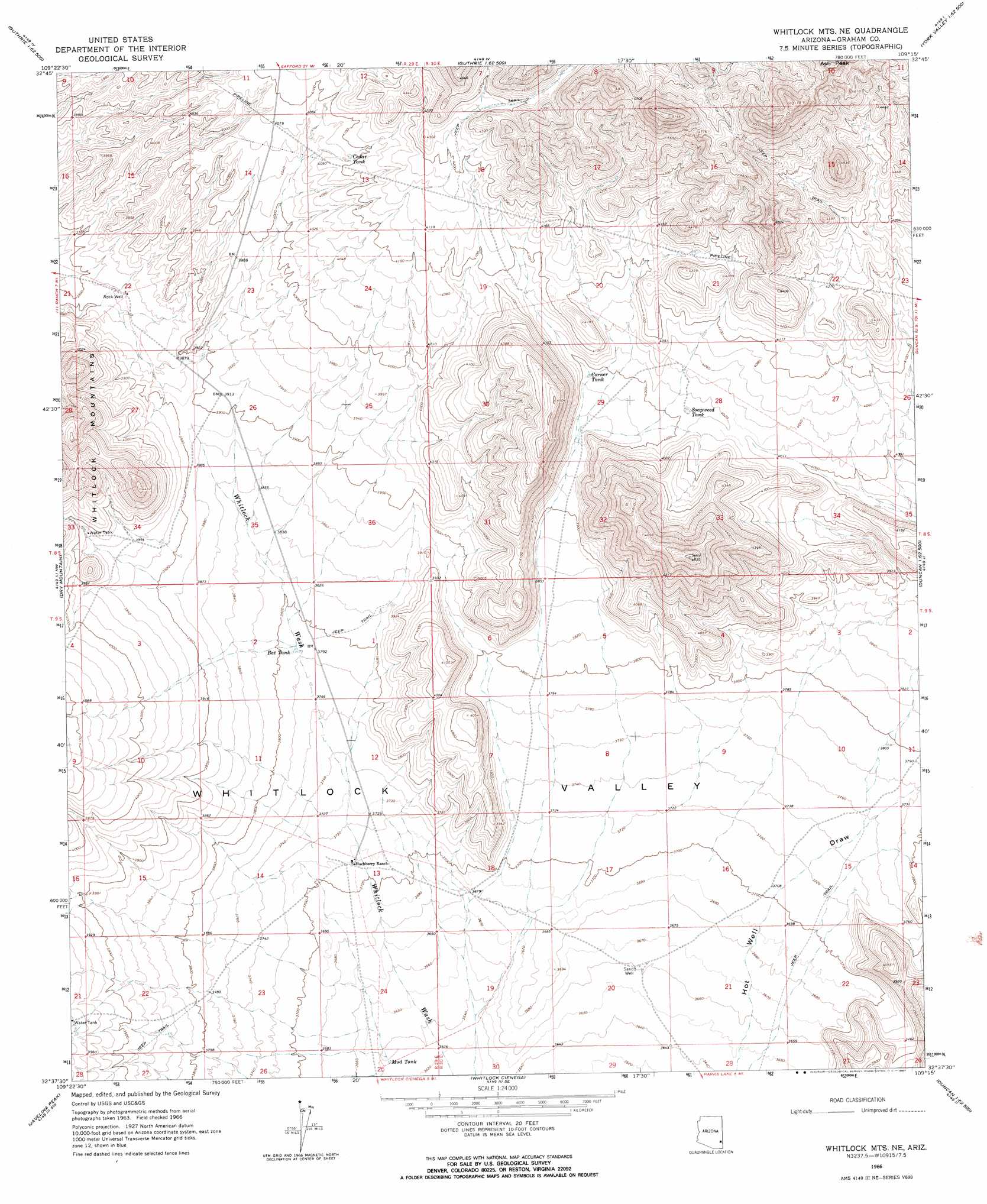
USGS Topo Quad 32109f3 - 1:24,000 scale
| Topo Map Name: | Whitlock Mountains Ne |
| USGS Topo Quad ID: | 32109f3 |
| Print Size: | ca. 21 1/4" wide x 27" high |
| Southeast Coordinates: | 32.625° N latitude / 109.25° W longitude |
| Map Center Coordinates: | 32.6875° N latitude / 109.3125° W longitude |
| U.S. State: | AZ |
| Filename: | o32109f3.jpg |
| Download Map JPG Image: | Whitlock Mountains Ne topo map 1:24,000 scale |
| Map Type: | Topographic |
| Topo Series: | 7.5´ |
| Map Scale: | 1:24,000 |
| Source of Map Images: | United States Geological Survey (USGS) |
| Alternate Map Versions: |
Whitlock Mts. NE AZ 1966, updated 1967 Download PDF Buy paper map Whitlock Mountains NE AZ 2011 Download PDF Buy paper map Whitlock Mountains NE AZ 2014 Download PDF Buy paper map |
1:24,000 Topo Quads surrounding Whitlock Mountains Ne
Lone Star Mountain |
Gila Box |
Guthrie |
York |
Tillie Hall Peak |
San Jose |
Tollgate Tank |
Ash Peak |
Sheldon |
Goat Camp Spring |
Artesia Ne |
Dry Mountain |
Whitlock Mountains Ne |
Hot Well |
Duncan |
Tanque |
Javelina Peak |
Whitlock Cienega |
Whitlock Peak |
Round Mountain |
Fisher Hills |
Ryan Draw |
Martin Well |
Orange Butte |
Engine Mountain |
> Back to 32109e1 at 1:100,000 scale
> Back to 32108a1 at 1:250,000 scale
> Back to U.S. Topo Maps home
Whitlock Mountains Ne topo map: Gazetteer
Whitlock Mountains Ne: Basins
Whitlock Valley elevation 1133m 3717′Whitlock Mountains Ne: Reservoirs
Bat Tank elevation 1154m 3786′Cedar Tank elevation 1247m 4091′
Corner Tank elevation 1216m 3989′
Mud Hole Tank elevation 1110m 3641′
Mud Tank elevation 1110m 3641′
Soapweed Tank elevation 1222m 4009′
Whitlock Mountains Ne: Wells
Rock Well elevation 1168m 3832′Whitlock Mountains Ne digital topo map on disk
Buy this Whitlock Mountains Ne topo map showing relief, roads, GPS coordinates and other geographical features, as a high-resolution digital map file on DVD: