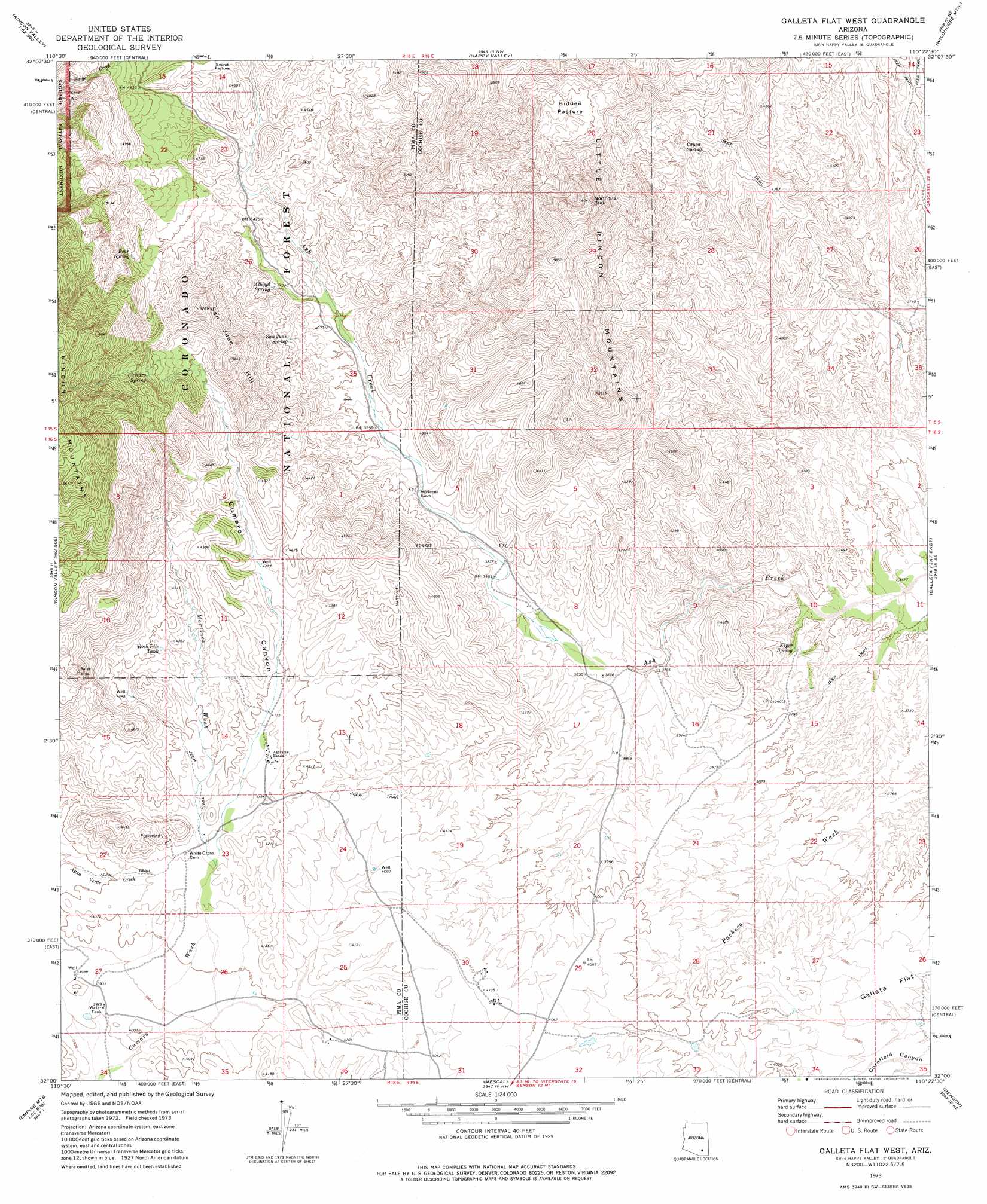
Galleta Flat West Topo Map Arizona
To zoom in, hover over the map of Galleta Flat West
USGS Topo Quad 32110a4 - 1:24,000 scale
| Topo Map Name: | Galleta Flat West |
| USGS Topo Quad ID: | 32110a4 |
| Print Size: | ca. 21 1/4" wide x 27" high |
| Southeast Coordinates: | 32° N latitude / 110.375° W longitude |
| Map Center Coordinates: | 32.0625° N latitude / 110.4375° W longitude |
| U.S. State: | AZ |
| Filename: | o32110a4.jpg |
| Download Map JPG Image: | Galleta Flat West topo map 1:24,000 scale |
| Map Type: | Topographic |
| Topo Series: | 7.5´ |
| Map Scale: | 1:24,000 |
| Source of Map Images: | United States Geological Survey (USGS) |
| Alternate Map Versions: |
Galleta Flat West AZ 1973, updated 1976 Download PDF Buy paper map Galleta Flat West AZ 1973, updated 1976 Download PDF Buy paper map Galleta Flat West AZ 1996, updated 2002 Download PDF Buy paper map Galleta Flat West AZ 2011 Download PDF Buy paper map Galleta Flat West AZ 2014 Download PDF Buy paper map |
| FStopo: | US Forest Service topo Galleta Flat West is available: Download FStopo PDF Download FStopo TIF |
1:24,000 Topo Quads surrounding Galleta Flat West
Agua Caliente Hill |
Piety Hill |
Soza Canyon |
Soza Mesa |
Hookers Hot Springs |
Tanque Verde Peak |
Mica Mountain |
Happy Valley |
Wildhorse Mountain |
Deepwell Ranch |
Vail |
Rincon Peak |
Galleta Flat West |
Galleta Flat East |
San Pedro Ranch |
Mount Fagan |
The Narrows |
Mescal |
Benson |
Saint David |
Empire Ranch |
Spring Water Canyon |
Apache Peak |
Mcgrew Spring |
Land |
> Back to 32110a1 at 1:100,000 scale
> Back to 32110a1 at 1:250,000 scale
> Back to U.S. Topo Maps home
Galleta Flat West topo map: Gazetteer
Galleta Flat West: Flats
Galleta Flat elevation 1172m 3845′Hidden Pasture elevation 1507m 4944′
Galleta Flat West: Reservoirs
East Tank elevation 1292m 4238′Mackenzie Tank elevation 1290m 4232′
Rock Pile Tank elevation 1322m 4337′
Galleta Flat West: Springs
Alboyd Spring elevation 1261m 4137′Bear Spring elevation 1405m 4609′
Canoa Spring elevation 1326m 4350′
Cumaro Spring elevation 1486m 4875′
Kiper Spring elevation 1125m 3690′
San Juan Spring elevation 0m 0′
Galleta Flat West: Streams
Martinez Wash elevation 1239m 4064′Galleta Flat West: Summits
North Star Peak elevation 1815m 5954′San Juan Hill elevation 0m 0′
Galleta Flat West: Valleys
Cumaro Canyon elevation 1244m 4081′Galleta Flat West digital topo map on disk
Buy this Galleta Flat West topo map showing relief, roads, GPS coordinates and other geographical features, as a high-resolution digital map file on DVD: