Black Mountain Topo Map Arizona
To zoom in, hover over the map of Black Mountain
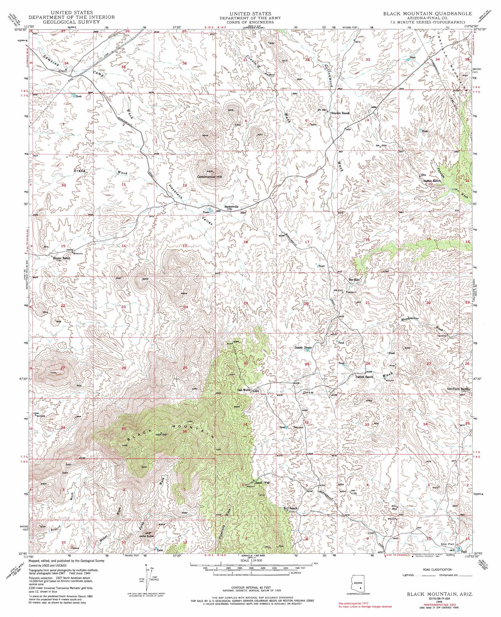
USGS Topo Quad 32110g8 - 1:24,000 scale
| Topo Map Name: | Black Mountain |
| USGS Topo Quad ID: | 32110g8 |
| Print Size: | ca. 21 1/4" wide x 27" high |
| Southeast Coordinates: | 32.75° N latitude / 110.875° W longitude |
| Map Center Coordinates: | 32.8125° N latitude / 110.9375° W longitude |
| U.S. State: | AZ |
| Filename: | o32110g8.jpg |
| Download Map JPG Image: | Black Mountain topo map 1:24,000 scale |
| Map Type: | Topographic |
| Topo Series: | 7.5´ |
| Map Scale: | 1:24,000 |
| Source of Map Images: | United States Geological Survey (USGS) |
| Alternate Map Versions: |
Black Mountain AZ 1949, updated 1961 Download PDF Buy paper map Black Mountain AZ 1949, updated 1975 Download PDF Buy paper map Black Mountain AZ 1949, updated 1985 Download PDF Buy paper map Black Mountain AZ 1950, updated 1950 Download PDF Buy paper map Black Mountain AZ 2011 Download PDF Buy paper map Black Mountain AZ 2014 Download PDF Buy paper map |
1:24,000 Topo Quads surrounding Black Mountain
North Butte |
Grayback |
Kearny |
Hayden |
Christmas |
Ninetysix Hills Nw |
Ninetysix Hills Ne |
Crozier Peak |
Winkelman |
Dudleyville |
Ninetysix Hills Sw |
Ninetysix Hills Se |
Black Mountain |
Putnam Wash |
Lookout Mountain |
Durham Hills |
Chief Butte |
Fortified Peak |
North Of Oracle |
Mammoth |
Desert Peak |
Tortolita Mountains |
Oracle Junction |
Oracle |
Campo Bonito |
> Back to 32110e1 at 1:100,000 scale
> Back to 32110a1 at 1:250,000 scale
> Back to U.S. Topo Maps home
Black Mountain topo map: Gazetteer
Black Mountain: Flats
Star Flat elevation 1168m 3832′Black Mountain: Populated Places
Barkerville elevation 1190m 3904′Oak Wells elevation 1364m 4475′
Black Mountain: Reservoirs
Double Tanks elevation 1292m 4238′Black Mountain: Streams
Jerky Wash elevation 1152m 3779′Black Mountain: Summits
Black Mountain elevation 1700m 5577′Cottonwood Hill elevation 1335m 4379′
Jerky Butte elevation 1385m 4543′
Black Mountain: Valleys
Haystack Valley elevation 1092m 3582′Black Mountain: Wells
Jewell Well elevation 1403m 4603′Black Mountain digital topo map on disk
Buy this Black Mountain topo map showing relief, roads, GPS coordinates and other geographical features, as a high-resolution digital map file on DVD: