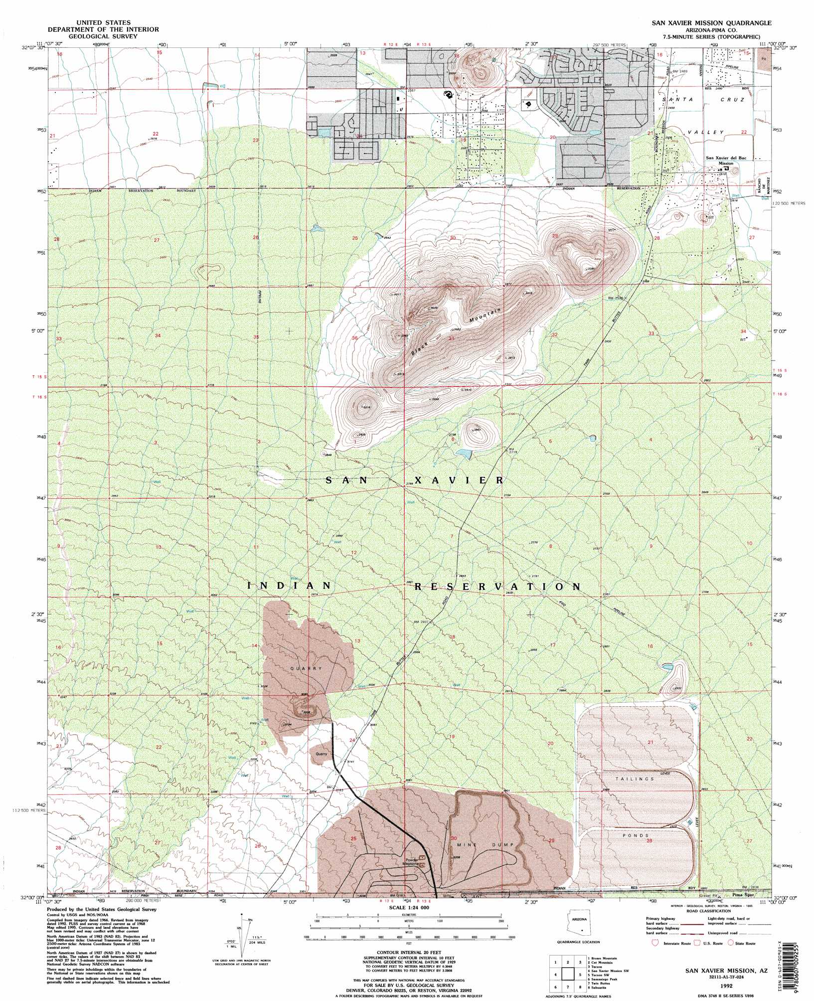
San Xavier Mission Topo Map Arizona
To zoom in, hover over the map of San Xavier Mission
USGS Topo Quad 32111a1 - 1:24,000 scale
| Topo Map Name: | San Xavier Mission |
| USGS Topo Quad ID: | 32111a1 |
| Print Size: | ca. 21 1/4" wide x 27" high |
| Southeast Coordinates: | 32° N latitude / 111° W longitude |
| Map Center Coordinates: | 32.0625° N latitude / 111.0625° W longitude |
| U.S. State: | AZ |
| Filename: | o32111a1.jpg |
| Download Map JPG Image: | San Xavier Mission topo map 1:24,000 scale |
| Map Type: | Topographic |
| Topo Series: | 7.5´ |
| Map Scale: | 1:24,000 |
| Source of Map Images: | United States Geological Survey (USGS) |
| Alternate Map Versions: |
San Xavier Mission AZ 1968, updated 1970 Download PDF Buy paper map San Xavier Mission AZ 1968, updated 1979 Download PDF Buy paper map San Xavier Mission AZ 1992, updated 1995 Download PDF Buy paper map San Xavier Mission AZ 2011 Download PDF Buy paper map San Xavier Mission AZ 2014 Download PDF Buy paper map |
1:24,000 Topo Quads surrounding San Xavier Mission
West Of Avra |
Avra |
Jaynes |
Tucson North |
Sabino Canyon |
Cocoraque Butte |
Brown Mountain |
Cat Mountain |
Tucson |
Tucson East |
Three Points |
San Xavier Mission Sw |
San Xavier Mission |
Tucson Sw |
Tucson Se |
Stevens Mountain |
Samaniego Peak |
Twin Buttes |
Sahuarita |
Corona De Tucson |
Penitas Hills |
Batamote Hills |
Esperanza Mill |
Green Valley |
Helvetia |
> Back to 32111a1 at 1:100,000 scale
> Back to 32110a1 at 1:250,000 scale
> Back to U.S. Topo Maps home
San Xavier Mission topo map: Gazetteer
San Xavier Mission: Summits
Black Mountain elevation 1098m 3602′San Xavier Mission digital topo map on disk
Buy this San Xavier Mission topo map showing relief, roads, GPS coordinates and other geographical features, as a high-resolution digital map file on DVD: