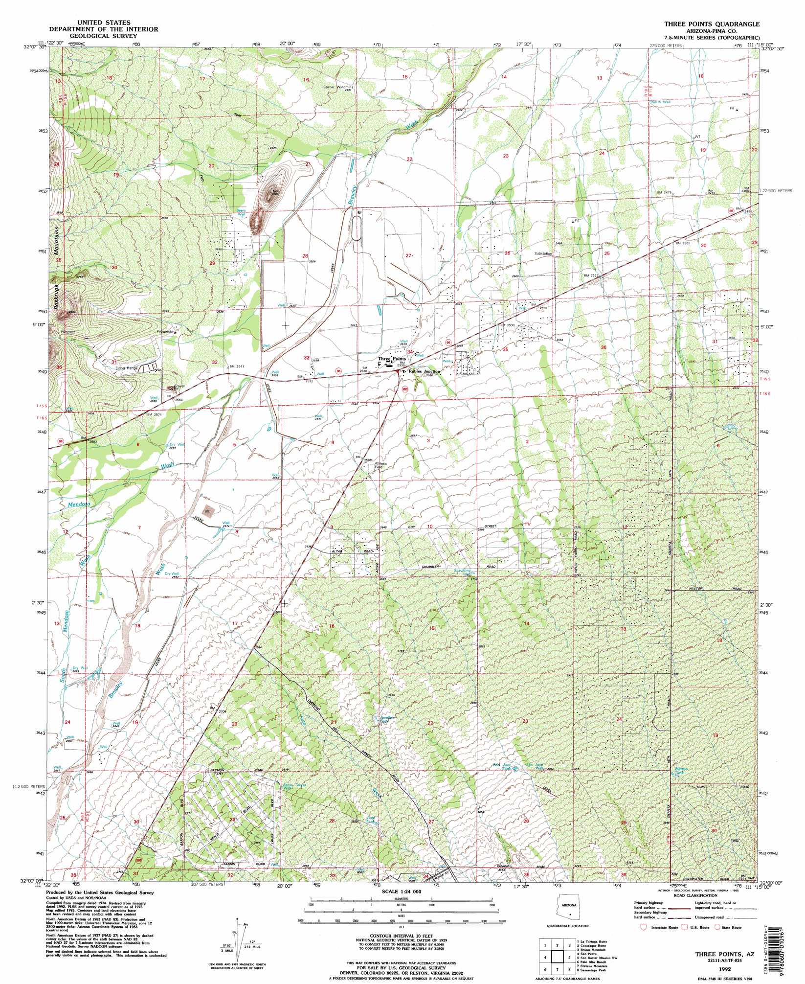
Three Points Topo Map Arizona
To zoom in, hover over the map of Three Points
USGS Topo Quad 32111a3 - 1:24,000 scale
| Topo Map Name: | Three Points |
| USGS Topo Quad ID: | 32111a3 |
| Print Size: | ca. 21 1/4" wide x 27" high |
| Southeast Coordinates: | 32° N latitude / 111.25° W longitude |
| Map Center Coordinates: | 32.0625° N latitude / 111.3125° W longitude |
| U.S. State: | AZ |
| Filename: | o32111a3.jpg |
| Download Map JPG Image: | Three Points topo map 1:24,000 scale |
| Map Type: | Topographic |
| Topo Series: | 7.5´ |
| Map Scale: | 1:24,000 |
| Source of Map Images: | United States Geological Survey (USGS) |
| Alternate Map Versions: |
Three Points AZ 1979, updated 1979 Download PDF Buy paper map Three Points AZ 1979, updated 1985 Download PDF Buy paper map Three Points AZ 1979, updated 1992 Download PDF Buy paper map Three Points AZ 1992, updated 1995 Download PDF Buy paper map Three Points AZ 1996, updated 2002 Download PDF Buy paper map Three Points AZ 2011 Download PDF Buy paper map Three Points AZ 2014 Download PDF Buy paper map |
1:24,000 Topo Quads surrounding Three Points
Koht Kohl Hill |
Waterman Peak |
West Of Avra |
Avra |
Jaynes |
San Ignacio Ranch |
La Tortuga Butte |
Cocoraque Butte |
Brown Mountain |
Cat Mountain |
Pan Tak |
San Pedro |
Three Points |
San Xavier Mission Sw |
San Xavier Mission |
Kitt Peak |
Palo Alto Ranch |
Stevens Mountain |
Samaniego Peak |
Twin Buttes |
Baboquivari Peak |
Fresno Wash |
Penitas Hills |
Batamote Hills |
Esperanza Mill |
> Back to 32111a1 at 1:100,000 scale
> Back to 32110a1 at 1:250,000 scale
> Back to U.S. Topo Maps home
Three Points topo map: Gazetteer
Three Points: Populated Places
Corner Windmill elevation 760m 2493′Robles Junction elevation 775m 2542′
Three Points elevation 775m 2542′
Three Points: Reservoirs
Javelina Tank elevation 867m 2844′Lost Tank elevation 908m 2979′
San Juan Tank elevation 0m 0′
Sierrita Tank elevation 0m 0′
Three Points: Streams
Mendoza Wash elevation 775m 2542′Soto Wash elevation 794m 2604′
South Mendoza Wash elevation 784m 2572′
Three Points: Wells
Beers Well elevation 768m 2519′North Well elevation 741m 2431′
San Juan Well elevation 0m 0′
Santa Teresa Well elevation 0m 0′
Spaulding Well elevation 833m 2732′
Three Points digital topo map on disk
Buy this Three Points topo map showing relief, roads, GPS coordinates and other geographical features, as a high-resolution digital map file on DVD: