Brown Mountain Topo Map Arizona
To zoom in, hover over the map of Brown Mountain
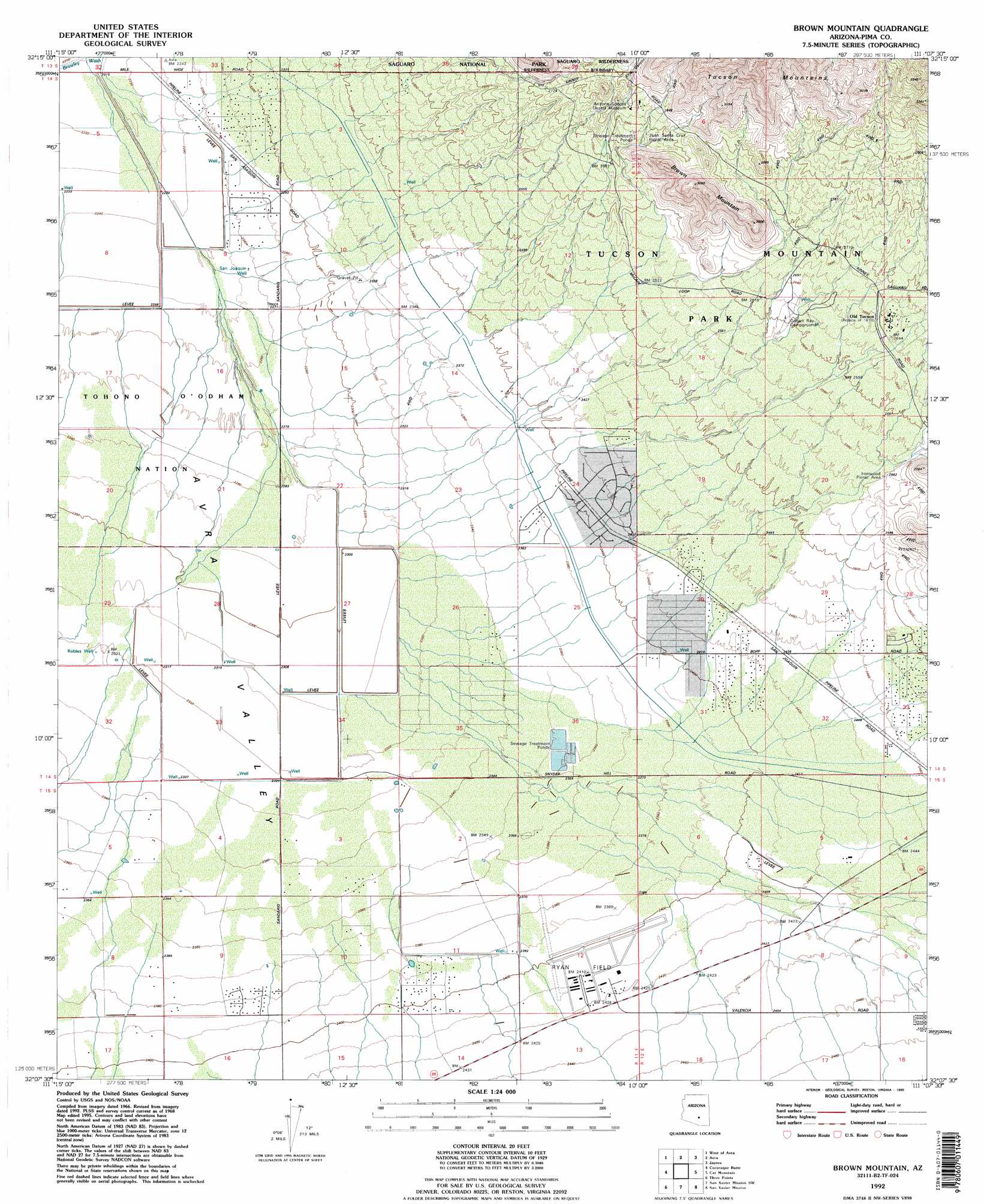
USGS Topo Quad 32111b2 - 1:24,000 scale
| Topo Map Name: | Brown Mountain |
| USGS Topo Quad ID: | 32111b2 |
| Print Size: | ca. 21 1/4" wide x 27" high |
| Southeast Coordinates: | 32.125° N latitude / 111.125° W longitude |
| Map Center Coordinates: | 32.1875° N latitude / 111.1875° W longitude |
| U.S. State: | AZ |
| Filename: | o32111b2.jpg |
| Download Map JPG Image: | Brown Mountain topo map 1:24,000 scale |
| Map Type: | Topographic |
| Topo Series: | 7.5´ |
| Map Scale: | 1:24,000 |
| Source of Map Images: | United States Geological Survey (USGS) |
| Alternate Map Versions: |
Brown Mountain AZ 1968, updated 1969 Download PDF Buy paper map Brown Mountain AZ 1968, updated 1970 Download PDF Buy paper map Brown Mountain AZ 1968, updated 1977 Download PDF Buy paper map Brown Mountain AZ 1992, updated 1995 Download PDF Buy paper map Brown Mountain AZ 1996, updated 2002 Download PDF Buy paper map Brown Mountain AZ 2011 Download PDF Buy paper map Brown Mountain AZ 2014 Download PDF Buy paper map |
1:24,000 Topo Quads surrounding Brown Mountain
Silver Bell East |
West Of Marana |
Marana |
Ruelas Canyon |
Oro Valley |
Waterman Peak |
West Of Avra |
Avra |
Jaynes |
Tucson North |
La Tortuga Butte |
Cocoraque Butte |
Brown Mountain |
Cat Mountain |
Tucson |
San Pedro |
Three Points |
San Xavier Mission Sw |
San Xavier Mission |
Tucson Sw |
Palo Alto Ranch |
Stevens Mountain |
Samaniego Peak |
Twin Buttes |
Sahuarita |
> Back to 32111a1 at 1:100,000 scale
> Back to 32110a1 at 1:250,000 scale
> Back to U.S. Topo Maps home
Brown Mountain topo map: Gazetteer
Brown Mountain: Airports
Ryan Field elevation 731m 2398′Brown Mountain: Parks
Ironwood Picnic Area elevation 778m 2552′Juan Santa Cruz Picnic Area elevation 843m 2765′
Tucson Mountain County Park elevation 783m 2568′
Brown Mountain: Populated Places
Old Tucson elevation 812m 2664′Brown Mountain: Summits
Brown Mountain elevation 934m 3064′Brown Mountain: Valleys
King Canyon elevation 844m 2769′Brown Mountain: Wells
Robles Well elevation 708m 2322′San Joaquin Well elevation 0m 0′
Brown Mountain digital topo map on disk
Buy this Brown Mountain topo map showing relief, roads, GPS coordinates and other geographical features, as a high-resolution digital map file on DVD: