West Of Avra Topo Map Arizona
To zoom in, hover over the map of West Of Avra
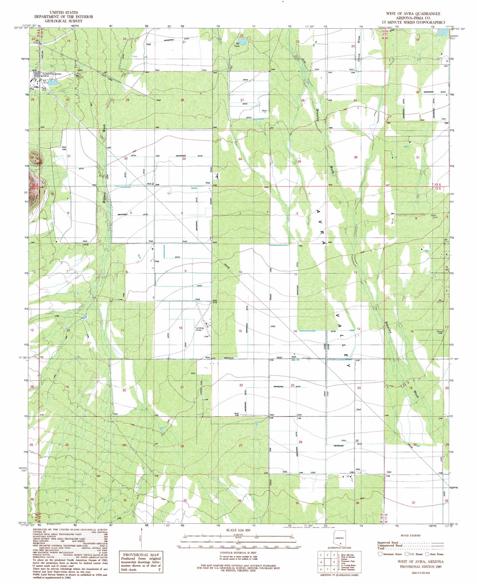
USGS Topo Quad 32111c3 - 1:24,000 scale
| Topo Map Name: | West Of Avra |
| USGS Topo Quad ID: | 32111c3 |
| Print Size: | ca. 21 1/4" wide x 27" high |
| Southeast Coordinates: | 32.25° N latitude / 111.25° W longitude |
| Map Center Coordinates: | 32.3125° N latitude / 111.3125° W longitude |
| U.S. State: | AZ |
| Filename: | o32111c3.jpg |
| Download Map JPG Image: | West Of Avra topo map 1:24,000 scale |
| Map Type: | Topographic |
| Topo Series: | 7.5´ |
| Map Scale: | 1:24,000 |
| Source of Map Images: | United States Geological Survey (USGS) |
| Alternate Map Versions: |
West of Avra AZ 1989, updated 1989 Download PDF Buy paper map West of Avra AZ 1996, updated 2002 Download PDF Buy paper map West of Avra AZ 2011 Download PDF Buy paper map West of Avra AZ 2014 Download PDF Buy paper map |
1:24,000 Topo Quads surrounding West Of Avra
Friendly Corners |
Samaniego Hills |
Red Rock |
Desert Peak |
Tortolita Mountains |
Silver Bell West |
Silver Bell East |
West Of Marana |
Marana |
Ruelas Canyon |
Koht Kohl Hill |
Waterman Peak |
West Of Avra |
Avra |
Jaynes |
San Ignacio Ranch |
La Tortuga Butte |
Cocoraque Butte |
Brown Mountain |
Cat Mountain |
Pan Tak |
San Pedro |
Three Points |
San Xavier Mission Sw |
San Xavier Mission |
> Back to 32111a1 at 1:100,000 scale
> Back to 32110a1 at 1:250,000 scale
> Back to U.S. Topo Maps home
West Of Avra topo map: Gazetteer
West Of Avra: Airports
Palm Valley Tucson Airport elevation 649m 2129′Taylor Field elevation 650m 2132′
The Ultralight Strip elevation 646m 2119′
West Of Avra: Reservoirs
BK Tank elevation 615m 2017′West Of Avra digital topo map on disk
Buy this West Of Avra topo map showing relief, roads, GPS coordinates and other geographical features, as a high-resolution digital map file on DVD: