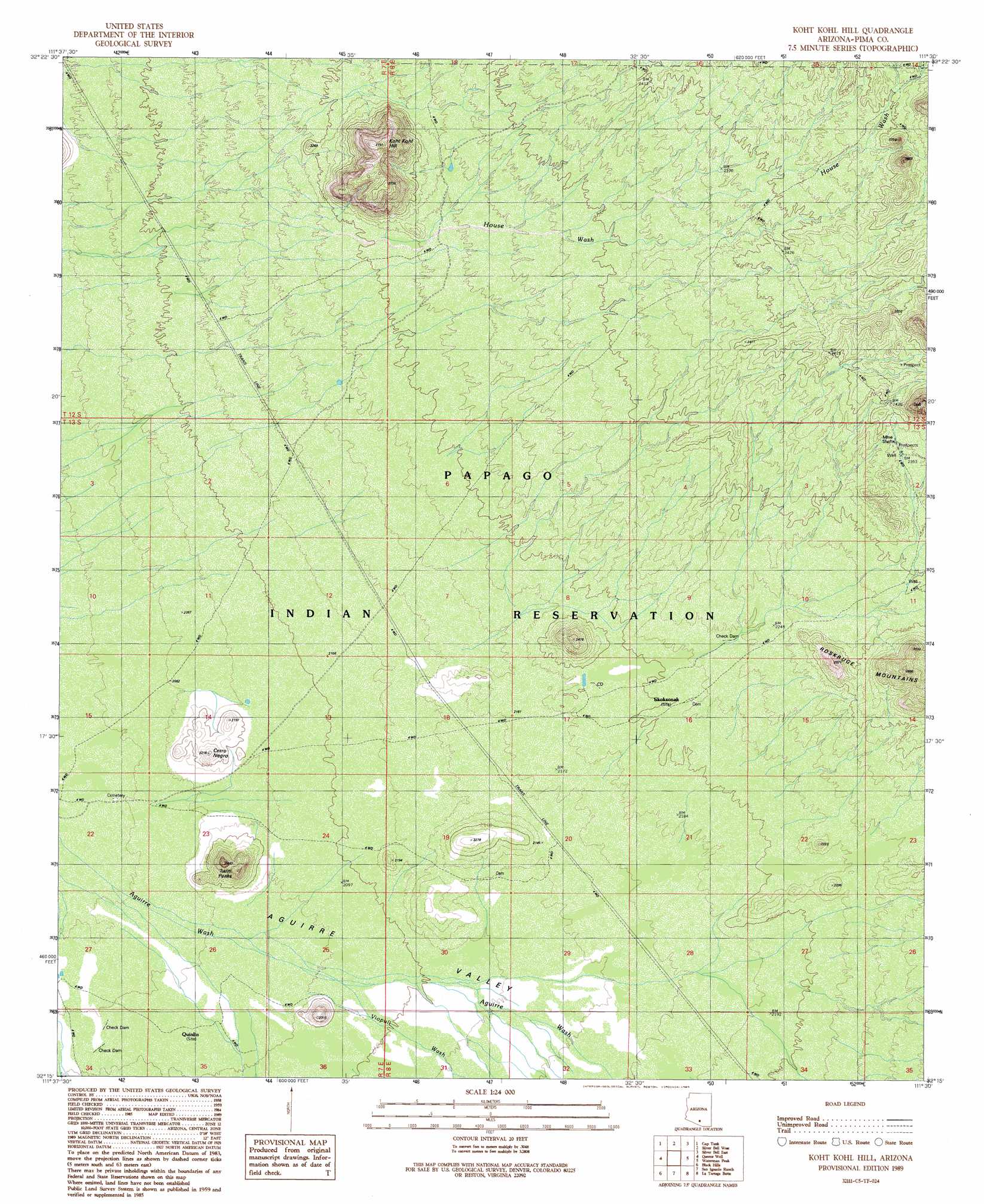
Koht Kohl Hill Topo Map Arizona
To zoom in, hover over the map of Koht Kohl Hill
USGS Topo Quad 32111c5 - 1:24,000 scale
| Topo Map Name: | Koht Kohl Hill |
| USGS Topo Quad ID: | 32111c5 |
| Print Size: | ca. 21 1/4" wide x 27" high |
| Southeast Coordinates: | 32.25° N latitude / 111.5° W longitude |
| Map Center Coordinates: | 32.3125° N latitude / 111.5625° W longitude |
| U.S. State: | AZ |
| Filename: | o32111c5.jpg |
| Download Map JPG Image: | Koht Kohl Hill topo map 1:24,000 scale |
| Map Type: | Topographic |
| Topo Series: | 7.5´ |
| Map Scale: | 1:24,000 |
| Source of Map Images: | United States Geological Survey (USGS) |
| Alternate Map Versions: |
Koht Kohl Hill AZ 1989, updated 1989 Download PDF Buy paper map Koht Kohl Hill AZ 1996, updated 2003 Download PDF Buy paper map Koht Kohl Hill AZ 2011 Download PDF Buy paper map Koht Kohl Hill AZ 2014 Download PDF Buy paper map |
1:24,000 Topo Quads surrounding Koht Kohl Hill
Silver Reef Mountains Se |
Greene Reservoir |
Friendly Corners |
Samaniego Hills |
Red Rock |
Santa Rosa Mountains Ne |
Gap Tank |
Silver Bell West |
Silver Bell East |
West Of Marana |
Santa Rosa Mountains Se |
Queens Well |
Koht Kohl Hill |
Waterman Peak |
West Of Avra |
Sil Nakya |
Black Hills |
San Ignacio Ranch |
La Tortuga Butte |
Cocoraque Butte |
Comobabi |
Haivana Nakya |
Pan Tak |
San Pedro |
Three Points |
> Back to 32111a1 at 1:100,000 scale
> Back to 32110a1 at 1:250,000 scale
> Back to U.S. Topo Maps home
Koht Kohl Hill topo map: Gazetteer
Koht Kohl Hill: Populated Places
Quinlin elevation 632m 2073′Skoksonak elevation 672m 2204′
Koht Kohl Hill: Reservoirs
Tank Eighty elevation 666m 2185′Tank One Hundred Five elevation 688m 2257′
Koht Kohl Hill: Streams
Romero Wash elevation 719m 2358′Viopuli Wash elevation 635m 2083′
Koht Kohl Hill: Summits
Cerro Negro elevation 667m 2188′Koht Kohl Hill elevation 837m 2746′
Twin Peaks elevation 739m 2424′
Koht Kohl Hill: Wells
Romero Well elevation 701m 2299′Koht Kohl Hill digital topo map on disk
Buy this Koht Kohl Hill topo map showing relief, roads, GPS coordinates and other geographical features, as a high-resolution digital map file on DVD: