Santa Rosa Mountains Se Topo Map Arizona
To zoom in, hover over the map of Santa Rosa Mountains Se
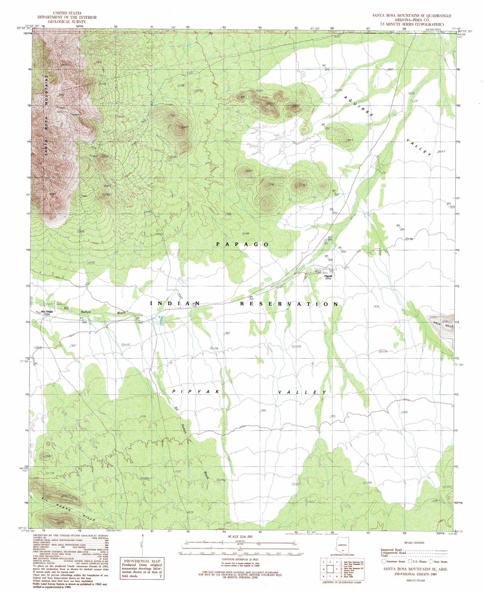
USGS Topo Quad 32111c7 - 1:24,000 scale
| Topo Map Name: | Santa Rosa Mountains Se |
| USGS Topo Quad ID: | 32111c7 |
| Print Size: | ca. 21 1/4" wide x 27" high |
| Southeast Coordinates: | 32.25° N latitude / 111.75° W longitude |
| Map Center Coordinates: | 32.3125° N latitude / 111.8125° W longitude |
| U.S. State: | AZ |
| Filename: | o32111c7.jpg |
| Download Map JPG Image: | Santa Rosa Mountains Se topo map 1:24,000 scale |
| Map Type: | Topographic |
| Topo Series: | 7.5´ |
| Map Scale: | 1:24,000 |
| Source of Map Images: | United States Geological Survey (USGS) |
| Alternate Map Versions: |
Santa Rosa Mountains SE AZ 1989, updated 1989 Download PDF Buy paper map Santa Rosa Mountains SE AZ 1996, updated 2003 Download PDF Buy paper map Santa Rosa Mountains SE AZ 2011 Download PDF Buy paper map Santa Rosa Mountains SE AZ 2014 Download PDF Buy paper map |
1:24,000 Topo Quads surrounding Santa Rosa Mountains Se
Kohatk |
North Komelik |
Silver Reef Mountains Se |
Greene Reservoir |
Friendly Corners |
Drew Spring Well |
Santa Rosa Mountains Nw |
Santa Rosa Mountains Ne |
Gap Tank |
Silver Bell West |
Gu Achi |
Santa Rosa Mountains Sw |
Santa Rosa Mountains Se |
Queens Well |
Koht Kohl Hill |
Gurli Put Vo |
Sand Wells |
Sil Nakya |
Black Hills |
San Ignacio Ranch |
Vainom Kug |
Ko Vaya |
Comobabi |
Haivana Nakya |
Pan Tak |
> Back to 32111a1 at 1:100,000 scale
> Back to 32110a1 at 1:250,000 scale
> Back to U.S. Topo Maps home
Santa Rosa Mountains Se topo map: Gazetteer
Santa Rosa Mountains Se: Populated Places
Hoi Oidak elevation 573m 1879′Pipyak elevation 581m 1906′
Santa Rosa Mountains Se: Valleys
Pipyak Valley elevation 570m 1870′Santa Rosa Mountains Se digital topo map on disk
Buy this Santa Rosa Mountains Se topo map showing relief, roads, GPS coordinates and other geographical features, as a high-resolution digital map file on DVD: