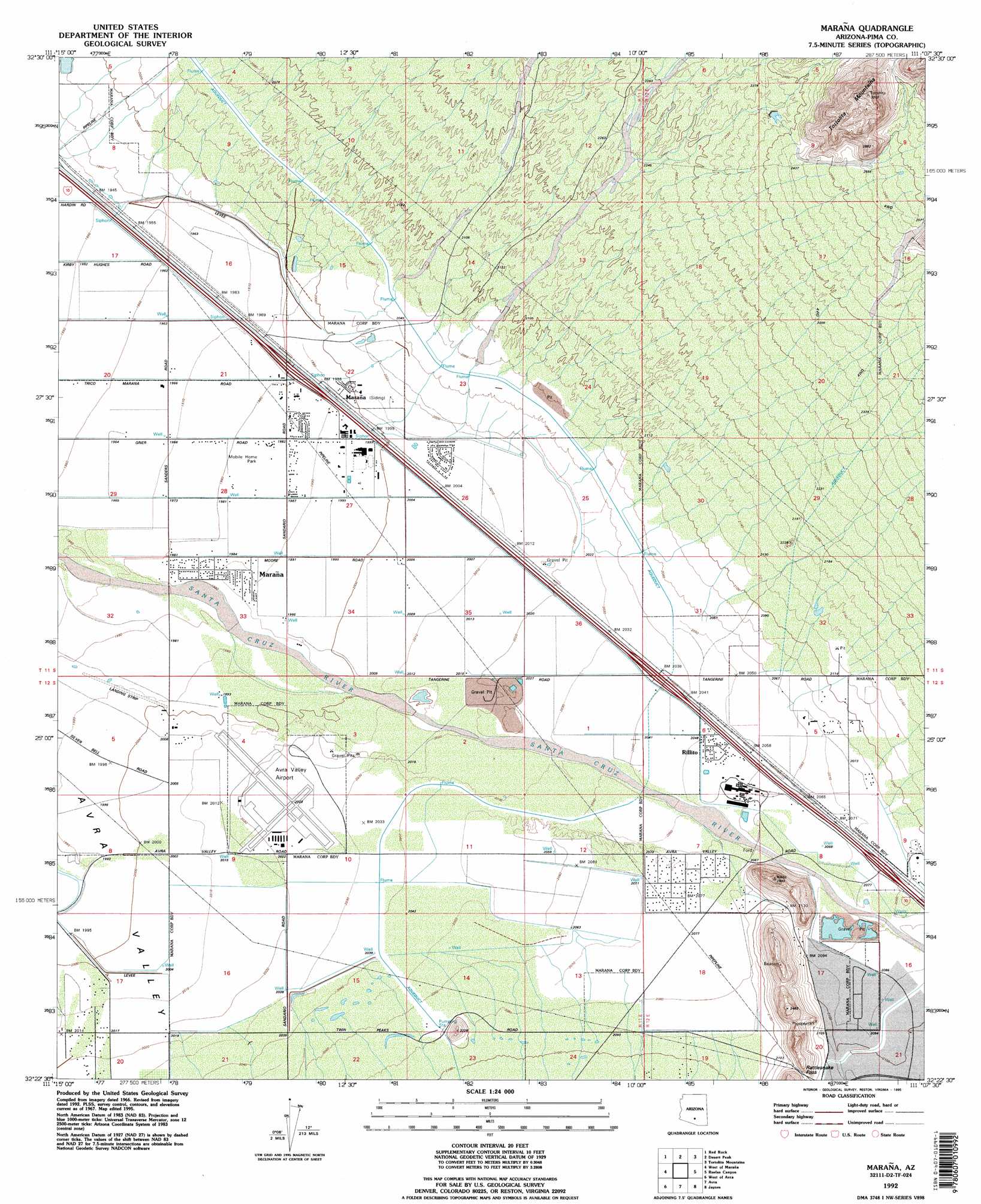
Marana Topo Map Arizona
To zoom in, hover over the map of Marana
USGS Topo Quad 32111d2 - 1:24,000 scale
| Topo Map Name: | Marana |
| USGS Topo Quad ID: | 32111d2 |
| Print Size: | ca. 21 1/4" wide x 27" high |
| Southeast Coordinates: | 32.375° N latitude / 111.125° W longitude |
| Map Center Coordinates: | 32.4375° N latitude / 111.1875° W longitude |
| U.S. State: | AZ |
| Filename: | o32111d2.jpg |
| Download Map JPG Image: | Marana topo map 1:24,000 scale |
| Map Type: | Topographic |
| Topo Series: | 7.5´ |
| Map Scale: | 1:24,000 |
| Source of Map Images: | United States Geological Survey (USGS) |
| Alternate Map Versions: |
Marana AZ 1967, updated 1969 Download PDF Buy paper map Marana AZ 1967, updated 1976 Download PDF Buy paper map Marana AZ 1967, updated 1986 Download PDF Buy paper map Marana AZ 1967, updated 1986 Download PDF Buy paper map Marana AZ 1992, updated 1995 Download PDF Buy paper map Marana AZ 1996, updated 2002 Download PDF Buy paper map Marana AZ 2011 Download PDF Buy paper map Marana AZ 2014 Download PDF Buy paper map |
1:24,000 Topo Quads surrounding Marana
Newman Peak |
Picacho Pass |
Durham Hills |
Chief Butte |
Fortified Peak |
Samaniego Hills |
Red Rock |
Desert Peak |
Tortolita Mountains |
Oracle Junction |
Silver Bell East |
West Of Marana |
Marana |
Ruelas Canyon |
Oro Valley |
Waterman Peak |
West Of Avra |
Avra |
Jaynes |
Tucson North |
La Tortuga Butte |
Cocoraque Butte |
Brown Mountain |
Cat Mountain |
Tucson |
> Back to 32111a1 at 1:100,000 scale
> Back to 32110a1 at 1:250,000 scale
> Back to U.S. Topo Maps home
Marana topo map: Gazetteer
Marana: Airports
Avra Valley Airport elevation 617m 2024′Marana: Crossings
Avra Valley Road Interchange elevation 634m 2080′Marana Interchange elevation 605m 1984′
Tangerine Interchange elevation 622m 2040′
Marana: Gaps
Rattlesnake Pass elevation 666m 2185′Marana: Parks
Marana Park elevation 609m 1998′Rillito Vista Park elevation 626m 2053′
Marana: Populated Places
Marana elevation 607m 1991′Rillito elevation 626m 2053′
Marana: Post Offices
Marana Post Office elevation 600m 1968′Marana digital topo map on disk
Buy this Marana topo map showing relief, roads, GPS coordinates and other geographical features, as a high-resolution digital map file on DVD: