Tortolita Mountains Topo Map Arizona
To zoom in, hover over the map of Tortolita Mountains
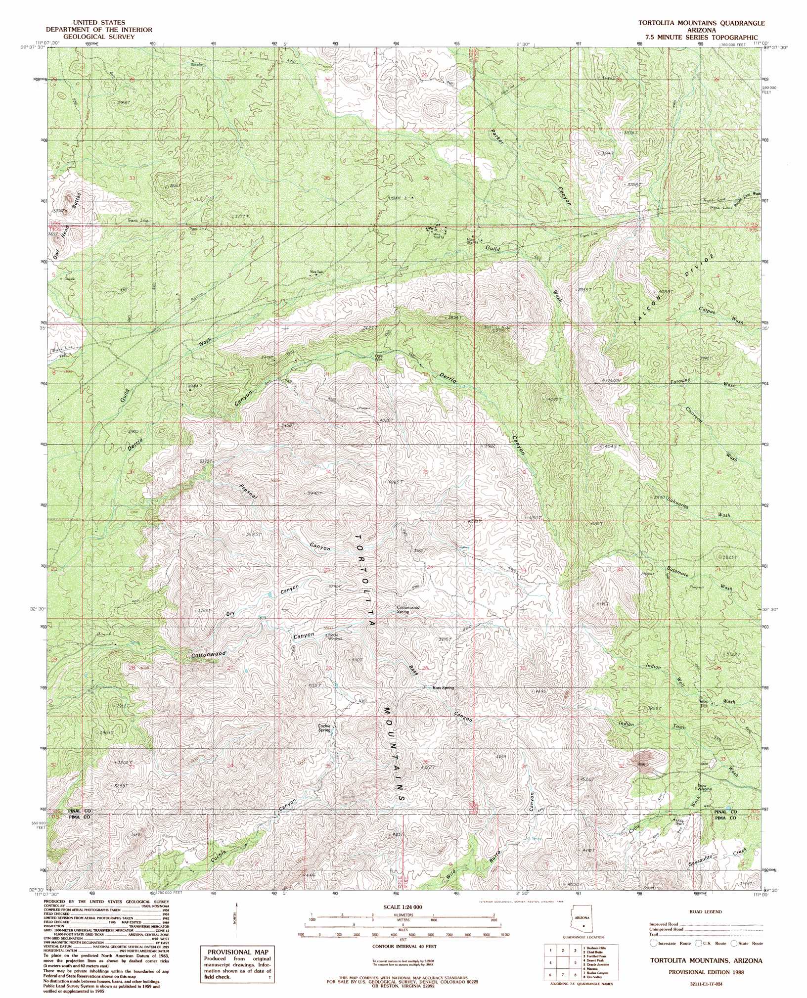
USGS Topo Quad 32111e1 - 1:24,000 scale
| Topo Map Name: | Tortolita Mountains |
| USGS Topo Quad ID: | 32111e1 |
| Print Size: | ca. 21 1/4" wide x 27" high |
| Southeast Coordinates: | 32.5° N latitude / 111° W longitude |
| Map Center Coordinates: | 32.5625° N latitude / 111.0625° W longitude |
| U.S. State: | AZ |
| Filename: | o32111e1.jpg |
| Download Map JPG Image: | Tortolita Mountains topo map 1:24,000 scale |
| Map Type: | Topographic |
| Topo Series: | 7.5´ |
| Map Scale: | 1:24,000 |
| Source of Map Images: | United States Geological Survey (USGS) |
| Alternate Map Versions: |
Tortolita Mountains AZ 1988, updated 1989 Download PDF Buy paper map Tortolita Mountains AZ 1988, updated 1989 Download PDF Buy paper map Tortolita Mountains AZ 1996, updated 2002 Download PDF Buy paper map Tortolita Mountains AZ 2011 Download PDF Buy paper map Tortolita Mountains AZ 2014 Download PDF Buy paper map |
1:24,000 Topo Quads surrounding Tortolita Mountains
Picacho Reservoir Se |
Ninetysix Hills Sw |
Ninetysix Hills Se |
Black Mountain |
Putnam Wash |
Picacho Pass |
Durham Hills |
Chief Butte |
Fortified Peak |
North Of Oracle |
Red Rock |
Desert Peak |
Tortolita Mountains |
Oracle Junction |
Oracle |
West Of Marana |
Marana |
Ruelas Canyon |
Oro Valley |
Mount Lemmon |
West Of Avra |
Avra |
Jaynes |
Tucson North |
Sabino Canyon |
> Back to 32111e1 at 1:100,000 scale
> Back to 32110a1 at 1:250,000 scale
> Back to U.S. Topo Maps home
Tortolita Mountains topo map: Gazetteer
Tortolita Mountains: Mines
Big Mine elevation 964m 3162′Tortolita Mountains: Reservoirs
Black Tank elevation 1092m 3582′Tortolita Mountains: Springs
Bass Spring elevation 1178m 3864′Cochie Spring elevation 1136m 3727′
Cottonwood Spring elevation 1139m 3736′
Tortolita Mountains: Streams
Crow Wash elevation 1082m 3549′Tortolita Mountains: Summits
Owl Head Buttes elevation 919m 3015′Tortolita Mountains: Valleys
Bass Canyon elevation 1097m 3599′Cottonwood Canyon elevation 839m 2752′
Dry Canyon elevation 865m 2837′
Fresnal Canyon elevation 940m 3083′
Tortolita Mountains: Wells
Ogle Well elevation 1009m 3310′Tortolita Mountains digital topo map on disk
Buy this Tortolita Mountains topo map showing relief, roads, GPS coordinates and other geographical features, as a high-resolution digital map file on DVD: