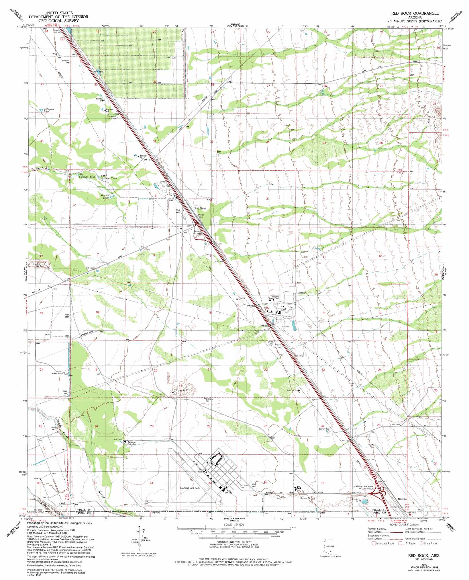
Red Rock Topo Map Arizona
To zoom in, hover over the map of Red Rock
USGS Topo Quad 32111e3 - 1:24,000 scale
| Topo Map Name: | Red Rock |
| USGS Topo Quad ID: | 32111e3 |
| Print Size: | ca. 21 1/4" wide x 27" high |
| Southeast Coordinates: | 32.5° N latitude / 111.25° W longitude |
| Map Center Coordinates: | 32.5625° N latitude / 111.3125° W longitude |
| U.S. State: | AZ |
| Filename: | o32111e3.jpg |
| Download Map JPG Image: | Red Rock topo map 1:24,000 scale |
| Map Type: | Topographic |
| Topo Series: | 7.5´ |
| Map Scale: | 1:24,000 |
| Source of Map Images: | United States Geological Survey (USGS) |
| Alternate Map Versions: |
Red Rock AZ 1980, updated 1981 Download PDF Buy paper map Red Rock AZ 1980, updated 1993 Download PDF Buy paper map Red Rock AZ 1996, updated 2002 Download PDF Buy paper map Red Rock AZ 2011 Download PDF Buy paper map Red Rock AZ 2014 Download PDF Buy paper map |
1:24,000 Topo Quads surrounding Red Rock
Eloy North |
Picacho Reservoir |
Picacho Reservoir Se |
Ninetysix Hills Sw |
Ninetysix Hills Se |
Eloy South |
Newman Peak |
Picacho Pass |
Durham Hills |
Chief Butte |
Friendly Corners |
Samaniego Hills |
Red Rock |
Desert Peak |
Tortolita Mountains |
Silver Bell West |
Silver Bell East |
West Of Marana |
Marana |
Ruelas Canyon |
Koht Kohl Hill |
Waterman Peak |
West Of Avra |
Avra |
Jaynes |
> Back to 32111e1 at 1:100,000 scale
> Back to 32110a1 at 1:250,000 scale
> Back to U.S. Topo Maps home
Red Rock topo map: Gazetteer
Red Rock: Airports
Marana Airpark elevation 573m 1879′Pinal Airpark elevation 573m 1879′
Red Rock: Crossings
Marana Air Park Interchange elevation 594m 1948′Red Rock Interchange elevation 575m 1886′
Red Rock: Populated Places
Avra elevation 580m 1902′Nariska elevation 595m 1952′
Red Rock elevation 570m 1870′
Red Rock: Reservoirs
Big Spreader Tank elevation 552m 1811′Double Tank elevation 555m 1820′
Little Spreader Tank elevation 554m 1817′
Number Three Tank elevation 551m 1807′
Wilmonts Pond elevation 547m 1794′
Red Rock: Streams
Parker Wash elevation 642m 2106′Suizo Wash elevation 572m 1876′
Red Rock digital topo map on disk
Buy this Red Rock topo map showing relief, roads, GPS coordinates and other geographical features, as a high-resolution digital map file on DVD: