Picacho Pass Topo Map Arizona
To zoom in, hover over the map of Picacho Pass
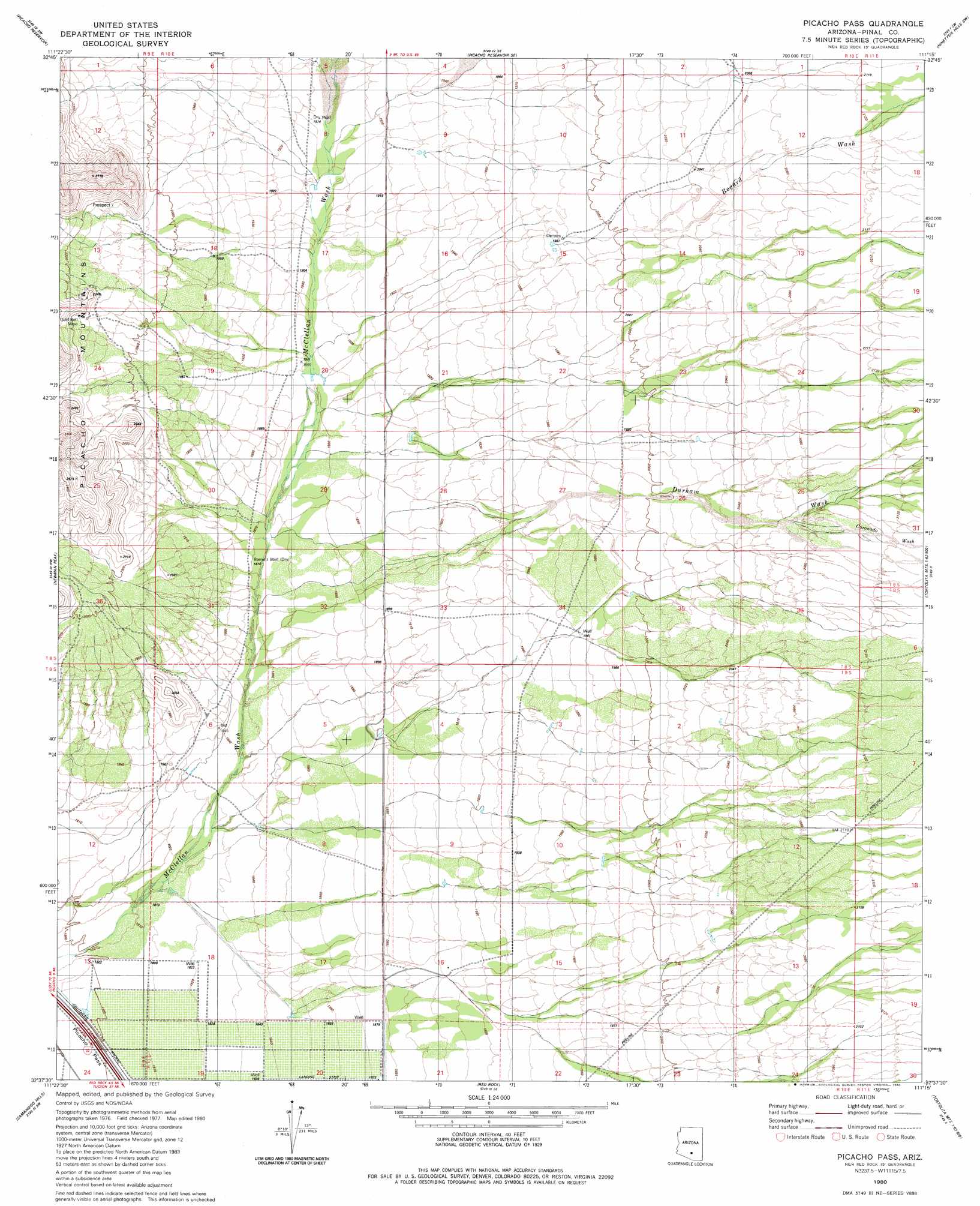
USGS Topo Quad 32111f3 - 1:24,000 scale
| Topo Map Name: | Picacho Pass |
| USGS Topo Quad ID: | 32111f3 |
| Print Size: | ca. 21 1/4" wide x 27" high |
| Southeast Coordinates: | 32.625° N latitude / 111.25° W longitude |
| Map Center Coordinates: | 32.6875° N latitude / 111.3125° W longitude |
| U.S. State: | AZ |
| Filename: | o32111f3.jpg |
| Download Map JPG Image: | Picacho Pass topo map 1:24,000 scale |
| Map Type: | Topographic |
| Topo Series: | 7.5´ |
| Map Scale: | 1:24,000 |
| Source of Map Images: | United States Geological Survey (USGS) |
| Alternate Map Versions: |
Picacho Pass AZ 1980, updated 1980 Download PDF Buy paper map Picacho Pass AZ 1996, updated 2003 Download PDF Buy paper map Picacho Pass AZ 2011 Download PDF Buy paper map Picacho Pass AZ 2014 Download PDF Buy paper map |
1:24,000 Topo Quads surrounding Picacho Pass
Coolidge |
Valley Farms |
Cactus Forest |
Ninetysix Hills Nw |
Ninetysix Hills Ne |
Eloy North |
Picacho Reservoir |
Picacho Reservoir Se |
Ninetysix Hills Sw |
Ninetysix Hills Se |
Eloy South |
Newman Peak |
Picacho Pass |
Durham Hills |
Chief Butte |
Friendly Corners |
Samaniego Hills |
Red Rock |
Desert Peak |
Tortolita Mountains |
Silver Bell West |
Silver Bell East |
West Of Marana |
Marana |
Ruelas Canyon |
> Back to 32111e1 at 1:100,000 scale
> Back to 32110a1 at 1:250,000 scale
> Back to U.S. Topo Maps home
Picacho Pass topo map: Gazetteer
Picacho Pass: Airports
Bud Antle Ranch Airstrip elevation 569m 1866′Picacho Pass: Mines
Gold Bell Mine elevation 667m 2188′Picacho Pass: Streams
Bogard Wash elevation 605m 1984′Coronado Wash elevation 631m 2070′
Durham Wash elevation 566m 1856′
Picacho Pass: Wells
Barnett Well elevation 571m 1873′Picacho Pass digital topo map on disk
Buy this Picacho Pass topo map showing relief, roads, GPS coordinates and other geographical features, as a high-resolution digital map file on DVD: