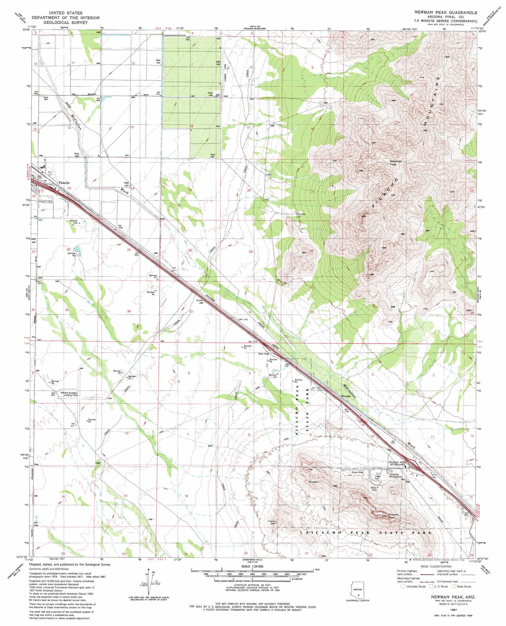
Newman Peak Topo Map Arizona
To zoom in, hover over the map of Newman Peak
USGS Topo Quad 32111f4 - 1:24,000 scale
| Topo Map Name: | Newman Peak |
| USGS Topo Quad ID: | 32111f4 |
| Print Size: | ca. 21 1/4" wide x 27" high |
| Southeast Coordinates: | 32.625° N latitude / 111.375° W longitude |
| Map Center Coordinates: | 32.6875° N latitude / 111.4375° W longitude |
| U.S. State: | AZ |
| Filename: | o32111f4.jpg |
| Download Map JPG Image: | Newman Peak topo map 1:24,000 scale |
| Map Type: | Topographic |
| Topo Series: | 7.5´ |
| Map Scale: | 1:24,000 |
| Source of Map Images: | United States Geological Survey (USGS) |
| Alternate Map Versions: |
Newman Peak AZ 1981, updated 1982 Download PDF Buy paper map Newman Peak AZ 1996, updated 2003 Download PDF Buy paper map Newman Peak AZ 2011 Download PDF Buy paper map Newman Peak AZ 2014 Download PDF Buy paper map |
1:24,000 Topo Quads surrounding Newman Peak
Casa Crande East |
Coolidge |
Valley Farms |
Cactus Forest |
Ninetysix Hills Nw |
Casa Grande Mountains |
Eloy North |
Picacho Reservoir |
Picacho Reservoir Se |
Ninetysix Hills Sw |
Arizona City |
Eloy South |
Newman Peak |
Picacho Pass |
Durham Hills |
Greene Reservoir |
Friendly Corners |
Samaniego Hills |
Red Rock |
Desert Peak |
Gap Tank |
Silver Bell West |
Silver Bell East |
West Of Marana |
Marana |
> Back to 32111e1 at 1:100,000 scale
> Back to 32110a1 at 1:250,000 scale
> Back to U.S. Topo Maps home
Newman Peak topo map: Gazetteer
Newman Peak: Airports
Newman Peak Ranch Airport elevation 498m 1633′Newman Peak: Crossings
Picacho Peak Interchange elevation 546m 1791′Newman Peak: Parks
Mormon Trail Historical Marker elevation 545m 1788′Picaclo Peak Nature Trail elevation 542m 1778′
Newman Peak: Populated Places
Picacho elevation 492m 1614′Wymola elevation 535m 1755′
Newman Peak: Summits
Newman Peak elevation 1368m 4488′Picacho Peak elevation 1011m 3316′
Newman Peak digital topo map on disk
Buy this Newman Peak topo map showing relief, roads, GPS coordinates and other geographical features, as a high-resolution digital map file on DVD: